How to get to Rettungswache by bus?
Click on the bus route to see step by step directions with maps, line arrival times and updated time schedules.
From Gaffenberg, Heilbronn
107 minFrom Luson Hair, Verwaltungsgemeinschaft Bad Friedrichshall
65 minFrom Salzstraße 133, Heilbronn
72 minFrom Audi Forum Neckarsulm, Verwaltungsgemeinschaft Neckarsulm
63 minFrom Kaufland, Verwaltungsgemeinschaft Neckarsulm
68 minFrom Audi AG Neckarsulm A21, Verwaltungsgemeinschaft Neckarsulm
71 minFrom Hauptfriedhof Heilbronn, Heilbronn
78 minFrom Karl-Wüst-Brücke, Heilbronn
53 min
How to get to Rettungswache by train?
Click on the train route to see step by step directions with maps, line arrival times and updated time schedules.
From Luson Hair, Verwaltungsgemeinschaft Bad Friedrichshall
71 minFrom Salzstraße 133, Heilbronn
70 minFrom Audi Forum Neckarsulm, Verwaltungsgemeinschaft Neckarsulm
72 minFrom Kaufland, Verwaltungsgemeinschaft Neckarsulm
69 minFrom Audi AG Neckarsulm A21, Verwaltungsgemeinschaft Neckarsulm
86 minFrom Kunsthalle Würth, Verwaltungsgemeinschaft Schwäbisch Hall
37 minFrom Hauptfriedhof Heilbronn, Heilbronn
53 minFrom Karl-Wüst-Brücke, Heilbronn
77 min
Bus stop near Rettungswache in Öhringen
- Öhringen Hauptbahnhof, 2 min walk,VIEW
Train stations near Rettungswache in Öhringen
Bus lines to Rettungswache in Öhringen
- 627, Öhringen Hauptbahnhof - Neuenstadt (K) ZOB Lindenplatz Bstg 8,VIEW
- MEX 18, Tübingen Hauptbahnhof - Osterburken, Bahnhof,VIEW
- R35, Öhringen Hauptbahnhof - Neuenstein ZWN,VIEW
- R38, Öhringen Hauptbahnhof - Untersteinbach Bühl,VIEW
- R50, Öhringen Hauptbahnhof - Zweiflingen Eichach,VIEW
- RB18, Heilbronn Hauptbahnhof Gleis 2 - Öhringen Cappel,VIEW
- RB 83, Heilbronn Hauptbahnhof Gleis 1 - Hessental Bahnhof,VIEW
- RE 80, Crailsheim Bahnhof - Heilbronn Hauptbahnhof Gleis 1,VIEW
- S4, Öhringen Cappel - Schwaigern(Württ) West,VIEW
What are the closest stations to Rettungswache?
The closest stations to Rettungswache are:
- Öhringen Hauptbahnhof is 86 meters away, 2 min walk.
- Öhringen West is 1468 meters away, 19 min walk.
- Öhringen Hbf is 1720 meters away, 23 min walk.
Which bus line stops near Rettungswache?
627 (Öhringen Hauptbahnhof)
Which train lines stop near Rettungswache?
These train lines stop near Rettungswache: RB 83, S4.
Which light rail line stops near Rettungswache?
S4 (Öhringen Cappel)
What’s the nearest train station to Rettungswache in Öhringen?
The nearest train station to Rettungswache in Öhringen is Öhringen West. It’s a 19 min walk away.
What’s the nearest bus station to Rettungswache in Öhringen?
The nearest bus station to Rettungswache in Öhringen is Öhringen Hauptbahnhof. It’s a 2 min walk away.
What time is the first light rail to Rettungswache in Öhringen?
The S4 is the first light rail that goes to Rettungswache in Öhringen. It stops nearby at 4:30 AM.
What time is the last light rail to Rettungswache in Öhringen?
The S4 is the last light rail that goes to Rettungswache in Öhringen. It stops nearby at 2:18 AM.
What time is the first train to Rettungswache in Öhringen?
The S4 is the first train that goes to Rettungswache in Öhringen. It stops nearby at 4:30 AM.
What time is the last train to Rettungswache in Öhringen?
The S4 is the last train that goes to Rettungswache in Öhringen. It stops nearby at 2:18 AM.
What time is the first bus to Rettungswache in Öhringen?
The 627 is the first bus that goes to Rettungswache in Öhringen. It stops nearby at 6:25 AM.
What time is the last bus to Rettungswache in Öhringen?
The R35 is the last bus that goes to Rettungswache in Öhringen. It stops nearby at 10:35 PM.
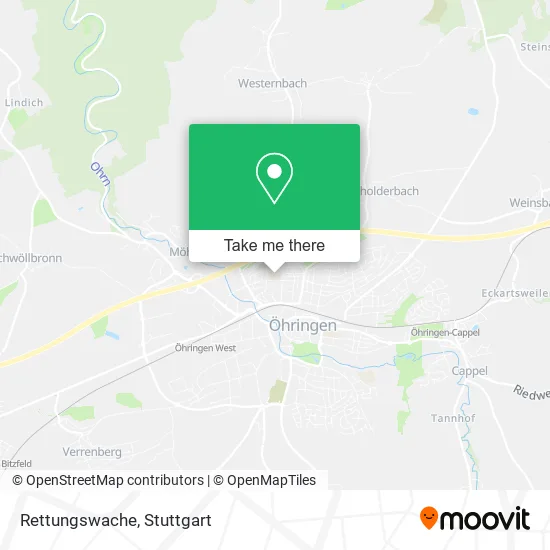
See Rettungswache, Öhringen, on the map
Public Transit to Rettungswache in Öhringen
Wondering how to get to Rettungswache in Öhringen? Moovit helps you find the best way to get to Rettungswache with step-by-step directions from the nearest public transit station.
Moovit provides free maps and live directions to help you navigate through your city. View schedules, routes, timetables, and find out how long does it take to get to Rettungswache in real time.
Looking for the nearest stop or station to Rettungswache? Check out this list of stops closest to your destination: Öhringen Hauptbahnhof; Öhringen West; Öhringen Hbf.
Bus: 627, MEX 18, R35, R38, R50.Train: RB 83, S4, MEX18, E, MEX18.Light Rail: S4.
Want to see if there’s another route that gets you there at an earlier time? Moovit helps you find alternative routes or times. Get directions from and directions to Rettungswache easily from the Moovit App or Website.
We make riding to Rettungswache easy, which is why over 1.5 million users, including users in Öhringen, trust Moovit as the best app for public transit. You don’t need to download an individual bus app or train app, Moovit is your all-in-one transit app that helps you find the best bus time or train time available.
For information on prices of bus, train and light rail, costs and ride fares to Rettungswache, please check the Moovit app.
Use the app to navigate to popular places including to the airport, hospital, stadium, grocery store, mall, coffee shop, school, college, and university.
Rettungswache Address: Sudetenstraße 4 74613 Öhringen street in Öhringen
- Gewerbliche Schule Öhringen,
- Svw TSG Öhringen links Login Schach Suche,
- DRK-Ortsverein Öhringen,
- Ochsenseegebäude,
- Meine Page,
- Drk Rettungswache Öhringen,
- Gäwelestr.,
- Görkem Kebapstube,
- Görkem Pizza & Kebap,
- Bauernverband Schwäbisch Hall - Hohenlohe - Rems E. V.,
- Freistil Medien Inh. Grabert Evelyn,
- None,
- Nagelstudio Bea-Uty-Nails,
- Landratsamt Hohenlohekreis,
- Schulen, Berufsbildende,
- Richard-Von-Weizäcker-Schule,
- Parkplatz Krankenhaus,
- Hohenloher Krankenhaus Öhringen,
- Dr.Med. Georg Wiesmüller Internist, Rheumatologe,
- Öhringer Hebammen Team
Places Near Rettungswache (Öhringen)
- Waldfriedhof, Degerloch,
- Hanns-Martin-Schleyer-Halle, Bad Cannstatt,
- Geilhaus Haus 33a, Reutlingen-Betzingen,
- Mercedes-Benz Museum (Mercedes Museum Stuttgart), Bad Cannstatt,
- Porsche Museum, Zuffenhausen,
- Wilhelma (U-Bahn Wilhelma), Bad Cannstatt,
- FlixBus Haltestelle, Stuttgart,
- Hauptbahnhof Stuttgart, Stuttgart-Mitte,
- Pariser Platz Stuttgart, Stuttgart-Mitte,
- Hanns-Martin-Schleyer-Halle (Stuttgart Hans-Martin-Schleyerhalle), Bad Cannstatt,
- SI-Centrum, Möhringen,
- Mettingen Eros-Center Puff Laufhaus, Esslingen Am Neckar,
- Porsche-Arena, Bad Cannstatt,
- Marmorsaal Im Weissenburgpark, Stuttgart-Süd,
- Gleis 101/102 (tief), Stuttgart-Mitte,
- Mercedes-Benz Museum, Bad Cannstatt,
- Klinikum Stuttgart - Katharinenhospital, Stuttgart-Mitte,
- Schleyerhalle, Bad Cannstatt,
- Gasometer Pforzheim, Pforzheim,
- Im Wizemann (Halle), Bad Cannstatt
How to get to popular places in Stuttgart with public transit
Get around Öhringen by public transit!
Traveling around Öhringen has never been so easy. See step by step directions as you travel to any attraction, street or major public transit station. View bus and train schedules, arrival times, service alerts and detailed routes on a map, so you know exactly how to get to anywhere in Öhringen.
When traveling to any destination around Öhringen use Moovit's Live Directions with Get Off Notifications to know exactly where and how far to walk, how long to wait for your line, and how many stops are left. Moovit will alert you when it's time to get off — no need to constantly re-check whether yours is the next stop.
Wondering how to use public transit in Öhringen or how to pay for public transit in Öhringen? Moovit public transit app can help you navigate your way with public transit easily, and at minimum cost. It includes public transit fees, ticket prices, and costs. Looking for a map of Öhringen public transit lines? Moovit public transit app shows all public transit maps in Öhringen with all Bus, Train, Subway, Light Rail, Ferry, S-Bahn and Funicular routes and stops on an interactive map.
Stuttgart has 7 transit type(s), including: Bus, Train, Subway, Light Rail, Ferry, S-Bahn and Funicular, operated by several transit agencies, including SSB - Stadtbahn, SSB, SSB - Seilbahn / Zacke, S-Bahn Stuttgart, Rhein-Neckar-Verkehr GmbH (rnv), Karlsruher Verkehrsverbund, DB AG, DB Regiobus BW, Arverio Baden-Württemberg GmbH, DB RegioNetz Verkehrs GmbH Westfrankenbahn, DB Regio AG Baden-Württemberg, Südwestdeutsche Verkehrs-AG, DB Regio AG Mitte Region Hessen, DB and Bodensee-Oberschwaben-Bahn