How to get to Rewind Reusables by bus?
Click on the bus route to see step by step directions with maps, line arrival times and updated time schedules.
From Kaye Edmonton Clinic Outpatient Referrals, Edmonton
81 minFrom Baker Hughes Canada Company, Edmonton
84 minFrom Safeway, Edmonton
71 minFrom Jubilee Auditorium, Edmonton
83 minFrom Original Cellphone Fix South, Edmonton
107 minFrom John E. Brownlee Building, Edmonton
46 minFrom Northern Alberta Jubilee Auditorium, Edmonton
83 minFrom 100 Ave. & 105 St., Edmonton
60 minFrom Digitex Inc, Edmonton
80 minFrom Victoria School of Performing Arts, Edmonton
60 min
Bus stop near Rewind Reusables in Edmonton
- 34 Street & 106 Avenue, 7 min walk,VIEW
Bus lines to Rewind Reusables in Edmonton
- 101, Abbottsfield Transit Centre,VIEW
What are the closest stations to Rewind Reusables?
The closest stations to Rewind Reusables are:
- 34 Street & 106 Avenue is 442 meters away, 7 min walk.
Which bus lines stop near Rewind Reusables?
These bus lines stop near Rewind Reusables: 001A, 008, 101.
What’s the nearest bus station to Rewind Reusables in Edmonton?
The nearest bus station to Rewind Reusables in Edmonton is 34 Street & 106 Avenue. It’s a 7 min walk away.
What time is the first bus to Rewind Reusables in Edmonton?
The 101 is the first bus that goes to Rewind Reusables in Edmonton. It stops nearby at 10:03 AM.
What time is the last bus to Rewind Reusables in Edmonton?
The 101 is the last bus that goes to Rewind Reusables in Edmonton. It stops nearby at 9:08 PM.
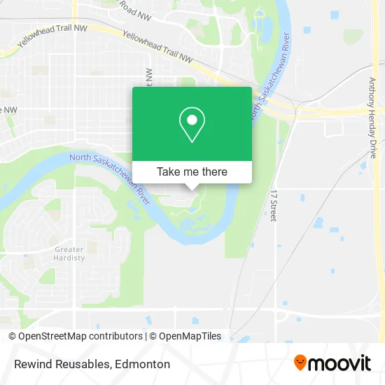
See Rewind Reusables, Edmonton, on the map
Public Transit to Rewind Reusables in Edmonton
Wondering how to get to Rewind Reusables in Edmonton? Moovit helps you find the best way to get to Rewind Reusables with step-by-step directions from the nearest public transit station.
Moovit provides free maps and live directions to help you navigate through your city. View schedules, routes, timetables, and find out how long does it take to get to Rewind Reusables in real time.
Looking for the nearest stop or station to Rewind Reusables? Check out this list of stops closest to your destination: 34 Street & 106 Avenue.
Bus: 001A, 008, 101.
Want to see if there’s another route that gets you there at an earlier time? Moovit helps you find alternative routes or times. Get directions from and directions to Rewind Reusables easily from the Moovit App or Website.
We make riding to Rewind Reusables easy, which is why over 1.5 million users, including users in Edmonton, trust Moovit as the best app for public transit. You don’t need to download an individual bus app or train app, Moovit is your all-in-one transit app that helps you find the best bus time or train time available.
For information on prices of bus, costs and ride fares to Rewind Reusables, please check the Moovit app.
Use the app to navigate to popular places including to the airport, hospital, stadium, grocery store, mall, coffee shop, school, college, and university.
Rewind Reusables Address: 10419 30 St NW Edmonton, AB T5W 1V6 street in Edmonton
- Deslaurier Financial Services Inc,
- Sparkle Solutions,
- Your Creative Dreams,
- Tiny Tots Dayhome,
- Rundle Park,
- Ainsworth Dyer Mémorial Bridge,
- Jade Reiki,
- Ken Lelacheur Authorized Alberta Marriage Commissioner,
- Modz N Repairs,
- Crème de la Crème Beauty Lounge,
- Rundle Park Golf Course,
- Rundle Park,
- Gold Bar Park,
- Miss Jay's Cleaning,
- Ampersandra Illustrations,
- Abbotts Grove Condominiums,
- Blessings Mobile Massa,
- Barvinok Apartments,
- Beverly Heights Variety Show,
- St Nicholas Catholic Junior High School
Places Near Rewind Reusables (Edmonton)
- Borden Park, Edmonton,
- Northgate Centre, Edmonton,
- Alberta Legislature Building, Edmonton,
- Grey Nuns Community Hospital, Edmonton,
- West Edmonton Mall, Edmonton,
- Edmonton EXPO Centre, Edmonton,
- Fort Edmonton Park, Edmonton,
- University of Alberta, Edmonton,
- Edmonton VIA Rail Station, Edmonton,
- Londonderry Mall, Edmonton,
- Canada Place Service Canada Centre, Edmonton,
- MacEwan University, Edmonton,
- Kaye Edmonton Clinic, Edmonton,
- Royal Alexandra Hospital, Edmonton,
- Cross Cancer Institute, Edmonton,
- Edmonton Commonwealth Stadium, Edmonton,
- Kingsway Mall, Edmonton,
- Edmonton Valley Zoo, Edmonton,
- Rogers Place, Edmonton,
- Whyte Avenue, Edmonton
How to get to popular places in Edmonton with public transit
Get around Edmonton by public transit!
Traveling around Edmonton has never been so easy. See step by step directions as you travel to any attraction, street or major public transit station. View bus and train schedules, arrival times, service alerts and detailed routes on a map, so you know exactly how to get to anywhere in Edmonton.
When traveling to any destination around Edmonton use Moovit's Live Directions with Get Off Notifications to know exactly where and how far to walk, how long to wait for your line, and how many stops are left. Moovit will alert you when it's time to get off — no need to constantly re-check whether yours is the next stop.
Wondering how to use public transit in Edmonton or how to pay for public transit in Edmonton? Moovit public transit app can help you navigate your way with public transit easily, and at minimum cost. It includes public transit fees, ticket prices, and costs. Looking for a map of Edmonton public transit lines? Moovit public transit app shows all public transit maps in Edmonton with all Bus and Light Rail routes and stops on an interactive map.
Edmonton has 2 transit type(s), including: Bus and Light Rail, operated by several transit agencies, including ETS LRT, ETS, Strathcona County Transit, St. Albert Transit, Spruce Grove Transit, Fort Saskatchewan Transit, Beaumont Transit and Leduc Transit