How to get to Rewired Path by bus?
Click on the bus route to see step by step directions with maps, line arrival times and updated time schedules.
From Rutgers, New Brunswick
293 minFrom Monster Truck Ice Cream Truck, Pacific Ave, Wildwood Crest, Nj
154 minFrom Freehold, NJ, Freehold
267 minFrom Toms River, NJ, Toms River
175 minFrom PNC Bank Arts Center, Holmdel
292 minFrom Pop Pop Park Park Pl, Atlantic City
54 minFrom Long Branch Beach & Boardwalk, Long Branch
338 min
Bus stops near Rewired Path in Somers Point
Bus lines to Rewired Path in Somers Point
What are the closest stations to Rewired Path?
The closest stations to Rewired Path are:
- New Rd at Rhode Island Ave is 446 yards away, 6 min walk.
- Shore Rd at Groveland Ave is 656 yards away, 8 min walk.
Which bus lines stop near Rewired Path?
These bus lines stop near Rewired Path: 507, 509.
What’s the nearest bus station to Rewired Path in Somers Point?
The nearest bus station to Rewired Path in Somers Point is New Rd at Rhode Island Ave. It’s a 6 min walk away.
What time is the first bus to Rewired Path in Somers Point?
The 507 is the first bus that goes to Rewired Path in Somers Point. It stops nearby at 3:00 AM.
What time is the last bus to Rewired Path in Somers Point?
The 507 is the last bus that goes to Rewired Path in Somers Point. It stops nearby at 3:01 AM.
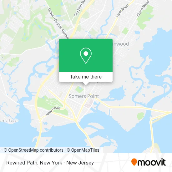
See Rewired Path, Somers Point, on the map
Public Transit to Rewired Path in Somers Point
Wondering how to get to Rewired Path in Somers Point? Moovit helps you find the best way to get to Rewired Path with step-by-step directions from the nearest public transit station.
Moovit provides free maps and live directions to help you navigate through your city. View schedules, routes, timetables, and find out how long does it take to get to Rewired Path in real time.
Looking for the nearest stop or station to Rewired Path? Check out this list of stops closest to your destination: New Rd at Rhode Island Ave; Shore Rd at Groveland Ave.
Bus: 507, 509.
Want to see if there’s another route that gets you there at an earlier time? Moovit helps you find alternative routes or times. Get directions from and directions to Rewired Path easily from the Moovit App or Website.
We make riding to Rewired Path easy, which is why over 1.5 million users, including users in Somers Point, trust Moovit as the best app for public transit. You don’t need to download an individual bus app or train app, Moovit is your all-in-one transit app that helps you find the best bus time or train time available.
For information on prices of bus and train, costs and ride fares to Rewired Path, please check the Moovit app.
Use the app to navigate to popular places including to the airport, hospital, stadium, grocery store, mall, coffee shop, school, college, and university.
Rewired Path Address: 408 Bethel Rd street in Somers Point
- Keating John J Dds,
- Apex Gutters Llc,
- Applebaum Joel Dds,
- Brighter Vision,
- Bethel Rd & Point Commons,
- Hello Wellness Counseling Services,
- Amy O'Connell,
- Termite Control Exterminators,
- NJ Planet Medical Supply,
- Park Bench Treatment Center,
- Shore Physicians Group Primary Care,
- 3 Men and A Hoe Llc,
- W Maryland Warehouses,
- Somers Point Bike Path,
- Cvs Pharmacy,
- Sure Connection Enterprises,
- Target,
- Kmart,
- Somers Point Garage Door Repair,
- Libertyx Bitcoin Atm
Places Near Rewired Path (Somers Point)
- 376 Hudson Street, Manhattan,
- Queens Center Mall, Queens,
- 26 Federal Plaza, Manhattan,
- Times Square, Manhattan,
- Mountainside Hospital, Glen Ridge,
- Chinatown, Manhattan,
- 911 Memorial, Manhattan,
- Katz's Deli, Manhattan,
- Hudson Yards, Manhattan,
- San Gennaro Feast, Manhattan,
- SoHo, Manhattan,
- Wall Street, Manhattan,
- 3 Stone St, Manhattan,
- Bellevue Hospital, Manhattan,
- 66 John Street, Manhattan,
- Rockefeller Center, Manhattan,
- qqqq, Manhattan,
- Pier 83, Manhattan,
- 1 Police Plaza, Manhattan,
- 111 Centre New York City Supreme Court, Manhattan
How to get to popular places in New York - New Jersey with public transit
Get around Somers Point by public transit!
Traveling around Somers Point has never been so easy. See step by step directions as you travel to any attraction, street or major public transit station. View bus and train schedules, arrival times, service alerts and detailed routes on a map, so you know exactly how to get to anywhere in Somers Point.
When traveling to any destination around Somers Point use Moovit's Live Directions with Get Off Notifications to know exactly where and how far to walk, how long to wait for your line, and how many stops are left. Moovit will alert you when it's time to get off — no need to constantly re-check whether yours is the next stop.
Wondering how to use public transit in Somers Point or how to pay for public transit in Somers Point? Moovit public transit app can help you navigate your way with public transit easily, and at minimum cost. It includes public transit fees, ticket prices, and costs. Looking for a map of Somers Point public transit lines? Moovit public transit app shows all public transit maps in Somers Point with all Bus, Train, Subway, Light Rail, Ferry and Cable Car routes and stops on an interactive map.
New York - New Jersey has 6 transit type(s), including: Bus, Train, Subway, Light Rail, Ferry and Cable Car, operated by several transit agencies, including MTA Subway, Metro-North Railroad, LIRR, PATH, MTA New York City Transit - Express routes, MTA Bus, NJ Transit, NYC Ferry, NICE bus, Bee-Line Bus, NJ Transit Rail, Norwalk Transit District, Hartford Line, River Valley Transit and HART