How to get to Reyes Construction Group by bus?
Click on the bus route to see step by step directions with maps, line arrival times and updated time schedules.
From Arabx Com Inc, Fairfax County
45 minFrom Freddie Mac, Fairfax County
48 minFrom Falls Church, VA, Falls Church
54 minFrom Fairfax County Government Center, Fairfax County
45 minFrom Leesburg VA-684, Fairfax County
55 minFrom Inova Fair Oaks Hospital, Fairfax County
55 minFrom Kaiser Permanente Tysons Corner Medical Center, Fairfax County
47 minFrom Hilton McLean Tysons Corner, Fairfax County
48 minFrom Inova employee Shuttle, Fairfax County
37 min
Bus stops near Reyes Construction Group in Fairfax
Metro station near Reyes Construction Group in Fairfax
- Vienna Metro Station, 43 min walk,VIEW
Bus lines to Reyes Construction Group in Fairfax
What are the closest stations to Reyes Construction Group?
The closest stations to Reyes Construction Group are:
- Blenheim Blvd at Embassy Ln (Sb) is 74 yards away, 1 min walk.
- Blenheim Blvd at Embassy Ln (Nb) is 141 yards away, 2 min walk.
- Blenheim Bl+Brookwood Dr is 253 yards away, 3 min walk.
- Vienna Metro Station is 3700 yards away, 43 min walk.
Which bus lines stop near Reyes Construction Group?
These bus lines stop near Reyes Construction Group: F50, GOLD 1, GOLD 2.
What’s the nearest bus station to Reyes Construction Group in Fairfax?
The nearest bus station to Reyes Construction Group in Fairfax is Blenheim Blvd at Embassy Ln (Sb). It’s a 1 min walk away.
What time is the first metro to Reyes Construction Group in Fairfax?
The ORANGE is the first metro that goes to Reyes Construction Group in Fairfax. It stops nearby at 5:00 AM.
What time is the last metro to Reyes Construction Group in Fairfax?
The ORANGE is the last metro that goes to Reyes Construction Group in Fairfax. It stops nearby at 12:32 AM.
What time is the first bus to Reyes Construction Group in Fairfax?
The F50 is the first bus that goes to Reyes Construction Group in Fairfax. It stops nearby at 5:24 AM.
What time is the last bus to Reyes Construction Group in Fairfax?
The GOLD 1 is the last bus that goes to Reyes Construction Group in Fairfax. It stops nearby at 10:30 PM.
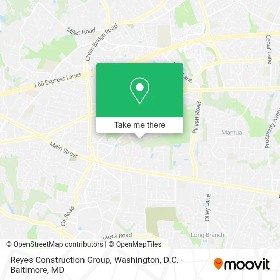
See Reyes Construction Group, Fairfax, on the map
Public Transit to Reyes Construction Group in Fairfax
Wondering how to get to Reyes Construction Group in Fairfax? Moovit helps you find the best way to get to Reyes Construction Group with step-by-step directions from the nearest public transit station.
Moovit provides free maps and live directions to help you navigate through your city. View schedules, routes, timetables, and find out how long does it take to get to Reyes Construction Group in real time.
Looking for the nearest stop or station to Reyes Construction Group? Check out this list of stops closest to your destination: Blenheim Blvd at Embassy Ln (Sb); Blenheim Blvd at Embassy Ln (Nb); Blenheim Bl+Brookwood Dr; Vienna Metro Station.
Bus: F50, GOLD 1, GOLD 2.Metro: ORANGE.
Want to see if there’s another route that gets you there at an earlier time? Moovit helps you find alternative routes or times. Get directions from and directions to Reyes Construction Group easily from the Moovit App or Website.
We make riding to Reyes Construction Group easy, which is why over 1.7 million users, including users in Fairfax, trust Moovit as the best app for public transit. You don’t need to download an individual bus app or train app, Moovit is your all-in-one transit app that helps you find the best bus time or train time available.
For information on prices of bus and metro, costs and ride fares to Reyes Construction Group, please check the Moovit app.
Use the app to navigate to popular places including to the airport, hospital, stadium, grocery store, mall, coffee shop, school, college, and university.
Reyes Construction Group Address: 3633 Heritage Ln street in Fairfax
- Fairfax (City),
- Fairfax High School,
- Fairfax High School (Fairfax High School (Fairfax, Virginia)),
- Al Azhar Mosque,
- Captain Pell's,
- Fairfax High School Field,
- Paul VI Catholic High School,
- Army-Navy Country Club (FFX),
- Holiday Inn Express Fairfax - Arlington Boulevard,
- Eaton Pl Fairfax,
- Silver Diner,
- The U.S. Supreme Court,
- Fairfax County Circuit Court,
- Old Town Fairfax, Virginia,
- The United States District Court for the Eastern District of Virginia,
- Fairfax County Probation Center,
- Solan Alzamora,
- Cinema Arts Theatre,
- Fairfax Ice Arena,
- Five Below
Places Near Reyes Construction Group (Fairfax)
- Rock Creek Tennis Center, Washington,
- Georgetown, Washington,
- M&T Bank Stadium, Baltimore,
- Warner Theatre, Washington,
- Museum Of The Bible, Washington,
- Capital One Arena, Washington,
- Marriott Marquis Washington, DC, Washington,
- National Theatre, Washington,
- National Museum of African American History and Culture, Washington,
- Sibley Memorial Hospital, Washington,
- PG Mall, Prince George's County,
- National Zoo, Washington,
- Amazon Hq2, Arlington County,
- The Anthem, Washington,
- Pennsylvania Ave NW (3rd st and pennsylvania), Washington,
- Washington DC VA Medical Center, Washington,
- Westfield Montgomery Mall, Montgomery County,
- Camden Yards, Baltimore,
- Basilica of the National Shrine, Washington,
- Washington National Cathedral, Washington
How to get to popular places in Washington, D.C. - Baltimore, MD with public transit
Get around Fairfax by public transit!
Traveling around Fairfax has never been so easy. See step by step directions as you travel to any attraction, street or major public transit station. View bus and train schedules, arrival times, service alerts and detailed routes on a map, so you know exactly how to get to anywhere in Fairfax.
When traveling to any destination around Fairfax use Moovit's Live Directions with Get Off Notifications to know exactly where and how far to walk, how long to wait for your line, and how many stops are left. Moovit will alert you when it's time to get off — no need to constantly re-check whether yours is the next stop.
Wondering how to use public transit in Fairfax or how to pay for public transit in Fairfax? Moovit public transit app can help you navigate your way with public transit easily, and at minimum cost. It includes public transit fees, ticket prices, and costs. Looking for a map of Fairfax public transit lines? Moovit public transit app shows all public transit maps in Fairfax with all Bus, Train, Metro, Light Rail and Ferry routes and stops on an interactive map.
Washington, D.C. - Baltimore, MD has 5 transit type(s), including: Bus, Train, Metro, Light Rail and Ferry, operated by several transit agencies, including WMATA, Montgomery County Ride On, Fairfax Connector, TheBus, PRTC, DASH - Alexandria, Arlington Transit (ART), RTA of Central Maryland, MDOT MTA, MDOT MTA Light RailLink, MDOT MTA Commuter Bus, MDOT MTA Local Bus, FXBGO!, Virginia Railway Express (VRE) and MARC