How to get to Reylux by bus?
Click on the bus route to see step by step directions with maps, line arrival times and updated time schedules.
From Costco, Área Metropolitana De Madrid Y Corredor Del Henares
86 minFrom Tanatorio Servisa Madrid, Área Metropolitana De Madrid Y Corredor Del Henares
72 minFrom Jowke, Alcorcón
72 minFrom Calle Juan Mieg 3, Madrid
72 minFrom rio alberche, Madrid
52 minFrom Comisaría de Policía de Madrid-Latina (y Oficina de Tramitación del DNI y Pasaporte), Madrid
39 minFrom Via Lusitana, Madrid
50 minFrom SAMBIL OUTLET Madrid, Leganés
50 minFrom Balneario Thermas De Griñón, Comarca Sur
59 minFrom C.C. Parque Oeste, Alcorcón
63 min
How to get to Reylux by train?
Click on the train route to see step by step directions with maps, line arrival times and updated time schedules.
How to get to Reylux by metro?
Click on the metro route to see step by step directions with maps, line arrival times and updated time schedules.
From Tanatorio Servisa Madrid, Área Metropolitana De Madrid Y Corredor Del Henares
94 minFrom Calle Juan Mieg 3, Madrid
94 minFrom rio alberche, Madrid
77 minFrom Comisaría de Policía de Madrid-Latina (y Oficina de Tramitación del DNI y Pasaporte), Madrid
81 minFrom Via Lusitana, Madrid
90 minFrom C.C. Parque Oeste, Alcorcón
43 min
Bus stops near Reylux in Fuenlabrada
Train station near Reylux in Fuenlabrada
- Fuenlabrada, 9 min walk,VIEW
Metro station near Reylux in Fuenlabrada
- Fuenlabrada Central, 9 min walk,VIEW
Bus lines to Reylux in Fuenlabrada
- 2, Ref Naranjo,VIEW
- 493, Av. Pablo Iglesias - Centro Comercial,VIEW
- 5, Nocturna,VIEW
- 3, Circular Roja,VIEW
- 491, Madrid (Aluche) - Fuenlabrada (B.º Naranjo),VIEW
- 492, Madrid (Aluche) - Fuenlabrada (P. Granada),VIEW
- 526, Fuenlabrada - Móstoles (por FF.CC.),VIEW
- N803, Madrid (Atocha) - Fuenlabrada (B.º Naranjo),VIEW
- 1, Recinto Ferial – Parque Miraflores,VIEW
- 13, Directo Tren,VIEW
What are the closest stations to Reylux?
The closest stations to Reylux are:
- Zamora - Av. Provincias is 377 meters away, 6 min walk.
- Av. España - Castilla La Nueva is 413 meters away, 6 min walk.
- Av. España - Castilla La Mancha is 430 meters away, 6 min walk.
- Fuenlabrada is 649 meters away, 9 min walk.
- Fuenlabrada Central is 660 meters away, 9 min walk.
- Móstoles - Colegio is 1055 meters away, 14 min walk.
Which bus lines stop near Reylux?
These bus lines stop near Reylux: 468, 492, 493, 526.
Which train line stops near Reylux?
C5 (Móstoles - El Soto)
Which metro line stops near Reylux?
M-12 (MetroSur Andén 2)
What’s the nearest metro station to Reylux in Fuenlabrada?
The nearest metro station to Reylux in Fuenlabrada is Fuenlabrada Central. It’s a 9 min walk away.
What’s the nearest train station to Reylux in Fuenlabrada?
The nearest train station to Reylux in Fuenlabrada is Fuenlabrada. It’s a 9 min walk away.
What’s the nearest bus station to Reylux in Fuenlabrada?
The nearest bus stations to Reylux in Fuenlabrada are Zamora - Av. Provincias, Av. España - Castilla La Nueva and Av. España - Castilla La Mancha. The closest one is a 6 min walk away.
What time is the first metro to Reylux in Fuenlabrada?
The M-12 is the first metro that goes to Reylux in Fuenlabrada. It stops nearby at 6:05 AM.
What time is the last metro to Reylux in Fuenlabrada?
The M-12 is the last metro that goes to Reylux in Fuenlabrada. It stops nearby at 2:10 AM.
What time is the first train to Reylux in Fuenlabrada?
The C5 is the first train that goes to Reylux in Fuenlabrada. It stops nearby at 5:30 AM.
What time is the last train to Reylux in Fuenlabrada?
The C5 is the last train that goes to Reylux in Fuenlabrada. It stops nearby at 12:38 AM.
What time is the first bus to Reylux in Fuenlabrada?
The 5 is the first bus that goes to Reylux in Fuenlabrada. It stops nearby at 3:00 AM.
What time is the last bus to Reylux in Fuenlabrada?
The 5 is the last bus that goes to Reylux in Fuenlabrada. It stops nearby at 2:54 AM.
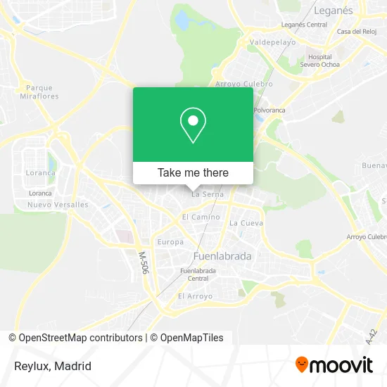
See Reylux, Fuenlabrada, on the map
Public Transit to Reylux in Fuenlabrada
Wondering how to get to Reylux in Fuenlabrada? Moovit helps you find the best way to get to Reylux with step-by-step directions from the nearest public transit station.
Moovit provides free maps and live directions to help you navigate through your city. View schedules, routes, timetables, and find out how long does it take to get to Reylux in real time.
Looking for the nearest stop or station to Reylux? Check out this list of stops closest to your destination: Zamora - Av. Provincias; Av. España - Castilla La Nueva; Av. España - Castilla La Mancha; Fuenlabrada; Fuenlabrada Central; Móstoles - Colegio.
Bus: 468, 492, 493, 526, 2, 5, 3, 491, N803, 1.Train: C5.Metro: M-12.
Want to see if there’s another route that gets you there at an earlier time? Moovit helps you find alternative routes or times. Get directions from and directions to Reylux easily from the Moovit App or Website.
We make riding to Reylux easy, which is why over 1.5 million users, including users in Fuenlabrada, trust Moovit as the best app for public transit. You don’t need to download an individual bus app or train app, Moovit is your all-in-one transit app that helps you find the best bus time or train time available.
For information on prices of bus, metro and train, costs and ride fares to Reylux, please check the Moovit app.
Use the app to navigate to popular places including to the airport, hospital, stadium, grocery store, mall, coffee shop, school, college, and university.
Reylux Address: Calle Vitoria, 1 28941 Fuenlabrada street in Fuenlabrada
- Asador Chelin sin Gluten,
- Centro Esotérico Luz D,
- Piscina Marta,
- Marcos Perez Agustin,
- Mail Boxes Etc.,
- Droguerias Low Cost,
- Cafetería Candelas Cervecería,
- Óptica Visol,
- Bar Candela,
- Taxi Lic,
- Soret Peluqueros,
- Licencia,
- Studium Fuenlabrada,
- Peluquería Azabache,
- Libertad Hipotecaria,
- Taxi Madrid Lc.4015,
- Hair Deluxe,
- Expresat Centro de Logopedia y Psicología,
- Alfonso Peña Lopez,
- Bjfotografía
Places Near Reylux (Fuenlabrada)
- Sala La Riviera, Madrid,
- Plaza Mayor, Madrid,
- Rastro De Madrid, Área Metropolitana De Madrid Y Corredor Del Henares,
- Tres Aguas, Alcorcón,
- Palacio De Vistalegre, Área Metropolitana De Madrid Y Corredor Del Henares,
- Hospital Universitario La Paz, Madrid,
- Centro Comercial Islazul, Área Metropolitana De Madrid Y Corredor Del Henares,
- Estacion de Chamartin, Madrid,
- Wizink Center, Madrid,
- Nassica, Área Metropolitana De Madrid Y Corredor Del Henares,
- Centro Comercial La Gavia, Área Metropolitana De Madrid Y Corredor Del Henares,
- Calle de López de Hoyos 169, Madrid,
- Mercadillo de Majadahonda, Majadahonda,
- Mendez Alvaro, Madrid,
- Centro Comercial La Vaguada, Área Metropolitana De Madrid Y Corredor Del Henares,
- Plenilunio, Área Metropolitana De Madrid Y Corredor Del Henares,
- Estadio Wanda Metropolitano, Área Metropolitana De Madrid Y Corredor Del Henares,
- Hospital Clínico Universitario San Carlos, Madrid,
- Hospital Universitario Ramón y Cajal, Madrid,
- Centro Comercial Oasiz Madrid, Área Metropolitana De Madrid Y Corredor Del Henares
How to get to popular places in Madrid with public transit
Get around Fuenlabrada by public transit!
Traveling around Fuenlabrada has never been so easy. See step by step directions as you travel to any attraction, street or major public transit station. View bus and train schedules, arrival times, service alerts and detailed routes on a map, so you know exactly how to get to anywhere in Fuenlabrada.
When traveling to any destination around Fuenlabrada use Moovit's Live Directions with Get Off Notifications to know exactly where and how far to walk, how long to wait for your line, and how many stops are left. Moovit will alert you when it's time to get off — no need to constantly re-check whether yours is the next stop.
Wondering how to use public transit in Fuenlabrada or how to pay for public transit in Fuenlabrada? Moovit public transit app can help you navigate your way with public transit easily, and at minimum cost. It includes public transit fees, ticket prices, and costs. Looking for a map of Fuenlabrada public transit lines? Moovit public transit app shows all public transit maps in Fuenlabrada with all Bus, Train, Metro and Light Rail routes and stops on an interactive map.
Madrid has 4 transit type(s), including: Bus, Train, Metro and Light Rail, operated by several transit agencies, including Metro de Madrid, Metro Ligero, Tranvía de Parla, Renfe Cercanías - Servicios de Autobús especiales, Renfe Cercanias, Renfe Cercanías, EMT, Interurbanos, Urbanos de Alcalá de Henares, Urbanos de Alcobendas, Urbanos de Alcorcón, Urbanos de Algete, Urbanos de Aranjuez, Urbanos de Arganda del Rey and Urbanos de Arroyomolinos