How to get to Reyo by bus?
Click on the bus route to see step by step directions with maps, line arrival times and updated time schedules.
From Hospital Universitario Rey Juan Carlos, Móstoles
58 minFrom Fuenlabrada-Madrid, Fuenlabrada
56 minFrom Calle Príncipe de Vergara, Madrid
85 minFrom rodriguez san pedro, Madrid
55 minFrom Camino de los Vinateros 51, Madrid
72 minFrom Calle Sancho Dávila, Madrid
80 minFrom Caja Mágica, Área Metropolitana De Madrid Y Corredor Del Henares
59 minFrom Zarzaquemada, Área Metropolitana De Madrid Y Corredor Del Henares
32 minFrom Avenida de las Arcas del Agua, Getafe
73 minFrom Calle Galileo, Madrid
61 min
How to get to Reyo by train?
Click on the train route to see step by step directions with maps, line arrival times and updated time schedules.
From Hospital Universitario Rey Juan Carlos, Móstoles
47 minFrom Fuenlabrada-Madrid, Fuenlabrada
48 minFrom Calle Príncipe de Vergara, Madrid
54 minFrom rodriguez san pedro, Madrid
56 minFrom Zarzaquemada, Área Metropolitana De Madrid Y Corredor Del Henares
48 minFrom Avenida de las Arcas del Agua, Getafe
60 min
How to get to Reyo by metro?
Click on the metro route to see step by step directions with maps, line arrival times and updated time schedules.
From Hospital Universitario Rey Juan Carlos, Móstoles
59 minFrom Fuenlabrada-Madrid, Fuenlabrada
88 minFrom Calle Príncipe de Vergara, Madrid
49 minFrom rodriguez san pedro, Madrid
49 minFrom Camino de los Vinateros 51, Madrid
60 minFrom Calle Sancho Dávila, Madrid
54 minFrom Caja Mágica, Área Metropolitana De Madrid Y Corredor Del Henares
65 minFrom Zarzaquemada, Área Metropolitana De Madrid Y Corredor Del Henares
49 minFrom Avenida de las Arcas del Agua, Getafe
64 minFrom Calle Galileo, Madrid
51 min
Bus stops near Reyo in Madrid
Metro station near Reyo in Madrid
- Empalme, 16 min walk,VIEW
Train station near Reyo in Madrid
- Las Águilas, 16 min walk,VIEW
Bus lines to Reyo in Madrid
What are the closest stations to Reyo?
The closest stations to Reyo are:
- Maestra Justa Freire - P. Aluche Cercanías is 133 meters away, 2 min walk.
- Rafael Finat - Valle Inclán is 141 meters away, 2 min walk.
- Junta Municipal Latina is 328 meters away, 5 min walk.
- Vidauba - Damasquillo is 376 meters away, 5 min walk.
- Empalme is 1226 meters away, 16 min walk.
- Las Águilas is 1230 meters away, 16 min walk.
Which bus lines stop near Reyo?
These bus lines stop near Reyo: 131, 138, 155, 17, 483, 491.
Which train line stops near Reyo?
C5 (Fuenlabrada)
Which metro line stops near Reyo?
M-5 (Alameda de Osuna)
What’s the nearest metro station to Reyo in Madrid?
The nearest metro station to Reyo in Madrid is Empalme. It’s a 16 min walk away.
What’s the nearest train station to Reyo in Madrid?
The nearest train station to Reyo in Madrid is Las Águilas. It’s a 16 min walk away.
What’s the nearest bus station to Reyo in Madrid?
The nearest bus stations to Reyo in Madrid are Maestra Justa Freire - P. Aluche Cercanías and Rafael Finat - Valle Inclán. The closest one is a 2 min walk away.
What time is the first metro to Reyo in Madrid?
The M-5 is the first metro that goes to Reyo in Madrid. It stops nearby at 6:05 AM.
What time is the last metro to Reyo in Madrid?
The M-5 is the last metro that goes to Reyo in Madrid. It stops nearby at 2:22 AM.
What time is the first train to Reyo in Madrid?
The C5 is the first train that goes to Reyo in Madrid. It stops nearby at 5:31 AM.
What time is the last train to Reyo in Madrid?
The C5 is the last train that goes to Reyo in Madrid. It stops nearby at 12:25 AM.
What time is the first bus to Reyo in Madrid?
The 155 is the first bus that goes to Reyo in Madrid. It stops nearby at 7:01 AM.
What time is the last bus to Reyo in Madrid?
The N18 is the last bus that goes to Reyo in Madrid. It stops nearby at 3:43 AM.
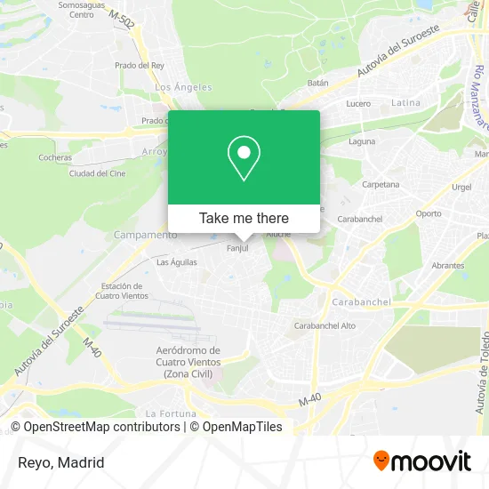
See Reyo, Madrid, on the map
Public Transit to Reyo in Madrid
Wondering how to get to Reyo in Madrid? Moovit helps you find the best way to get to Reyo with step-by-step directions from the nearest public transit station.
Moovit provides free maps and live directions to help you navigate through your city. View schedules, routes, timetables, and find out how long does it take to get to Reyo in real time.
Looking for the nearest stop or station to Reyo? Check out this list of stops closest to your destination: Maestra Justa Freire - P. Aluche Cercanías; Rafael Finat - Valle Inclán; Junta Municipal Latina; Vidauba - Damasquillo; Empalme; Las Águilas.
Bus: 131, 138, 155, 17, 483, 491, 139, 487, N18.Train: C5.Metro: M-5.
Want to see if there’s another route that gets you there at an earlier time? Moovit helps you find alternative routes or times. Get directions from and directions to Reyo easily from the Moovit App or Website.
We make riding to Reyo easy, which is why over 1.5 million users, including users in Madrid, trust Moovit as the best app for public transit. You don’t need to download an individual bus app or train app, Moovit is your all-in-one transit app that helps you find the best bus time or train time available.
For information on prices of metro, train and bus, costs and ride fares to Reyo, please check the Moovit app.
Use the app to navigate to popular places including to the airport, hospital, stadium, grocery store, mall, coffee shop, school, college, and university.
Reyo Address: Calle Doctor Blanco Soler, 17 28044 Las Águilas Madrid street in Madrid
- A.O. Konica - Minolta,
- Print Copiadoras Proyectos Integrales de Fotocopiadoras,
- PRINT Copiadoras Y Fotocopias,
- Yogamago,
- Ninon Peluqueros,
- Ultramarinos Madriz,
- Panadería Merche,
- Calle Doctor Blanco Soler,
- Silvia Altolaguirre Soler,
- Caja España-Duero,
- Peluqueria Begoña,
- Contenedores Aluche,
- Eldorado,
- Bt España Compañia de Servicios Globales de Telecomunicaciones,
- Suma Supermercado,
- Lavandería Autoservici,
- Calle Rafael Finat 17,
- Cafetería Desayunos Bar,
- Bar El Burgalés,
- Casa Félix II
Places Near Reyo (Madrid)
- Calle de López de Hoyos 169, Madrid,
- Centro Comercial Islazul, Área Metropolitana De Madrid Y Corredor Del Henares,
- Centro Comercial La Gavia, Área Metropolitana De Madrid Y Corredor Del Henares,
- Rastro De Madrid, Área Metropolitana De Madrid Y Corredor Del Henares,
- Mercadillo de Majadahonda, Majadahonda,
- Hospital Universitario La Paz, Madrid,
- Estacion de Chamartin, Madrid,
- Mendez Alvaro, Madrid,
- Centro Comercial La Vaguada, Área Metropolitana De Madrid Y Corredor Del Henares,
- Centro Comercial Oasiz Madrid, Área Metropolitana De Madrid Y Corredor Del Henares,
- Hospital Universitario Ramón y Cajal, Madrid,
- Plenilunio, Área Metropolitana De Madrid Y Corredor Del Henares,
- Hospital Clínico Universitario San Carlos, Madrid,
- Palacio De Vistalegre, Área Metropolitana De Madrid Y Corredor Del Henares,
- Estadio Wanda Metropolitano, Área Metropolitana De Madrid Y Corredor Del Henares,
- Plaza Mayor, Madrid,
- Wizink Center, Madrid,
- Sala La Riviera, Madrid,
- Tres Aguas, Alcorcón,
- Nassica, Área Metropolitana De Madrid Y Corredor Del Henares
How to get to popular places in Madrid with public transit
Get around Madrid by public transit!
Traveling around Madrid has never been so easy. See step by step directions as you travel to any attraction, street or major public transit station. View bus and train schedules, arrival times, service alerts and detailed routes on a map, so you know exactly how to get to anywhere in Madrid.
When traveling to any destination around Madrid use Moovit's Live Directions with Get Off Notifications to know exactly where and how far to walk, how long to wait for your line, and how many stops are left. Moovit will alert you when it's time to get off — no need to constantly re-check whether yours is the next stop.
Wondering how to use public transit in Madrid or how to pay for public transit in Madrid? Moovit public transit app can help you navigate your way with public transit easily, and at minimum cost. It includes public transit fees, ticket prices, and costs. Looking for a map of Madrid public transit lines? Moovit public transit app shows all public transit maps in Madrid with all Bus, Train, Metro and Light Rail routes and stops on an interactive map.
Madrid has 4 transit type(s), including: Bus, Train, Metro and Light Rail, operated by several transit agencies, including Metro de Madrid, Metro Ligero, Tranvía de Parla, Renfe Cercanías - Servicios de Autobús especiales, Renfe Cercanias, Renfe Cercanías, EMT, Interurbanos, Urbanos de Alcalá de Henares, Urbanos de Alcobendas, Urbanos de Alcorcón, Urbanos de Algete, Urbanos de Aranjuez, Urbanos de Arganda del Rey and Urbanos de Arroyomolinos