How to get to Rgm Construction by bus?
Click on the bus route to see step by step directions with maps, line arrival times and updated time schedules.
From Indiana State Fairgrounds South Pavilion (Saddle Horse Barn), Indianapolis City (Balance)
33 minFrom Michaels, Indianapolis City (Balance)
88 minFrom American Family Care - Urgent Care, Lawrence
19 minFrom Fisheye Seafood, Indianapolis City (Balance)
85 minFrom E 75th St / N Shadeland Ave, Indianapolis City (Balance)
59 minFrom Kittle's Furniture, Indianapolis City (Balance)
93 minFrom Community Heart-Vascular Physicians, Indianapolis City (Balance)
62 minFrom Wheeler Mission Center For Women & Children, Indianapolis City (Balance)
55 minFrom PLS Financial Services (PLS Check Cashing Store), Indianapolis City (Balance)
48 minFrom E 10th St / N German Church Rd, Indianapolis City (Balance)
40 min
Bus stops near Rgm Construction in Indianapolis City (Balance)
Bus lines to Rgm Construction in Indianapolis City (Balance)
What are the closest stations to Rgm Construction?
The closest stations to Rgm Construction are:
- 42nd St & Aspen Way is 174 yards away, 3 min walk.
- Post Rd And 42nd St is 814 yards away, 10 min walk.
- Post & 42nd Station Sb is 829 yards away, 10 min walk.
Which bus lines stop near Rgm Construction?
These bus lines stop near Rgm Construction: 30, 87.
What’s the nearest bus station to Rgm Construction in Indianapolis City (Balance)?
The nearest bus station to Rgm Construction in Indianapolis City (Balance) is 42nd St & Aspen Way. It’s a 3 min walk away.
What time is the first bus to Rgm Construction in Indianapolis City (Balance)?
The 92 is the first bus that goes to Rgm Construction in Indianapolis City (Balance). It stops nearby at 4:16 AM.
What time is the last bus to Rgm Construction in Indianapolis City (Balance)?
The 92 is the last bus that goes to Rgm Construction in Indianapolis City (Balance). It stops nearby at 1:01 AM.
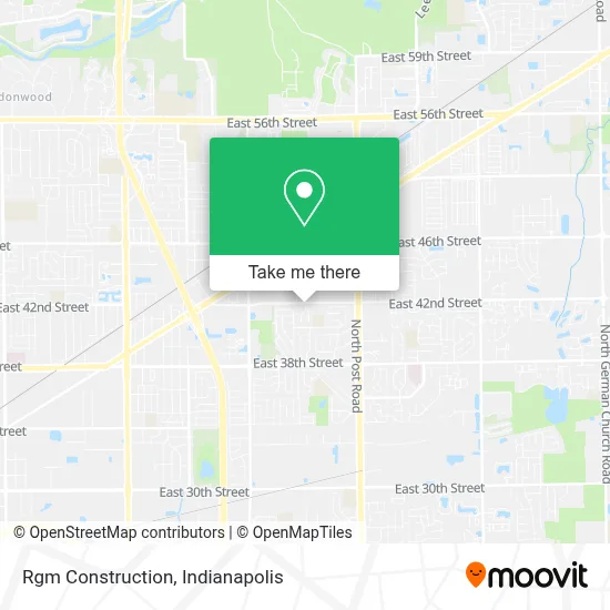
See Rgm Construction, Indianapolis City (Balance), on the map
Public Transit to Rgm Construction in Indianapolis City (Balance)
Wondering how to get to Rgm Construction in Indianapolis City (Balance)? Moovit helps you find the best way to get to Rgm Construction with step-by-step directions from the nearest public transit station.
Moovit provides free maps and live directions to help you navigate through your city. View schedules, routes, timetables, and find out how long does it take to get to Rgm Construction in real time.
Looking for the nearest stop or station to Rgm Construction? Check out this list of stops closest to your destination: 42nd St & Aspen Way; Post Rd And 42nd St; Post & 42nd Station Sb.
Bus: 30, 87, 92.
Want to see if there’s another route that gets you there at an earlier time? Moovit helps you find alternative routes or times. Get directions from and directions to Rgm Construction easily from the Moovit App or Website.
We make riding to Rgm Construction easy, which is why over 1.5 million users, including users in Indianapolis City (Balance), trust Moovit as the best app for public transit. You don’t need to download an individual bus app or train app, Moovit is your all-in-one transit app that helps you find the best bus time or train time available.
For information on prices of bus, costs and ride fares to Rgm Construction, please check the Moovit app.
Use the app to navigate to popular places including to the airport, hospital, stadium, grocery store, mall, coffee shop, school, college, and university.
Rgm Construction Address: 4144 Richelieu Rd street in Indianapolis City (Balance)
- Davidson Rehabilitation Center,
- WS Electric,
- Prestige Siding & Windows Llc,
- B Joyner,
- Key Boss Locksmith,
- A Mothers Love Childcare,
- Rdg Flooring Installation,
- Marcos Tree Care,
- Best Fun Party Rental And Entertainment,
- B B Security Co OP Associatio,
- The Ross Foundation,
- Cccoc Indy,
- Dt Preschool Ministry,
- THE NORTH FACE,
- Glidden Professional Paint Center,
- Rachael Kathleen Agbonhese, MD,
- Rainbow Shops,
- Vernon Lee Osburn, Aprn,
- Discount Mattress,
- Deluxe Hot Dogs
Places Near Rgm Construction (Indianapolis City (Balance))
- Indianapolis Airport Zone 2, Indianapolis City (Balance),
- Gainbridge Fieldhouse, Indianapolis City (Balance),
- THE BALT, Indianapolis City (Balance),
- Indiana Convention Center, Indianapolis City (Balance),
- Lilly Corporate Center (Eli Lilly & Co), Indianapolis City (Balance),
- Lucas Oil Stadium, Indianapolis City (Balance),
- I U Health Methodist Hospital, Indianapolis City (Balance),
- Train Ride At Castleton Mall, Indianapolis City (Balance),
- Jersey Barn, Indianapolis City (Balance),
- Indiana, Indianapolis City (Balance),
- St. Vincent entrance #1, Indianapolis City (Balance),
- Indianapolis Motor Speedway, Speedway,
- Plainfield, IN, Plainfield,
- St. Vincent Hospital - Indianapolis, Indianapolis City (Balance),
- Eskenazi Hospital, Indianapolis City (Balance),
- Methodist Hospital of Indianapolis, Indianapolis City (Balance),
- 119 W 19th St Parking, Indianapolis City (Balance),
- I-465 / I-65 Interchange, Indianapolis City (Balance),
- Castleton Square Mall, Indianapolis,
- Cotter's Massage Parlor With Happy Endings, Indianapolis City (Balance)
How to get to popular places in Indianapolis with public transit
Get around Indianapolis City (Balance) by public transit!
Traveling around Indianapolis City (Balance) has never been so easy. See step by step directions as you travel to any attraction, street or major public transit station. View bus and train schedules, arrival times, service alerts and detailed routes on a map, so you know exactly how to get to anywhere in Indianapolis City (Balance).
When traveling to any destination around Indianapolis City (Balance) use Moovit's Live Directions with Get Off Notifications to know exactly where and how far to walk, how long to wait for your line, and how many stops are left. Moovit will alert you when it's time to get off — no need to constantly re-check whether yours is the next stop.
Wondering how to use public transit in Indianapolis City (Balance) or how to pay for public transit in Indianapolis City (Balance)? Moovit public transit app can help you navigate your way with public transit easily, and at minimum cost. It includes public transit fees, ticket prices, and costs. Looking for a map of Indianapolis City (Balance) public transit lines? Moovit public transit app shows all public transit maps in Indianapolis City (Balance) with all bus routes and stops on an interactive map.
Indianapolis has 1 transit type(s), including: bus, operated by several transit agencies, including IndyGo, FlixBus-us and Greyhound-us