Directions to Rgr Transportes (Araucária) with public transportation
The following transit lines have routes that pass near Rgr Transportes
How to get to Rgr Transportes by bus?
Click on the bus route to see step by step directions with maps, line arrival times and updated time schedules.
From Fazenda Rio Grande, Fazenda Rio Grande
85 minFrom Rua Cyro Correia Pereira, Cic
58 minFrom Terminal Fazenda Rio Grande, Fazenda Rio Grande
69 minFrom BR-116, km 125 s/n, Fazenda Rio Grande
85 minFrom Bosch, Cic
63 minFrom Rua Tenente Sandro Luiz Kampa 182, Fazenda Rio Grande
85 minFrom Mondelez Brasil, Cic
49 minFrom Campo de Santana, Campo De Santana
77 minFrom Estrada Delegado Bruno de Almeida, Campo De Santana
65 minFrom Rua Engenheiro Eduardo Afonso Nadolny, Cic
72 min
Bus stops near Rgr Transportes in Araucária
Bus lines to Rgr Transportes in Araucária
- 21 FONTE NOVA / SHANGRI-LA, Terminal Central Araucária ↺ Fonte Nova / Shangri-Lá (Circular),VIEW
- F04 JARDINEIRA, Rua Hortência → Terminal Central Araucária,VIEW
- 24 SÃO FRANCISCO, Terminal Central Araucária ↺ São Francisco (Circular),VIEW
- 02 LINHÃO 02 (ANGÉLICA / TUPY), Terminal Vila Angélica → Tupy,VIEW
- 20 PLANALTO / MINAS GERAIS, Terminal Central Araucária ↺ Planalto via Minas Gerais (Circular),VIEW
- 25 COSTEIRA / D'AMPEZZO, Terminal Central Araucária ↺ Costeira / D'Ampezzo (Circular),VIEW
What are the closest stations to Rgr Transportes?
The closest stations to Rgr Transportes are:
- Rua Rio Grande Do Sul, 479 is 240 meters away, 4 min walk.
- Rua Miguel Bertolino Pizato, 1037 is 470 meters away, 7 min walk.
- Avenida Archelau De Almeida Tôrres, 836 is 701 meters away, 10 min walk.
Which bus lines stop near Rgr Transportes?
These bus lines stop near Rgr Transportes: 02 LINHÃO 02 (ANGÉLICA / TUPY), 21 FONTE NOVA / SHANGRI-LA.
What’s the nearest bus station to Rgr Transportes in Araucária?
The nearest bus station to Rgr Transportes in Araucária is Rua Rio Grande Do Sul, 479. It’s a 4 min walk away.
What time is the first bus to Rgr Transportes in Araucária?
The 24 SÃO FRANCISCO is the first bus that goes to Rgr Transportes in Araucária. It stops nearby at 4:26 AM.
What time is the last bus to Rgr Transportes in Araucária?
The 02 LINHÃO 02 (ANGÉLICA / TUPY) is the last bus that goes to Rgr Transportes in Araucária. It stops nearby at 1:02 AM.
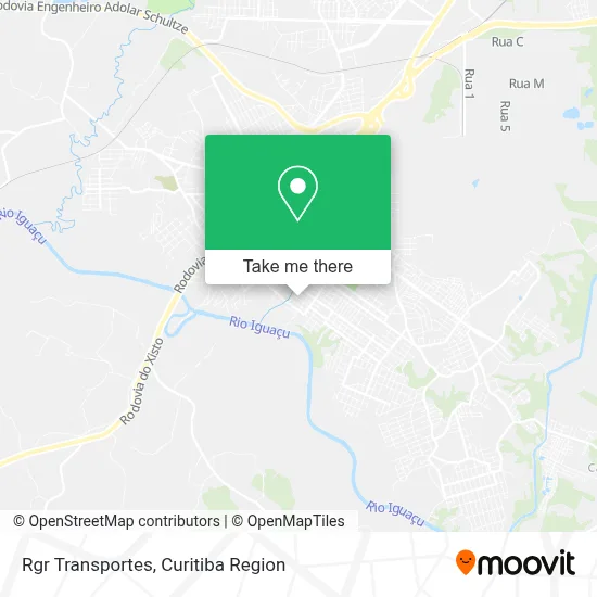
See Rgr Transportes, Araucária, on the map
Public Transit to Rgr Transportes in Araucária
Wondering how to get to Rgr Transportes in Araucária? Moovit helps you find the best way to get to Rgr Transportes with step-by-step directions from the nearest public transit station.
Moovit provides free maps and live directions to help you navigate through your city. View schedules, routes, timetables, and find out how long does it take to get to Rgr Transportes in real time.
Looking for the nearest stop or station to Rgr Transportes? Check out this list of stops closest to your destination: Rua Rio Grande Do Sul; Rua Miguel Bertolino Pizato; Avenida Archelau De Almeida Tôrres.
Bus: 02 LINHÃO 02 (ANGÉLICA / TUPY), 21 FONTE NOVA / SHANGRI-LA, F04 JARDINEIRA, 24 SÃO FRANCISCO, 20 PLANALTO / MINAS GERAIS, 25 COSTEIRA / D'AMPEZZO.
Want to see if there’s another route that gets you there at an earlier time? Moovit helps you find alternative routes or times. Get directions from and directions to Rgr Transportes easily from the Moovit App or Website.
We make riding to Rgr Transportes easy, which is why over 1.5 million users, including users in Araucária, trust Moovit as the best app for public transit. You don’t need to download an individual bus app or train app, Moovit is your all-in-one transit app that helps you find the best bus time or train time available.
For information on prices of bus, costs and ride fares to Rgr Transportes, please check the Moovit app.
Use the app to navigate to popular places including to the airport, hospital, stadium, grocery store, mall, coffee shop, school, college, and university.
Rgr Transportes Address: Rua Professor Augusto Sebastião Querne, 69 Iguaçu Araucária-PR 83701-070 street in Araucária
- Pgl Construções,
- Rbv Consultoria Empresarial,
- Papos de Guria Decor,
- Buhnemann Incorporadora,
- Maison Gestao,
- L.M. Incorporadora,
- Discomotriz,
- Residencial Malibu,
- Lem Motoboy,
- Mais Top Estética - Araucária / Iguaçu,
- Espaço Bruna Vogmann,
- Lion Seg,
- Panificadora Doce Pao,
- Condominio Residencial Terezinha Kuchta,
- Acesscont Servicos Adminstrativos,
- Fernanda Beauty Center,
- Neiva Lima,
- Bull Suplementos,
- Nh Moda Fitness,
- Atelier Luiz Carlos Quadros
Places Near Rgr Transportes (Araucária)
- Hospital Universitário Evangélico de Curitiba, Bigorrilho,
- Rua Martim Afonso 558, Mercês,
- Jardim Botânico de Curitiba PR, Centro,
- Hospital Da Cruz Vermelha, Batel,
- Hospital de Clínicas (HC - UFPR), Centro,
- Hospital do Rocio, Campo,
- Hospital Erasto Gaertner, Jardim Das Américas,
- Hospital Nossa Senhora Das Graças, Mercês,
- Hospital Angelina Caron, Campina Grande Do Sul,
- Campo Largo, Campo,
- Hospital Madalena Sofia, Bairro Alto,
- Hhhhh, Fazendinha,
- Park Shopping Barigüi, Mossunguê,
- Parque Barigui, Mercês,
- Arena Da Baixada - Curitiba,
- Pontifícia Universidade Católica do Paraná (PUCPR), Prado Velho,
- Shopping Estação, Rebouças,
- Jockey Plaza Shopping Center, Tarumã,
- Shopping Palladium, Portão,
- Rua General Mário Tourinho, Campina Do Siqueira
How to get to popular places in Curitiba Region with public transit
Get around Araucária by public transit!
Traveling around Araucária has never been so easy. See step by step directions as you travel to any attraction, street or major public transit station. View bus and train schedules, arrival times, service alerts and detailed routes on a map, so you know exactly how to get to anywhere in Araucária.
When traveling to any destination around Araucária use Moovit's Live Directions with Get Off Notifications to know exactly where and how far to walk, how long to wait for your line, and how many stops are left. Moovit will alert you when it's time to get off — no need to constantly re-check whether yours is the next stop.
Wondering how to use public transit in Araucária or how to pay for public transit in Araucária? Moovit public transit app can help you navigate your way with public transit easily, and at minimum cost. It includes public transit fees, ticket prices, and costs. Looking for a map of Araucária public transit lines? Moovit public transit app shows all public transit maps in Araucária with all Bus and Cable Car routes and stops on an interactive map.
Curitiba Region has 2 transit type(s), including: Bus and Cable Car, operated by several transit agencies, including Sistema Integrado de Mobilidade (URBS), Sistema Integrado de Mobilidade (AMEP), URBS (Cartões bancários e Dinheiro), URBS (Cartões bancários / Cartão URBS), AMEP (Cartões bancários / Cartão MetroCard), AMEP (Cartões bancários / Cartão MetroCard / Dinheiro), Viação Colombo (Dinheiro), TRIAR (Cartão TRIAR / Dinheiro), Empresa Curitiba Cerro Azul (Dinheiro), Expresso Nossa Senhora da Penha (Dinheiro), Empresa Campo Alto Tijucas (Dinheiro), Auto Viação São José (Cartão VEM / Dinheiro), BRT S/A (Cartão VEM / Dinheiro), TransPiedade (Cartão Cidadão / Dinheiro) and Oceânica Sul (Cartão Transporte / Dinheiro)