How to get to Rheumatoid Arthritis by bus?
Click on the bus route to see step by step directions with maps, line arrival times and updated time schedules.
From Shell, Indianapolis City (Balance)
29 minFrom Methodist Hospital Cardiac Catheterization Lab, Indianapolis City (Balance)
53 minFrom Amir Cuts, Indianapolis City (Balance)
57 minFrom 38th and Boulevard, Indianapolis City (Balance)
48 minFrom IU Health Methodist Professional Center 1, Indianapolis City (Balance)
59 minFrom Citibank, Indianapolis City (Balance)
46 minFrom Anthem BCBS/Wellpoint Ben Lytle Building, Indianapolis City (Balance)
58 minFrom Methodist Hospital of Indianapolis, Indianapolis City (Balance)
58 minFrom Uptons Famous Pet Training Center, Indianapolis City (Balance)
78 minFrom Jake's Locksmith Shop, Indianapolis City (Balance)
67 min
Bus stops near Rheumatoid Arthritis in Indianapolis City (Balance)
Bus lines to Rheumatoid Arthritis in Indianapolis City (Balance)
What are the closest stations to Rheumatoid Arthritis?
The closest stations to Rheumatoid Arthritis are:
- Shadeland Ave & 32nd St is 328 yards away, 5 min walk.
- 30th St - 6555 E is 576 yards away, 7 min walk.
Which bus lines stop near Rheumatoid Arthritis?
These bus lines stop near Rheumatoid Arthritis: 2, 30.
What’s the nearest bus station to Rheumatoid Arthritis in Indianapolis City (Balance)?
The nearest bus station to Rheumatoid Arthritis in Indianapolis City (Balance) is Shadeland Ave & 32nd St. It’s a 5 min walk away.
What time is the first bus to Rheumatoid Arthritis in Indianapolis City (Balance)?
The 30 is the first bus that goes to Rheumatoid Arthritis in Indianapolis City (Balance). It stops nearby at 4:27 AM.
What time is the last bus to Rheumatoid Arthritis in Indianapolis City (Balance)?
The 30 is the last bus that goes to Rheumatoid Arthritis in Indianapolis City (Balance). It stops nearby at 11:52 PM.
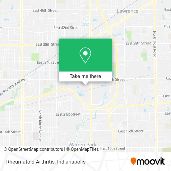
See Rheumatoid Arthritis, Indianapolis City (Balance), on the map
Public Transit to Rheumatoid Arthritis in Indianapolis City (Balance)
Wondering how to get to Rheumatoid Arthritis in Indianapolis City (Balance)? Moovit helps you find the best way to get to Rheumatoid Arthritis with step-by-step directions from the nearest public transit station.
Moovit provides free maps and live directions to help you navigate through your city. View schedules, routes, timetables, and find out how long does it take to get to Rheumatoid Arthritis in real time.
Looking for the nearest stop or station to Rheumatoid Arthritis? Check out this list of stops closest to your destination: Shadeland Ave & 32nd St; 30th St - 6555 E.
Bus: 2, 30.
Want to see if there’s another route that gets you there at an earlier time? Moovit helps you find alternative routes or times. Get directions from and directions to Rheumatoid Arthritis easily from the Moovit App or Website.
We make riding to Rheumatoid Arthritis easy, which is why over 1.5 million users, including users in Indianapolis City (Balance), trust Moovit as the best app for public transit. You don’t need to download an individual bus app or train app, Moovit is your all-in-one transit app that helps you find the best bus time or train time available.
For information on prices of bus, costs and ride fares to Rheumatoid Arthritis, please check the Moovit app.
Use the app to navigate to popular places including to the airport, hospital, stadium, grocery store, mall, coffee shop, school, college, and university.
Rheumatoid Arthritis Address: 2900 N Shadeland Ave street in Indianapolis City (Balance)
- New Creative Blankets,
- Angels In Our Hearts,
- Mobtee,
- The Flock,
- Blessed by Jesus,
- Jesus Is My Life,
- Inspired by Christ,
- Black And Boujee - Winterbubble,
- God And Love - Liontee Print,
- Tee 9999,
- Topchoicetee,
- 81 Fanmade,
- Buddy Store,
- Goodwill Outlet Store,
- Abc Supply Co., Inc.,
- Folks First Garage Door Services,
- Abc Supply Co. Inc.,
- Creative Card Group, A World Media Group, Inc. Company,
- Goodwill Outlet Store,
- Pulsebamboo
Places Near Rheumatoid Arthritis (Indianapolis City (Balance))
- THE BALT, Indianapolis City (Balance),
- Indiana Convention Center, Indianapolis City (Balance),
- Jersey Barn, Indianapolis City (Balance),
- Plainfield, IN, Plainfield,
- Indiana, Indianapolis City (Balance),
- I-465 / I-65 Interchange, Indianapolis City (Balance),
- Eskenazi Hospital, Indianapolis City (Balance),
- Lucas Oil Stadium, Indianapolis City (Balance),
- Lilly Corporate Center (Eli Lilly & Co), Indianapolis City (Balance),
- Indianapolis Motor Speedway, Speedway,
- St. Vincent Hospital - Indianapolis, Indianapolis City (Balance),
- St. Vincent entrance #1, Indianapolis City (Balance),
- I U Health Methodist Hospital, Indianapolis City (Balance),
- 119 W 19th St Parking, Indianapolis City (Balance),
- Castleton Square Mall, Indianapolis,
- Train Ride At Castleton Mall, Indianapolis City (Balance),
- Cotter's Massage Parlor With Happy Endings, Indianapolis City (Balance),
- Indianapolis Airport Zone 2, Indianapolis City (Balance),
- Methodist Hospital of Indianapolis, Indianapolis City (Balance),
- Gainbridge Fieldhouse, Indianapolis City (Balance)
How to get to popular places in Indianapolis with public transit
Get around Indianapolis City (Balance) by public transit!
Traveling around Indianapolis City (Balance) has never been so easy. See step by step directions as you travel to any attraction, street or major public transit station. View bus and train schedules, arrival times, service alerts and detailed routes on a map, so you know exactly how to get to anywhere in Indianapolis City (Balance).
When traveling to any destination around Indianapolis City (Balance) use Moovit's Live Directions with Get Off Notifications to know exactly where and how far to walk, how long to wait for your line, and how many stops are left. Moovit will alert you when it's time to get off — no need to constantly re-check whether yours is the next stop.
Wondering how to use public transit in Indianapolis City (Balance) or how to pay for public transit in Indianapolis City (Balance)? Moovit public transit app can help you navigate your way with public transit easily, and at minimum cost. It includes public transit fees, ticket prices, and costs. Looking for a map of Indianapolis City (Balance) public transit lines? Moovit public transit app shows all public transit maps in Indianapolis City (Balance) with all bus routes and stops on an interactive map.
Indianapolis has 1 transit type(s), including: bus, operated by several transit agencies, including IndyGo, FlixBus-us and Greyhound-us