How to get to Rhs by bus?
Click on the bus route to see step by step directions with maps, line arrival times and updated time schedules.
From Hôpital André Mignot, Le Chesnay
57 minFrom Voisins-Le-Bretonneux, Voisins-Le-Bretonneux
81 minFrom Élancourt, Elancourt
81 minFrom Chambourcy, Chambourcy
69 minFrom Guyancourt, Guyancourt
66 minFrom Le Chesnay, Le Chesnay
57 minFrom Parly 2, Le Chesnay
60 minFrom Maurepas, Maurepas
90 minFrom Hôpital Mignot – Centre Hospitalier de Versailles, Le Chesnay
57 minFrom Château de Versailles, Versailles
36 min
How to get to Rhs by train?
Click on the train route to see step by step directions with maps, line arrival times and updated time schedules.
Bus stops near Rhs in Les Clayes-Sous-Bois
Train station near Rhs in Les Clayes-Sous-Bois
- Villepreux - Les Clayes, 5 min walk,VIEW
Bus lines to Rhs in Les Clayes-Sous-Bois
- 5289, Notre Dame du Bel-Air,VIEW
- 5296, Pablo Picasso,VIEW
- 5323, Gare Routière Des Clayes,VIEW
- 5101, Gare de Plaisir Grignon - Quai 4,VIEW
- 5112, Gare Routière Des Clayes,VIEW
- 5102, Versailles Chantiers Gare - Quai J,VIEW
- N160, Gare de Plaisir Grignon - Quai 7,VIEW
- 5199, Lycée Sonia Delaunay,VIEW
- 5117, Gare de Plaisir Grignon - Quai 1,VIEW
What are the closest stations to Rhs?
The closest stations to Rhs are:
- République is 186 meters away, 3 min walk.
- Gare Routière Des Clayes is 253 meters away, 4 min walk.
- Jules Ferry is 313 meters away, 5 min walk.
- Villepreux - Les Clayes is 361 meters away, 5 min walk.
- Moulin is 445 meters away, 6 min walk.
Which bus lines stop near Rhs?
These bus lines stop near Rhs: 5102, 5112, 5323.
Which train line stops near Rhs?
N (Paris-Montparnasse)
What’s the nearest train station to Rhs in Les Clayes-Sous-Bois?
The nearest train station to Rhs in Les Clayes-Sous-Bois is Villepreux - Les Clayes. It’s a 5 min walk away.
What’s the nearest bus station to Rhs in Les Clayes-Sous-Bois?
The nearest bus station to Rhs in Les Clayes-Sous-Bois is République. It’s a 3 min walk away.
What time is the first train to Rhs in Les Clayes-Sous-Bois?
The N is the first train that goes to Rhs in Les Clayes-Sous-Bois. It stops nearby at 4:47 AM.
What time is the last train to Rhs in Les Clayes-Sous-Bois?
The N is the last train that goes to Rhs in Les Clayes-Sous-Bois. It stops nearby at 11:44 PM.
What time is the first bus to Rhs in Les Clayes-Sous-Bois?
The N160 is the first bus that goes to Rhs in Les Clayes-Sous-Bois. It stops nearby at 3:32 AM.
What time is the last bus to Rhs in Les Clayes-Sous-Bois?
The N160 is the last bus that goes to Rhs in Les Clayes-Sous-Bois. It stops nearby at 3:32 AM.
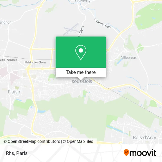
See Rhs, Les Clayes-Sous-Bois, on the map
Public Transit to Rhs in Les Clayes-Sous-Bois
Wondering how to get to Rhs in Les Clayes-Sous-Bois? Moovit helps you find the best way to get to Rhs with step-by-step directions from the nearest public transit station.
Moovit provides free maps and live directions to help you navigate through your city. View schedules, routes, timetables, and find out how long does it take to get to Rhs in real time.
Looking for the nearest stop or station to Rhs? Check out this list of stops closest to your destination: République; Gare Routière Des Clayes; Jules Ferry; Villepreux - Les Clayes; Moulin.
Bus: 5102, 5112, 5323, 5289, 5296, 5101, N160, 5199, 5117.Train: N.
Want to see if there’s another route that gets you there at an earlier time? Moovit helps you find alternative routes or times. Get directions from and directions to Rhs easily from the Moovit App or Website.
We make riding to Rhs easy, which is why over 1.5 million users, including users in Les Clayes-Sous-Bois, trust Moovit as the best app for public transit. You don’t need to download an individual bus app or train app, Moovit is your all-in-one transit app that helps you find the best bus time or train time available.
For information on prices of bus, train and light rail, costs and ride fares to Rhs, please check the Moovit app.
Use the app to navigate to popular places including to the airport, hospital, stadium, grocery store, mall, coffee shop, school, college, and university.
Rhs Address: 21 Avenue Jules Ferry 78340 Les Clayes-sous-Bois street in Les Clayes-Sous-Bois
- Pharmacie Mahé,
- Mp Design,
- Chez L Institut,
- Audioprothésiste (78340) - Centre Auditif Audika,
- Maison Foude,
- Ebami René,
- Jules Ferry 2,
- Espace Philippe Noiret,
- Le Resto'Théâtre,
- Mairie des Clayes-sous-Bois,
- Lidl,
- Place de la République,
- Les Clayes-sous-Bois,
- Pinocchio Pizzeria,
- Point de Vue,
- Magasin Boulanger,
- Catherine Zabus,
- Market,
- Résidence les Fougères,
- Credissimmo
Places Near Rhs (Les Clayes-Sous-Bois)
- 29 Rue Manin, Paris,
- Galeries Lafayette, Paris,
- Atelier Des Lumieres, Paris,
- Fondation Louis Vuitton, Paris,
- Institut Curie, Paris,
- Hôpital Cochin, Paris,
- Hôpital Beaujon, Clichy,
- Galeries Lafayette Haussmann, Paris,
- Théâtre Mogador, Paris,
- Centre Hospitalier des 15/20, Paris,
- Hôpital Necker, Paris,
- Créteil Soleil, Creteil,
- Hopital Lariboisière, Paris,
- Marché Saint-Pierre, Paris,
- Hôpital Pitié Salpêtrière, Paris,
- Hôpital Saint-Joseph, Paris,
- Gare Routière Flixbus, Paris,
- Hôpital de la Pitié-Salpêtrière, Paris,
- Hôpital Henri Mondor, Creteil,
- Hopital Foch, Suresnes
How to get to popular places in Paris with public transit
Get around Les Clayes-Sous-Bois by public transit!
Traveling around Les Clayes-Sous-Bois has never been so easy. See step by step directions as you travel to any attraction, street or major public transit station. View bus and train schedules, arrival times, service alerts and detailed routes on a map, so you know exactly how to get to anywhere in Les Clayes-Sous-Bois.
When traveling to any destination around Les Clayes-Sous-Bois use Moovit's Live Directions with Get Off Notifications to know exactly where and how far to walk, how long to wait for your line, and how many stops are left. Moovit will alert you when it's time to get off — no need to constantly re-check whether yours is the next stop.
Wondering how to use public transit in Les Clayes-Sous-Bois or how to pay for public transit in Les Clayes-Sous-Bois? Moovit public transit app can help you navigate your way with public transit easily, and at minimum cost. It includes public transit fees, ticket prices, and costs. Looking for a map of Les Clayes-Sous-Bois public transit lines? Moovit public transit app shows all public transit maps in Les Clayes-Sous-Bois with all Bus, Train, Metro, Light Rail, RER, Funicular and Gondola routes and stops on an interactive map.
Paris has 7 transit type(s), including: Bus, Train, Metro, Light Rail, RER, Funicular and Gondola, operated by several transit agencies, including RATP, RER, RER Bus de remplacement, Train, Train Bus de remplacement, Tramway Bus de remplacement, TER, ADP, Magical Shuttle, Argenteuil - Boucles de Seine, Autocars Dominique, Bièvre, Brie et 2 Morin, Le Bus - C.C. du Clermontois and Cœur d’Essonne