How to get to Ri2f by bus?
Click on the bus route to see step by step directions with maps, line arrival times and updated time schedules.
How to get to Ri2f by train?
Click on the train route to see step by step directions with maps, line arrival times and updated time schedules.
Bus stops near Ri2f in Saint-Max
Bus lines to Ri2f in Saint-Max
What are the closest stations to Ri2f?
The closest stations to Ri2f are:
- Washington Foch is 294 meters away, 4 min walk.
- Pont De Pierre is 729 meters away, 10 min walk.
- Libérator is 854 meters away, 11 min walk.
- Gérard Barrois is 883 meters away, 12 min walk.
- Varoquaux is 913 meters away, 12 min walk.
- Dommartemont is 1106 meters away, 15 min walk.
Which bus lines stop near Ri2f?
These bus lines stop near Ri2f: 13, T3.
Which train lines stop near Ri2f?
These train lines stop near Ri2f: C41, C44.
Which light rail line stops near Ri2f?
T1 (Essey Mouzimpré)
What’s the nearest bus station to Ri2f in Saint-Max?
The nearest bus station to Ri2f in Saint-Max is Washington Foch. It’s a 4 min walk away.
What time is the first light rail to Ri2f in Saint-Max?
The T1 is the first light rail that goes to Ri2f in Saint-Max. It stops nearby at 4:40 AM.
What time is the last light rail to Ri2f in Saint-Max?
The T1 is the last light rail that goes to Ri2f in Saint-Max. It stops nearby at 12:54 AM.
What time is the first bus to Ri2f in Saint-Max?
The 13 is the first bus that goes to Ri2f in Saint-Max. It stops nearby at 7:00 AM.
What time is the last bus to Ri2f in Saint-Max?
The 13 is the last bus that goes to Ri2f in Saint-Max. It stops nearby at 9:21 PM.
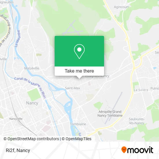
See Ri2f, Saint-Max, on the map
Public Transit to Ri2f in Saint-Max
Wondering how to get to Ri2f in Saint-Max? Moovit helps you find the best way to get to Ri2f with step-by-step directions from the nearest public transit station.
Moovit provides free maps and live directions to help you navigate through your city. View schedules, routes, timetables, and find out how long does it take to get to Ri2f in real time.
Looking for the nearest stop or station to Ri2f? Check out this list of stops closest to your destination: Washington Foch; Pont De Pierre; Libérator; Gérard Barrois; Varoquaux; Dommartemont.
Bus: 13, T3, T1, 22, 32, 58, 65, 59, 60, 54.Train: C41, C44.Light Rail: T1.
Want to see if there’s another route that gets you there at an earlier time? Moovit helps you find alternative routes or times. Get directions from and directions to Ri2f easily from the Moovit App or Website.
We make riding to Ri2f easy, which is why over 1.5 million users, including users in Saint-Max, trust Moovit as the best app for public transit. You don’t need to download an individual bus app or train app, Moovit is your all-in-one transit app that helps you find the best bus time or train time available.
For information on prices of bus, light rail and train, costs and ride fares to Ri2f, please check the Moovit app.
Use the app to navigate to popular places including to the airport, hospital, stadium, grocery store, mall, coffee shop, school, college, and university.
Ri2f Address: 47 Rue du Maréchal Foch 54130 Saint-Max street in Saint-Max
- France Parquet Eurl,
- Ecole Primaire Jules Ferry,
- Mairie De St Max,
- La Poste Saint-Max,
- Maison de Retraite du Clos Pré,
- Carnot,
- La Poste - Centre d'Examen du Code de la Route,
- Charlotte Biok,
- 95 Avenue Carnot,
- Grazioso Sébastien,
- Phot'Antik,
- Secours Catholique,
- Ldlt,
- Nur-Aydin,
- Secours Populaire Français - Antenne De Saint-Max,
- Amazon Locker-Adorable,
- Chez Maurice,
- Dr. Paquis-Parisot Jill,
- Hôtel Club Résidence Retraite,
- Sfs
Places Near Ri2f (Saint-Max)
- Maxéville, Maxéville,
- Nancy Thermal, Nancy,
- Polyclinique De Gentilly, Nancy,
- Kinepolis Nancy, Nancy,
- Clinique Majorelle, Nancy,
- Hopital de Brabois CHU, VandUvre-Lès-Nancy,
- centre d'imagerie jacques callot, Maxéville,
- Tomblaine, Tomblaine,
- Dépose-Minute, Nancy,
- Cora, Houdemont,
- Villa Majorelle, Nancy,
- Essey-Lès-Nancy, Essey-Lès-Nancy,
- Zénith De Nancy, Maxéville,
- Haut Du Lièvre, Nancy,
- E.Leclerc, VandUvre-Lès-Nancy,
- Villers-Lès-Nancy, Villers-Lès-Nancy,
- Piscine Nancy Thermal, Nancy,
- Clinique Pasteur, Essey-Lès-Nancy,
- Rue Colette, Nancy,
- Hôpital Central, Nancy
How to get to popular places in Nancy with public transit
Get around Saint-Max by public transit!
Traveling around Saint-Max has never been so easy. See step by step directions as you travel to any attraction, street or major public transit station. View bus and train schedules, arrival times, service alerts and detailed routes on a map, so you know exactly how to get to anywhere in Saint-Max.
When traveling to any destination around Saint-Max use Moovit's Live Directions with Get Off Notifications to know exactly where and how far to walk, how long to wait for your line, and how many stops are left. Moovit will alert you when it's time to get off — no need to constantly re-check whether yours is the next stop.
Wondering how to use public transit in Saint-Max or how to pay for public transit in Saint-Max? Moovit public transit app can help you navigate your way with public transit easily, and at minimum cost. It includes public transit fees, ticket prices, and costs. Looking for a map of Saint-Max public transit lines? Moovit public transit app shows all public transit maps in Saint-Max with all Bus, Train and Light Rail routes and stops on an interactive map.
Nancy has 3 transit type(s), including: Bus, Train and Light Rail, operated by several transit agencies, including Réseau STAN, SNCF VOYAGEURS and OCEdefault