How to get to Riaz Verwaltungs by bus?
Click on the bus route to see step by step directions with maps, line arrival times and updated time schedules.
From Baden-Baden, Karlsruhe/Baden-Baden Airport, Rheinmünster
213 minFrom Panorama-Bad Freudenstadt, Vereinbarte Verwaltungsgemeinschaft Freudenstadt
459 minFrom Krankenhaus Freudenstadt, Vereinbarte Verwaltungsgemeinschaft Freudenstadt
469 minFrom Klinik Hohenfreudenstadt, Vereinbarte Verwaltungsgemeinschaft Freudenstadt
452 minFrom Hotel Palmenwald, Vereinbarte Verwaltungsgemeinschaft Freudenstadt
365 minFrom Parkplatz Bauhaus, Verwaltungsgemeinschaft Offenburg
44 minFrom Berghütte Lauterbad, Vereinbarte Verwaltungsgemeinschaft Freudenstadt
371 minFrom Grinde-Hütte, Seebach
139 min
Bus stop near Riaz Verwaltungs in Hohberg
- Diersburg Rathaus, 9 min walk,VIEW
Bus lines to Riaz Verwaltungs in Hohberg
What are the closest stations to Riaz Verwaltungs?
The closest stations to Riaz Verwaltungs are:
- Diersburg Rathaus is 677 meters away, 9 min walk.
Which bus line stops near Riaz Verwaltungs?
S6 (Diersburg Rathaus)
What’s the nearest bus station to Riaz Verwaltungs in Hohberg?
The nearest bus station to Riaz Verwaltungs in Hohberg is Diersburg Rathaus. It’s a 9 min walk away.
What time is the first bus to Riaz Verwaltungs in Hohberg?
The S6 is the first bus that goes to Riaz Verwaltungs in Hohberg. It stops nearby at 5:15 AM.
What time is the last bus to Riaz Verwaltungs in Hohberg?
The S6 is the last bus that goes to Riaz Verwaltungs in Hohberg. It stops nearby at 10:38 PM.
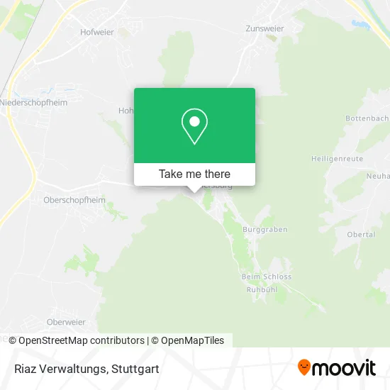
See Riaz Verwaltungs, Hohberg, on the map
Public Transit to Riaz Verwaltungs in Hohberg
Wondering how to get to Riaz Verwaltungs in Hohberg? Moovit helps you find the best way to get to Riaz Verwaltungs with step-by-step directions from the nearest public transit station.
Moovit provides free maps and live directions to help you navigate through your city. View schedules, routes, timetables, and find out how long does it take to get to Riaz Verwaltungs in real time.
Looking for the nearest stop or station to Riaz Verwaltungs? Check out this list of stops closest to your destination: Diersburg Rathaus.
Bus: S6, 7141.
Want to see if there’s another route that gets you there at an earlier time? Moovit helps you find alternative routes or times. Get directions from and directions to Riaz Verwaltungs easily from the Moovit App or Website.
We make riding to Riaz Verwaltungs easy, which is why over 1.5 million users, including users in Hohberg, trust Moovit as the best app for public transit. You don’t need to download an individual bus app or train app, Moovit is your all-in-one transit app that helps you find the best bus time or train time available.
For information on prices of bus, train and light rail, costs and ride fares to Riaz Verwaltungs, please check the Moovit app.
Use the app to navigate to popular places including to the airport, hospital, stadium, grocery store, mall, coffee shop, school, college, and university.
Riaz Verwaltungs Address: Felixstraße 22 Diersburg, 77749 Hohberg street in Hohberg
- Albert Weingart,
- Schwarz Maßiv-Bau,
- Debeka Versichern Bausparen Bernfried Herrmann,
- Ferienwohnung Gastezimmer Elisabeth Wohrle,
- Schlägli Bar,
- Friseurteam Melanie Casiero,
- Christel Kleber Gasthof,
- Transporte Joachim Heyden,
- Toby's Kneiple,
- Des Guten Hirten,
- Diersburg Miniaturdörfle,
- Reifenservice,
- Schlepperfreunde Diersburg,
- Weingut Freiherr Roeder Diersburg,
- Edeka Kohler,
- Kempf Daten- und Umweltsysteme,
- Wöhrle Mühlen,
- Wöhrle Mühlen- und Fuhrbetriebs,
- Prowin Evelin,
- VIP Cutting Service
Places Near Riaz Verwaltungs (Hohberg)
- SI-Centrum, Möhringen,
- Mettingen Eros-Center Puff Laufhaus, Esslingen Am Neckar,
- Mercedes-Benz Museum (Mercedes Museum Stuttgart), Bad Cannstatt,
- Klinikum Stuttgart - Katharinenhospital, Stuttgart-Mitte,
- Hanns-Martin-Schleyer-Halle (Stuttgart Hans-Martin-Schleyerhalle), Bad Cannstatt,
- Porsche Museum, Zuffenhausen,
- Gleis 101/102 (tief), Stuttgart-Mitte,
- Gasometer Pforzheim, Pforzheim,
- Im Wizemann (Halle), Bad Cannstatt,
- Geilhaus Haus 33a, Reutlingen-Betzingen,
- Schleyerhalle, Bad Cannstatt,
- Pariser Platz Stuttgart, Stuttgart-Mitte,
- Wilhelma (U-Bahn Wilhelma), Bad Cannstatt,
- Porsche-Arena, Bad Cannstatt,
- Hanns-Martin-Schleyer-Halle, Bad Cannstatt,
- Waldfriedhof, Degerloch,
- Mercedes-Benz Museum, Bad Cannstatt,
- Hauptbahnhof Stuttgart, Stuttgart-Mitte,
- Marmorsaal Im Weissenburgpark, Stuttgart-Süd,
- FlixBus Haltestelle, Stuttgart
How to get to popular places in Stuttgart with public transit
Get around Hohberg by public transit!
Traveling around Hohberg has never been so easy. See step by step directions as you travel to any attraction, street or major public transit station. View bus and train schedules, arrival times, service alerts and detailed routes on a map, so you know exactly how to get to anywhere in Hohberg.
When traveling to any destination around Hohberg use Moovit's Live Directions with Get Off Notifications to know exactly where and how far to walk, how long to wait for your line, and how many stops are left. Moovit will alert you when it's time to get off — no need to constantly re-check whether yours is the next stop.
Wondering how to use public transit in Hohberg or how to pay for public transit in Hohberg? Moovit public transit app can help you navigate your way with public transit easily, and at minimum cost. It includes public transit fees, ticket prices, and costs. Looking for a map of Hohberg public transit lines? Moovit public transit app shows all public transit maps in Hohberg with all Bus, Train, Subway, Light Rail, Ferry, S-Bahn and Funicular routes and stops on an interactive map.
Stuttgart has 7 transit type(s), including: Bus, Train, Subway, Light Rail, Ferry, S-Bahn and Funicular, operated by several transit agencies, including SSB - Stadtbahn, SSB, SSB - Seilbahn / Zacke, S-Bahn Stuttgart, Rhein-Neckar-Verkehr GmbH (rnv), Karlsruher Verkehrsverbund, DB AG, DB Regiobus BW, Arverio Baden-Württemberg GmbH, DB RegioNetz Verkehrs GmbH Westfrankenbahn, DB Regio AG Baden-Württemberg, Südwestdeutsche Verkehrs-AG, DB Regio AG Mitte Region Hessen, DB and Bodensee-Oberschwaben-Bahn