Directions to Ricardo Arcanjo (Araucária) with public transportation
The following transit lines have routes that pass near Ricardo Arcanjo
How to get to Ricardo Arcanjo by bus?
Click on the bus route to see step by step directions with maps, line arrival times and updated time schedules.
From Rua Nicola Pellanda, Pinheirinho
59 minFrom Rua Pedro Gusso, Capão Raso
55 minFrom Rua Professor Algacyr Munhoz Mader, Cic
37 minFrom Rua Nicola Pellanda, Umbará
73 minFrom Terminal CIC (Cidade Industrial de Curitiba), Cic
38 minFrom Avenida Winston Churchill, Capão Raso
53 minFrom Rodovia Régis Bittencourt (BR-116), Cic
60 minFrom Barigui, Araucária
28 minFrom Cidade da Lapa (PR), Capão Raso
71 minFrom Rua Marechal Otávio Saldanha Mazza 7584, Capão Raso
53 min
Bus stops near Ricardo Arcanjo in Araucária
Bus lines to Ricardo Arcanjo in Araucária
What are the closest stations to Ricardo Arcanjo?
The closest stations to Ricardo Arcanjo are:
- Rua Uirapuru, 804 is 311 meters away, 5 min walk.
- Rua Uirapuru, 810 is 331 meters away, 5 min walk.
Which bus lines stop near Ricardo Arcanjo?
These bus lines stop near Ricardo Arcanjo: 14 IPÊS / JATOBÁ, 33 CALIFÓRNIA / IPÊS.
What’s the nearest bus station to Ricardo Arcanjo in Araucária?
The nearest bus stations to Ricardo Arcanjo in Araucária are Rua Uirapuru, 804 and Rua Uirapuru, 810. The closest one is a 5 min walk away.
What time is the first bus to Ricardo Arcanjo in Araucária?
The 14 IPÊS / JATOBÁ is the first bus that goes to Ricardo Arcanjo in Araucária. It stops nearby at 4:23 AM.
What time is the last bus to Ricardo Arcanjo in Araucária?
The 14 IPÊS / JATOBÁ is the last bus that goes to Ricardo Arcanjo in Araucária. It stops nearby at 1:00 AM.
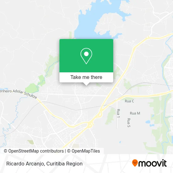
See Ricardo Arcanjo, Araucária, on the map
Public Transit to Ricardo Arcanjo in Araucária
Wondering how to get to Ricardo Arcanjo in Araucária? Moovit helps you find the best way to get to Ricardo Arcanjo with step-by-step directions from the nearest public transit station.
Moovit provides free maps and live directions to help you navigate through your city. View schedules, routes, timetables, and find out how long does it take to get to Ricardo Arcanjo in real time.
Looking for the nearest stop or station to Ricardo Arcanjo? Check out this list of stops closest to your destination: Rua Uirapuru; Rua Uirapuru.
Bus: 14 IPÊS / JATOBÁ, 33 CALIFÓRNIA / IPÊS, 38 FAZENDA VELHA.
Want to see if there’s another route that gets you there at an earlier time? Moovit helps you find alternative routes or times. Get directions from and directions to Ricardo Arcanjo easily from the Moovit App or Website.
We make riding to Ricardo Arcanjo easy, which is why over 1.5 million users, including users in Araucária, trust Moovit as the best app for public transit. You don’t need to download an individual bus app or train app, Moovit is your all-in-one transit app that helps you find the best bus time or train time available.
For information on prices of bus, costs and ride fares to Ricardo Arcanjo, please check the Moovit app.
Use the app to navigate to popular places including to the airport, hospital, stadium, grocery store, mall, coffee shop, school, college, and university.
Ricardo Arcanjo Address: Rua Águia, 637 Capela Velha Araucária-PR 83706-180 street in Araucária
- Caipirinha do Panda,
- Gilmarnichak,
- Divadeaquino,
- Haluch Moveis Sob Medida,
- Gds - Construcao Civil,
- Its Confeccoes,
- De Matos Confeccoes,
- José Lemos Pereira,
- Igreja Evangélica Pentecostal Divino Redentor,
- Rua Pinguim 371,
- Pará Vendas,
- Colégio Estadual Agalvira B. Pinto,
- Taborda Solucoes Industriais,
- Rua Andorinha,
- Milla Lacchi Modas,
- Eeef Rocha Pombo,
- Aviário Santa Rita,
- Casa Gourmet,
- Escola Elvira,
- Hiper Cesta Comércio de Cesta Basica
Places Near Ricardo Arcanjo (Araucária)
- Rua General Mário Tourinho, Campina Do Siqueira,
- Campo Largo, Campo,
- Hospital Universitário Evangélico de Curitiba, Bigorrilho,
- Jockey Plaza Shopping Center, Tarumã,
- Shopping Estação, Rebouças,
- Jardim Botânico de Curitiba PR, Centro,
- Hospital de Clínicas (HC - UFPR), Centro,
- Hospital Da Cruz Vermelha, Batel,
- Hospital Angelina Caron, Campina Grande Do Sul,
- Rua Martim Afonso 558, Mercês,
- Pontifícia Universidade Católica do Paraná (PUCPR), Prado Velho,
- Park Shopping Barigüi, Mossunguê,
- Parque Barigui, Mercês,
- Hospital do Rocio, Campo,
- Hhhhh, Fazendinha,
- Arena Da Baixada - Curitiba,
- Hospital Madalena Sofia, Bairro Alto,
- Hospital Nossa Senhora Das Graças, Mercês,
- Shopping Palladium, Portão,
- Hospital Erasto Gaertner, Jardim Das Américas
How to get to popular places in Curitiba Region with public transit
Get around Araucária by public transit!
Traveling around Araucária has never been so easy. See step by step directions as you travel to any attraction, street or major public transit station. View bus and train schedules, arrival times, service alerts and detailed routes on a map, so you know exactly how to get to anywhere in Araucária.
When traveling to any destination around Araucária use Moovit's Live Directions with Get Off Notifications to know exactly where and how far to walk, how long to wait for your line, and how many stops are left. Moovit will alert you when it's time to get off — no need to constantly re-check whether yours is the next stop.
Wondering how to use public transit in Araucária or how to pay for public transit in Araucária? Moovit public transit app can help you navigate your way with public transit easily, and at minimum cost. It includes public transit fees, ticket prices, and costs. Looking for a map of Araucária public transit lines? Moovit public transit app shows all public transit maps in Araucária with all Bus and Cable Car routes and stops on an interactive map.
Curitiba Region has 2 transit type(s), including: Bus and Cable Car, operated by several transit agencies, including Sistema Integrado de Mobilidade (URBS), Sistema Integrado de Mobilidade (AMEP), URBS (Cartões bancários e Dinheiro), URBS (Cartões bancários / Cartão URBS), AMEP (Cartões bancários / Cartão MetroCard), AMEP (Cartões bancários / Cartão MetroCard / Dinheiro), Viação Colombo (Dinheiro), TRIAR (Cartão TRIAR / Dinheiro), Empresa Curitiba Cerro Azul (Dinheiro), Expresso Nossa Senhora da Penha (Dinheiro), Empresa Campo Alto Tijucas (Dinheiro), Auto Viação São José (Cartão VEM / Dinheiro), BRT S/A (Cartão VEM / Dinheiro), TransPiedade (Cartão Cidadão / Dinheiro) and Oceânica Sul (Cartão Transporte / Dinheiro)