How to get to Ricardo Rubio by bus?
Click on the bus route to see step by step directions with maps, line arrival times and updated time schedules.
From The Style Outlets Las Rozas, Las Rozas De Madrid
91 minFrom Centro Penitenciario Madrid V - Soto Del Real, Cuenca Alta Del Manzanares
155 minFrom Heron City Madrid, Área Metropolitana De Madrid Y Corredor Del Henares
90 minFrom Polígono Európolis, Las Rozas De Madrid
115 minFrom Polígono P-29, Collado Villalba
112 minFrom Hospital HM Universitario Torrelodones, Torrelodones
88 minFrom Manzanares el Real, Manzanares El Real
127 minFrom Costco Wholesale, Las Rozas De Madrid
102 minFrom Hospital Público de Collado Villalba, Collado Villalba
54 minFrom Las Presillas, Rascafría
82 min
How to get to Ricardo Rubio by train?
Click on the train route to see step by step directions with maps, line arrival times and updated time schedules.
Bus stops near Ricardo Rubio in Cercedilla
Train station near Ricardo Rubio in Cercedilla
- Cercedilla, 20 min walk,VIEW
Bus lines to Ricardo Rubio in Cercedilla
What are the closest stations to Ricardo Rubio?
The closest stations to Ricardo Rubio are:
- Cancha - Río Navia is 263 meters away, 4 min walk.
- Av. Sierra Guadarrama - Pza. Mayor is 637 meters away, 9 min walk.
- Cercedilla is 1533 meters away, 20 min walk.
Which bus lines stop near Ricardo Rubio?
These bus lines stop near Ricardo Rubio: 684, 692.
Which train line stops near Ricardo Rubio?
C8B (Cercedilla)
What’s the nearest train station to Ricardo Rubio in Cercedilla?
The nearest train station to Ricardo Rubio in Cercedilla is Cercedilla. It’s a 20 min walk away.
What’s the nearest bus station to Ricardo Rubio in Cercedilla?
The nearest bus station to Ricardo Rubio in Cercedilla is Cancha - Río Navia. It’s a 4 min walk away.
What time is the first train to Ricardo Rubio in Cercedilla?
The C8B is the first train that goes to Ricardo Rubio in Cercedilla. It stops nearby at 6:31 AM.
What time is the last train to Ricardo Rubio in Cercedilla?
The C8B is the last train that goes to Ricardo Rubio in Cercedilla. It stops nearby at 12:24 AM.
What time is the first bus to Ricardo Rubio in Cercedilla?
The 684 is the first bus that goes to Ricardo Rubio in Cercedilla. It stops nearby at 4:37 AM.
What time is the last bus to Ricardo Rubio in Cercedilla?
The 684 is the last bus that goes to Ricardo Rubio in Cercedilla. It stops nearby at 12:50 AM.
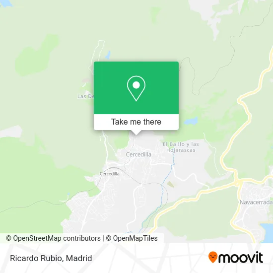
See Ricardo Rubio, Cercedilla, on the map
Public Transit to Ricardo Rubio in Cercedilla
Wondering how to get to Ricardo Rubio in Cercedilla? Moovit helps you find the best way to get to Ricardo Rubio with step-by-step directions from the nearest public transit station.
Moovit provides free maps and live directions to help you navigate through your city. View schedules, routes, timetables, and find out how long does it take to get to Ricardo Rubio in real time.
Looking for the nearest stop or station to Ricardo Rubio? Check out this list of stops closest to your destination: Cancha - Río Navia; Av. Sierra Guadarrama - Pza. Mayor; Cercedilla.
Bus: 684, 692, 1, 680.Train: C8B, C9, REG.
Want to see if there’s another route that gets you there at an earlier time? Moovit helps you find alternative routes or times. Get directions from and directions to Ricardo Rubio easily from the Moovit App or Website.
We make riding to Ricardo Rubio easy, which is why over 1.5 million users, including users in Cercedilla, trust Moovit as the best app for public transit. You don’t need to download an individual bus app or train app, Moovit is your all-in-one transit app that helps you find the best bus time or train time available.
For information on prices of bus and train, costs and ride fares to Ricardo Rubio, please check the Moovit app.
Use the app to navigate to popular places including to the airport, hospital, stadium, grocery store, mall, coffee shop, school, college, and university.
Ricardo Rubio Address: Calle Herrén de los Reales, 9 28470 Cercedilla street in Cercedilla
- Hotel Pasadoiro,
- Casona de Navalmedio,
- Camino Cerca de la Mata,
- Hernandez de Grado,
- Begona Sánchez,
- Calle Parroquia / Calle Carrera del Señor,
- Hostal La Maya,
- Jide Const.Metalicas,
- Hospedería y Centro de la Naturaleza El Recreo S.L.,
- Hernández Aparicio Javier,
- Escuela de Educación Infantil de Cercedilla,
- Adriana Stan,
- Centro Médico Sierra Valle,
- Restaurante Cambalache de la Sierra,
- Blackroll Spain,
- Regalos Sáenz de Miera,
- Antonia Martín Velasco,
- Floristería Hiedra,
- Chester,
- Cocokou
Places Near Ricardo Rubio (Cercedilla)
- Mercadillo de Majadahonda, Majadahonda,
- Estadio Wanda Metropolitano, Área Metropolitana De Madrid Y Corredor Del Henares,
- Wizink Center, Madrid,
- Plaza Mayor, Madrid,
- Tres Aguas, Alcorcón,
- Centro Comercial La Vaguada, Área Metropolitana De Madrid Y Corredor Del Henares,
- Centro Comercial Oasiz Madrid, Área Metropolitana De Madrid Y Corredor Del Henares,
- Hospital Clínico Universitario San Carlos, Madrid,
- Mendez Alvaro, Madrid,
- Sala La Riviera, Madrid,
- Nassica, Área Metropolitana De Madrid Y Corredor Del Henares,
- Rastro De Madrid, Área Metropolitana De Madrid Y Corredor Del Henares,
- Estacion de Chamartin, Madrid,
- Hospital Universitario La Paz, Madrid,
- Plenilunio, Área Metropolitana De Madrid Y Corredor Del Henares,
- Hospital Universitario Ramón y Cajal, Madrid,
- Palacio De Vistalegre, Área Metropolitana De Madrid Y Corredor Del Henares,
- Centro Comercial La Gavia, Área Metropolitana De Madrid Y Corredor Del Henares,
- Centro Comercial Islazul, Área Metropolitana De Madrid Y Corredor Del Henares,
- Calle de López de Hoyos 169, Madrid
How to get to popular places in Madrid with public transit
Get around Cercedilla by public transit!
Traveling around Cercedilla has never been so easy. See step by step directions as you travel to any attraction, street or major public transit station. View bus and train schedules, arrival times, service alerts and detailed routes on a map, so you know exactly how to get to anywhere in Cercedilla.
When traveling to any destination around Cercedilla use Moovit's Live Directions with Get Off Notifications to know exactly where and how far to walk, how long to wait for your line, and how many stops are left. Moovit will alert you when it's time to get off — no need to constantly re-check whether yours is the next stop.
Wondering how to use public transit in Cercedilla or how to pay for public transit in Cercedilla? Moovit public transit app can help you navigate your way with public transit easily, and at minimum cost. It includes public transit fees, ticket prices, and costs. Looking for a map of Cercedilla public transit lines? Moovit public transit app shows all public transit maps in Cercedilla with all Bus, Train, Metro and Light Rail routes and stops on an interactive map.
Madrid has 4 transit type(s), including: Bus, Train, Metro and Light Rail, operated by several transit agencies, including Metro de Madrid, Metro Ligero, Tranvía de Parla, Renfe Cercanías - Servicios de Autobús especiales, Renfe Cercanias, Renfe Cercanías, EMT, Interurbanos, Urbanos de Alcalá de Henares, Urbanos de Alcobendas, Urbanos de Alcorcón, Urbanos de Algete, Urbanos de Aranjuez, Urbanos de Arganda del Rey and Urbanos de Arroyomolinos