How to get to Ricciardi Marco by bus?
Click on the bus route to see step by step directions with maps, line arrival times and updated time schedules.
Bus stop near Ricciardi Marco in Volterra
- Roman Theater, 2 min walk,VIEW
Bus lines to Ricciardi Marco in Volterra
- 1, Amidei,VIEW
What are the closest stations to Ricciardi Marco?
The closest stations to Ricciardi Marco are:
- Roman Theater is 118 meters away, 2 min walk.
Which bus lines stop near Ricciardi Marco?
These bus lines stop near Ricciardi Marco: 500, 770.
What’s the nearest bus station to Ricciardi Marco in Volterra?
The nearest bus station to Ricciardi Marco in Volterra is Roman Theater. It’s a 2 min walk away.
What time is the first bus to Ricciardi Marco in Volterra?
The 780 is the first bus that goes to Ricciardi Marco in Volterra. It stops nearby at 10:30 AM.
What time is the last bus to Ricciardi Marco in Volterra?
The 500 is the last bus that goes to Ricciardi Marco in Volterra. It stops nearby at 8:56 PM.
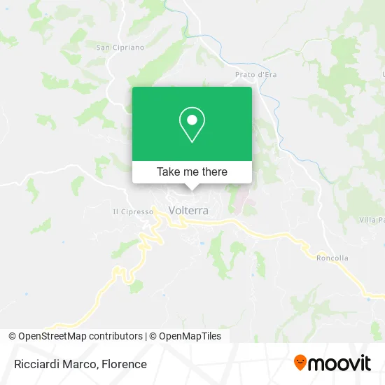
See Ricciardi Marco, Volterra, on the map
Public Transit to Ricciardi Marco in Volterra
Wondering how to get to Ricciardi Marco in Volterra? Moovit helps you find the best way to get to Ricciardi Marco with step-by-step directions from the nearest public transit station.
Moovit provides free maps and live directions to help you navigate through your city. View schedules, routes, timetables, and find out how long does it take to get to Ricciardi Marco in real time.
Looking for the nearest stop or station to Ricciardi Marco? Check out this list of stops closest to your destination: Roman Theater.
Bus: 500, 770, 1.
Want to see if there’s another route that gets you there at an earlier time? Moovit helps you find alternative routes or times. Get directions from and directions to Ricciardi Marco easily from the Moovit App or Website.
We make riding to Ricciardi Marco easy, which is why over 1.5 million users, including users in Volterra, trust Moovit as the best app for public transit. You don’t need to download an individual bus app or train app, Moovit is your all-in-one transit app that helps you find the best bus time or train time available.
For information on prices of bus and train, costs and ride fares to Ricciardi Marco, please check the Moovit app.
Use the app to navigate to popular places including to the airport, hospital, stadium, grocery store, mall, coffee shop, school, college, and university.
Ricciardi Marco Address: Via Porta Diana, 10 56048 Volterra street in Volterra
- Blackbindu Tattoo Art,
- Giulia Napolitano,
- Arkigraph Professional Design and Commercial Consulting by Gentile Orofal,
- Porta Diana Street,
- Volterra Municipality,
- Heirs of Spinelli Duilio,
- Agritourism,
- Province of Pisa,
- Municipal Cemetery,
- Casa Emilia,
- Porta Fiorentina Parking,
- EnelX,
- Terme,
- Gazzanelli Marzia,
- La Locanda Hotel,
- Ferruccio Niccolini Technical Commercial Institute,
- Bardini Enrico,
- Public Park External Bastion,
- Volterra Track,
- Punta dei Lecci Agritourism
Places Near Ricciardi Marco (Volterra)
- Viola Park, Bagno a Ripoli,
- Santa Maria Novella Station, Florence,
- Tobacco Manufacture, Florence,
- Asmana, Campi Bisenzio,
- Field of Mars, Florence,
- Campi Bisenzio, Campi Bisenzio,
- Santa Maria Nuova Hospital, Florence,
- Cascine Park, Florence,
- IKEA Florence, Sesto Fiorentino,
- Artemio Franchi Municipal Stadium, Florence,
- Wanny Palace, Florence,
- Nelson Mandela Forum, Florence,
- Michelangelo Square, Florence,
- OOO, Florence,
- Michelangelo Square, Florence,
- Torregalli Hospital Scandicci *, Scandicci,
- Verdi Theater, Florence,
- Piero Palagi Hospital Facility-Florence, Florence,
- Mandela Forum (Nelson Mandela Forum), Florence,
- I Gigli, Campi Bisenzio
How to get to popular places in Florence with public transit
Get around Volterra by public transit!
Traveling around Volterra has never been so easy. See step by step directions as you travel to any attraction, street or major public transit station. View bus and train schedules, arrival times, service alerts and detailed routes on a map, so you know exactly how to get to anywhere in Volterra.
When traveling to any destination around Volterra use Moovit's Live Directions with Get Off Notifications to know exactly where and how far to walk, how long to wait for your line, and how many stops are left. Moovit will alert you when it's time to get off — no need to constantly re-check whether yours is the next stop.
Wondering how to use public transit in Volterra or how to pay for public transit in Volterra? Moovit public transit app can help you navigate your way with public transit easily, and at minimum cost. It includes public transit fees, ticket prices, and costs. Looking for a map of Volterra public transit lines? Moovit public transit app shows all public transit maps in Volterra with all Bus, Train, Light Rail, Ferry and Funicular routes and stops on an interactive map.
Florence has 5 transit type(s), including: Bus, Train, Light Rail, Ferry and Funicular, operated by several transit agencies, including Florence Urban - Tuscan Bus Lines, GEST, Livorno and Province - Tuscan Bus Lines, Arezzo, Florence and Provinces - Tuscan Bus Lines, Prato and Province - Tuscan Bus Lines, Lucca and Province - Tuscan Bus Lines, Massa, Carrara and Province - Tuscan Bus Lines, Pisa and Province - Tuscan Bus Lines, Grosseto, Siena and Provinces - Tuscan Bus Lines, Arezzo, Siena and Provinces - Tuscan Bus Lines, Florence and Province - Tuscan Bus Lines, Pistoia and Province - Tuscan Bus Lines, Siena and Province - Tuscan Bus Lines, Arezzo and Province - Tuscan Bus Lines and Trenitalia