How to get to Rice Around the World by bus?
Click on the bus route to see step by step directions with maps, line arrival times and updated time schedules.
From Montgomery Blair High School, Montgomery County
42 minFrom Bullis School, Montgomery County
49 minFrom Georgia Ave & Icc Park & Ride Lot, Montgomery County
48 minFrom Walter Reed National Military Medical Center, Montgomery County
37 minFrom Wheaton Mall, Montgomery County
59 minFrom The Fillmore Silver Spring, Montgomery County
58 minFrom Silver Spring Civic Building (Silver Spring Civic Center), Montgomery County
57 minFrom Ellsworth Place, Montgomery County
58 minFrom Intelligence Community Campus—Bethesda, Montgomery County
56 minFrom I-270 Exit 9A/B (I-370 / Sam Eig Hwy. Interchange), Montgomery County
81 min
How to get to Rice Around the World by metro?
Click on the metro route to see step by step directions with maps, line arrival times and updated time schedules.
From Walter Reed National Military Medical Center, Montgomery County
30 minFrom Wheaton Mall, Montgomery County
78 minFrom The Fillmore Silver Spring, Montgomery County
67 minFrom Silver Spring Civic Building (Silver Spring Civic Center), Montgomery County
70 minFrom Ellsworth Place, Montgomery County
67 min
Metro station near Rice Around the World in Montgomery County
- Rockville, 6 min walk,VIEW
Bus stops near Rice Around the World in Montgomery County
Train station near Rice Around the World in Montgomery County
- Garrett Park Marc Wb, 48 min walk,VIEW
Bus lines to Rice Around the World in Montgomery County
What are the closest stations to Rice Around the World?
The closest stations to Rice Around the World are:
- Rockville is 462 yards away, 6 min walk.
- Twinbrook Pkwy & Alderbrook Ct is 525 yards away, 7 min walk.
- Twinbrook Pkwy & Parklawn Dr is 534 yards away, 7 min walk.
- Parklawn Bldg;Parklawn & Twinbrook is 627 yards away, 8 min walk.
- Garrett Park Marc Wb is 4107 yards away, 48 min walk.
Which bus lines stop near Rice Around the World?
These bus lines stop near Rice Around the World: 26, 45, 46, M12.
Which metro line stops near Rice Around the World?
RED (Shady Grove)
What’s the nearest metro station to Rice Around the World in Montgomery County?
The nearest metro station to Rice Around the World in Montgomery County is Rockville. It’s a 6 min walk away.
What’s the nearest bus station to Rice Around the World in Montgomery County?
The nearest bus stations to Rice Around the World in Montgomery County are Twinbrook Pkwy & Alderbrook Ct and Twinbrook Pkwy & Parklawn Dr. The closest one is a 7 min walk away.
What time is the first metro to Rice Around the World in Montgomery County?
The RED is the first metro that goes to Rice Around the World in Montgomery County. It stops nearby at 5:04 AM.
What time is the last metro to Rice Around the World in Montgomery County?
The RED is the last metro that goes to Rice Around the World in Montgomery County. It stops nearby at 12:38 AM.
What time is the first train to Rice Around the World in Montgomery County?
The MARC is the first train that goes to Rice Around the World in Montgomery County. It stops nearby at 6:06 AM.
What time is the last train to Rice Around the World in Montgomery County?
The MARC is the last train that goes to Rice Around the World in Montgomery County. It stops nearby at 7:50 PM.
What time is the first bus to Rice Around the World in Montgomery County?
The M12 is the first bus that goes to Rice Around the World in Montgomery County. It stops nearby at 4:15 AM.
What time is the last bus to Rice Around the World in Montgomery County?
The M12 is the last bus that goes to Rice Around the World in Montgomery County. It stops nearby at 2:43 AM.
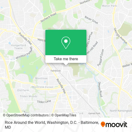
See Rice Around the World, Montgomery County, on the map
Public Transit to Rice Around the World in Montgomery County
Wondering how to get to Rice Around the World in Montgomery County? Moovit helps you find the best way to get to Rice Around the World with step-by-step directions from the nearest public transit station.
Moovit provides free maps and live directions to help you navigate through your city. View schedules, routes, timetables, and find out how long does it take to get to Rice Around the World in real time.
Looking for the nearest stop or station to Rice Around the World? Check out this list of stops closest to your destination: Rockville; Twinbrook Pkwy & Alderbrook Ct; Twinbrook Pkwy & Parklawn Dr; Parklawn Bldg;Parklawn & Twinbrook; Garrett Park Marc Wb.
Bus: 26, 45, 46, M12, 44.Train: MARC.Metro: RED.
Want to see if there’s another route that gets you there at an earlier time? Moovit helps you find alternative routes or times. Get directions from and directions to Rice Around the World easily from the Moovit App or Website.
We make riding to Rice Around the World easy, which is why over 1.5 million users, including users in Montgomery County, trust Moovit as the best app for public transit. You don’t need to download an individual bus app or train app, Moovit is your all-in-one transit app that helps you find the best bus time or train time available.
For information on prices of bus and metro, costs and ride fares to Rice Around the World, please check the Moovit app.
Use the app to navigate to popular places including to the airport, hospital, stadium, grocery store, mall, coffee shop, school, college, and university.
Rice Around the World Address: 12712 Rock Creek Mill Rd Rockville, MD 20852 street in Montgomery County
- Made 2 Perform Basketball Center,
- JBG Smith Management Office,
- Technology Transfer & Intellectual,
- Coffee Zone,
- Usp,
- Health Resources and Services Administration (HRSA),
- NIH,
- Morris Coding and Testing Center,
- Sam's Driving School,
- FCN Inc.,
- Montgomery County Police Department,
- Bright Horizons,
- United States Pharmacopeia,
- FDA - Element Building,
- New Covenant Baptist Church of Maryland,
- Fda Shuttle,
- Twinbrook Station & Bay B - East ,
- C4 Metrobus,
- Our Rockville Warehouse,
- Karen Brooks
Places Near Rice Around the World (Montgomery County)
- PG Mall, Prince George's County,
- National Zoo, Washington,
- Marriott Marquis Washington, DC, Washington,
- Washington National Cathedral, Washington,
- National Theatre, Washington,
- Rock Creek Tennis Center, Washington,
- The Anthem, Washington,
- Pennsylvania Ave NW (3rd st and pennsylvania), Washington,
- Capital One Arena, Washington,
- Museum Of The Bible, Washington,
- Westfield Montgomery Mall, Montgomery County,
- National Museum of African American History and Culture, Washington,
- Georgetown, Washington,
- Camden Yards, Baltimore,
- M&T Bank Stadium, Baltimore,
- Sibley Memorial Hospital, Washington,
- Washington DC VA Medical Center, Washington,
- Basilica of the National Shrine, Washington,
- Warner Theatre, Washington,
- Amazon Hq2, Arlington County
How to get to popular places in Washington, D.C. - Baltimore, MD with public transit
Get around Montgomery County by public transit!
Traveling around Montgomery County has never been so easy. See step by step directions as you travel to any attraction, street or major public transit station. View bus and train schedules, arrival times, service alerts and detailed routes on a map, so you know exactly how to get to anywhere in Montgomery County.
When traveling to any destination around Montgomery County use Moovit's Live Directions with Get Off Notifications to know exactly where and how far to walk, how long to wait for your line, and how many stops are left. Moovit will alert you when it's time to get off — no need to constantly re-check whether yours is the next stop.
Wondering how to use public transit in Montgomery County or how to pay for public transit in Montgomery County? Moovit public transit app can help you navigate your way with public transit easily, and at minimum cost. It includes public transit fees, ticket prices, and costs. Looking for a map of Montgomery County public transit lines? Moovit public transit app shows all public transit maps in Montgomery County with all Bus, Train, Metro, Light Rail and Ferry routes and stops on an interactive map.
Washington, D.C. - Baltimore, MD has 5 transit type(s), including: Bus, Train, Metro, Light Rail and Ferry, operated by several transit agencies, including WMATA, Montgomery County Ride On, Fairfax Connector, TheBus, PRTC, DASH - Alexandria, Arlington Transit (ART), RTA of Central Maryland, MDOT MTA, MDOT MTA Light RailLink, MDOT MTA Commuter Bus, MDOT MTA Local Bus, FXBGO!, Virginia Railway Express (VRE) and MARC