How to get to Rice Bowl Mbak Ci by bus?
Click on the bus route to see step by step directions with maps, line arrival times and updated time schedules.
From Shinshe Tan Tjhing Ho, Ploso
67 minFrom menganti gresik, Ngagelrejo
57 minFrom dharmahusada indah 1, Mulyorejo
70 minFrom SMK Negeri 5 Surabaya, Mojo
58 minFrom Jalan Tunjungan, Genteng
59 minFrom Sumarlin Ahli Gigi, Ploso
70 minFrom Dlundung, Trawas, mojokerto, Ploso
73 minFrom Jalan Kalikepiting Jaya I, Pacar Kembang
73 minFrom Universitas Pembangunan Nasional Veteran Jawa Timur, Gunung Anyar
66 min
Bus stops near Rice Bowl Mbak Ci in Kedurus
Bus lines to Rice Bowl Mbak Ci in Kedurus
What are the closest stations to Rice Bowl Mbak Ci?
The closest stations to Rice Bowl Mbak Ci are:
- Universitas Wijaya Putra is 403 meters away, 6 min walk.
- Jalan Raya Menganti Wiyung 19 is 442 meters away, 6 min walk.
Which bus lines stop near Rice Bowl Mbak Ci?
These bus lines stop near Rice Bowl Mbak Ci: FD6, JM.
What’s the nearest bus station to Rice Bowl Mbak Ci in Kedurus?
The nearest bus stations to Rice Bowl Mbak Ci in Kedurus are Universitas Wijaya Putra and Jalan Raya Menganti Wiyung 19. The closest one is a 6 min walk away.
What time is the first bus to Rice Bowl Mbak Ci in Kedurus?
The JM is the first bus that goes to Rice Bowl Mbak Ci in Kedurus. It stops nearby at 5:10 AM.
What time is the last bus to Rice Bowl Mbak Ci in Kedurus?
The FD6 is the last bus that goes to Rice Bowl Mbak Ci in Kedurus. It stops nearby at 9:12 PM.
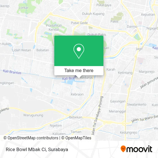
See Rice Bowl Mbak Ci, Kedurus, on the map
Public Transit to Rice Bowl Mbak Ci in Kedurus
Wondering how to get to Rice Bowl Mbak Ci in Kedurus? Moovit helps you find the best way to get to Rice Bowl Mbak Ci with step-by-step directions from the nearest public transit station.
Moovit provides free maps and live directions to help you navigate through your city. View schedules, routes, timetables, and find out how long does it take to get to Rice Bowl Mbak Ci in real time.
Looking for the nearest stop or station to Rice Bowl Mbak Ci? Check out this list of stops closest to your destination: Universitas Wijaya Putra; Jalan Raya Menganti Wiyung 19.
Bus: FD6, JM.
Want to see if there’s another route that gets you there at an earlier time? Moovit helps you find alternative routes or times. Get directions from and directions to Rice Bowl Mbak Ci easily from the Moovit App or Website.
We make riding to Rice Bowl Mbak Ci easy, which is why over 1.5 million users, including users in Kedurus, trust Moovit as the best app for public transit. You don’t need to download an individual bus app or train app, Moovit is your all-in-one transit app that helps you find the best bus time or train time available.
For information on prices of bus, costs and ride fares to Rice Bowl Mbak Ci, please check the Moovit app.
Use the app to navigate to popular places including to the airport, hospital, stadium, grocery store, mall, coffee shop, school, college, and university.
Rice Bowl Mbak Ci Address: Jalan Gunung Sari Indah Blok ZZ Surabaya 60223 street in Kedurus
- Toko Cahaya,
- Solly Jelly Ig Sollyjellyid,
- Toko Ibu Esti,
- Valka Drygoods Hq,
- Bakul Kembang Official,
- Florist Murah Surabaya,
- Bengkel Prendol,
- Zz 27,
- Waduk Gunungsari Indah - Wiyung,
- Mall,
- Herbal Shop Surabaya,
- Drh Ina Nurani,
- Store Benings Skincare Dr Oky Pratama Surabaya,
- Gunungsari Indah Blok Oo No 7,
- Hey Collection,
- Hanwash Wiyung,
- Kebelut Surabaya,
- Khiko Food,
- Bay's Room,
- Puya27
Places Near Rice Bowl Mbak Ci (Kedurus)
- Graha Pena, Ketintang,
- Smoking Room Terminal Domestik Juanda International Airport, Sidoarjo,
- Halte Bis Royal Plaza, Wonokromo,
- Kantor Regional II BKN Surabaya, Sidoarjo,
- GBT (Gelora Bung Tomo) Surabaya, Benowo,
- Stadion gelora bung tomo(surabaya,jawa timur), Surabaya,
- BG Junction Mall, Bubutan,
- Pelabuhan Tanjung Perak,
- Kebun Binatang Surabaya, Darmo,
- Universitas Negeri Surabaya (UNESA), Lidah Wetan,
- Pakuwon City Mall, Keputih,
- Bg Junction, Bubutan,
- Taman Harmoni, Keputih,
- Masjid Al-Akbar, Surabaya,
- PTC, Surabaya,
- Galaxy Mall Surabaya, Mulyorejo,
- UPN Veteran Jawa Timur, Gunung Anyar,
- Pakuwon Mall, Lontar,
- Grand City Mall, Surabaya, Gubeng,
- Bis Damri P1 (Perak-Bungurasih PP), Krembangan Selatan
How to get to popular places in Surabaya with public transit
Get around Kedurus by public transit!
Traveling around Kedurus has never been so easy. See step by step directions as you travel to any attraction, street or major public transit station. View bus and train schedules, arrival times, service alerts and detailed routes on a map, so you know exactly how to get to anywhere in Kedurus.
When traveling to any destination around Kedurus use Moovit's Live Directions with Get Off Notifications to know exactly where and how far to walk, how long to wait for your line, and how many stops are left. Moovit will alert you when it's time to get off — no need to constantly re-check whether yours is the next stop.
Wondering how to use public transit in Kedurus or how to pay for public transit in Kedurus? Moovit public transit app can help you navigate your way with public transit easily, and at minimum cost. It includes public transit fees, ticket prices, and costs. Looking for a map of Kedurus public transit lines? Moovit public transit app shows all public transit maps in Kedurus with all Bus and Train routes and stops on an interactive map.
Surabaya has 2 transit type(s), including: Bus and Train, operated by several transit agencies, including KAI Commuter, Angkutan Surabaya, Trans Semanggi Suroboyo, Suroboyo Bus, Feeder Wira Wiri Suroboyo, Trans Jatim and DAMRI