How to get to Rice John J by bus?
Click on the bus route to see step by step directions with maps, line arrival times and updated time schedules.
Bus stops near Rice John J in Newport News
Bus lines to Rice John J in Newport News
What are the closest stations to Rice John J?
The closest stations to Rice John J are:
- Canon & Town Center is 786 yards away, 10 min walk.
- Jefferson & Loftis is 817 yards away, 10 min walk.
- Fishing Point & Gum Rock is 1047 yards away, 13 min walk.
Which bus lines stop near Rice John J?
These bus lines stop near Rice John J: 108, 112.
What’s the nearest bus station to Rice John J in Newport News?
The nearest bus stations to Rice John J in Newport News are Canon & Town Center and Jefferson & Loftis. The closest one is a 10 min walk away.
What time is the first bus to Rice John J in Newport News?
The 108 is the first bus that goes to Rice John J in Newport News. It stops nearby at 5:16 AM.
What time is the last bus to Rice John J in Newport News?
The 112 is the last bus that goes to Rice John J in Newport News. It stops nearby at 12:58 AM.
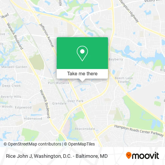
See Rice John J, Newport News, on the map
Public Transit to Rice John J in Newport News
Wondering how to get to Rice John J in Newport News? Moovit helps you find the best way to get to Rice John J with step-by-step directions from the nearest public transit station.
Moovit provides free maps and live directions to help you navigate through your city. View schedules, routes, timetables, and find out how long does it take to get to Rice John J in real time.
Looking for the nearest stop or station to Rice John J? Check out this list of stops closest to your destination: Canon & Town Center; Jefferson & Loftis; Fishing Point & Gum Rock.
Bus: 108, 112, 111, 414.
Want to see if there’s another route that gets you there at an earlier time? Moovit helps you find alternative routes or times. Get directions from and directions to Rice John J easily from the Moovit App or Website.
We make riding to Rice John J easy, which is why over 1.5 million users, including users in Newport News, trust Moovit as the best app for public transit. You don’t need to download an individual bus app or train app, Moovit is your all-in-one transit app that helps you find the best bus time or train time available.
For information on prices of bus and train, costs and ride fares to Rice John J, please check the Moovit app.
Use the app to navigate to popular places including to the airport, hospital, stadium, grocery store, mall, coffee shop, school, college, and university.
Rice John J Address: 707 Mobjack Pl Newport News, VA 23606 street in Newport News
- Imprimis Associates,
- Client Protective Services,
- Kersey, Sealey, Clark & Associates,
- American Foot & Ankle Center,
- Dawn R Reese, PHD,
- Sonia Tao Yi,
- City Center Dental Care,
- Virginia Commonwealth Realty,
- Cap First Mortgage,
- Business,
- Black Pine Counseling Center,
- Drug Rehab Newport News,
- A Able Attorneys,
- Alliance Legal Group,
- Nathaniel J Webb III,
- Caliper,
- Healthy Touch Therapeutic Massage,
- Richard S Gordon,
- Integrative Healthcare: Valerie Neal, DNP, FNP-C, PMHNP-BC,
- Lomilomi Relaxing Hands
Places Near Rice John J (Newport News)
- Marriott Marquis Washington, DC, Washington,
- Sibley Memorial Hospital, Washington,
- National Mall, Washington,
- Camden Yards, Baltimore,
- Basilica of the National Shrine, Washington,
- Amazon Hq2, Arlington County,
- National Museum of African American History and Culture, Washington,
- Georgetown, Washington,
- Washington National Cathedral, Washington,
- Rock Creek Tennis Center, Washington,
- National Zoo, Washington,
- M&T Bank Stadium, Baltimore,
- The Anthem, Washington,
- Museum Of The Bible, Washington,
- Capital One Arena, Washington,
- Westfield Montgomery Mall, Montgomery County,
- Warner Theatre, Washington,
- PG Mall, Prince George's County,
- Pennsylvania Ave NW (3rd st and pennsylvania), Washington,
- Washington DC VA Medical Center, Washington
How to get to popular places in Washington, D.C. - Baltimore, MD with public transit
Get around Newport News by public transit!
Traveling around Newport News has never been so easy. See step by step directions as you travel to any attraction, street or major public transit station. View bus and train schedules, arrival times, service alerts and detailed routes on a map, so you know exactly how to get to anywhere in Newport News.
When traveling to any destination around Newport News use Moovit's Live Directions with Get Off Notifications to know exactly where and how far to walk, how long to wait for your line, and how many stops are left. Moovit will alert you when it's time to get off — no need to constantly re-check whether yours is the next stop.
Wondering how to use public transit in Newport News or how to pay for public transit in Newport News? Moovit public transit app can help you navigate your way with public transit easily, and at minimum cost. It includes public transit fees, ticket prices, and costs. Looking for a map of Newport News public transit lines? Moovit public transit app shows all public transit maps in Newport News with all Bus, Train, Metro, Light Rail and Ferry routes and stops on an interactive map.
Washington, D.C. - Baltimore, MD has 5 transit type(s), including: Bus, Train, Metro, Light Rail and Ferry, operated by several transit agencies, including WMATA, Montgomery County Ride On, Fairfax Connector, TheBus, PRTC, DASH - Alexandria, Arlington Transit (ART), RTA of Central Maryland, MDOT MTA, MDOT MTA Light RailLink, MDOT MTA Commuter Bus, MDOT MTA Local Bus, FXBGO!, Virginia Railway Express (VRE) and MARC