How to get to Rickshaws by bus?
Click on the bus route to see step by step directions with maps, line arrival times and updated time schedules.
From Paragon Centre, Worli
39 minFrom Wockhardt Hospital in Mumbai Central, Byculla
44 minFrom Mira Datar Dargah Main Khadim, Byculla
60 minFrom Wockhardt Hospital, Byculla
44 minFrom Prithvi Cafe, Andheri West
36 minFrom Times Square, Andheri East
46 minFrom NESCO IT Park, Goregaon
30 minFrom PWC, Goregaon
29 minFrom Oberoi Garden Estate, Chandivali
56 minFrom Shree Sadguru Sant Balumama Mandir, Chembur
37 min
How to get to Rickshaws by train?
Click on the train route to see step by step directions with maps, line arrival times and updated time schedules.
How to get to Rickshaws by metro?
Click on the metro route to see step by step directions with maps, line arrival times and updated time schedules.
Bus stops near Rickshaws in Vandre East
Metro station near Rickshaws in Vandre East
- Bandra Kurla Complex, 9 min walk,VIEW
Bus lines to Rickshaws in Vandre East
- 2 LTD, Colaba Depot - Bandra Colony Bus Station,VIEW
- 11, Bandra Colony Bus Station - Sion Railway Station,VIEW
- 11 LTD, Bandra Colony Bus Station - Navy Nagar (Colaba),VIEW
- 87 LTD, Bandra Colony Bus Station - Vasantrao Naik Chowk (Tardeo),VIEW
- 87 LTD, Bandra Colony Bus Station - Mantralaya,VIEW
- 316, Bandra Terminus - Bandra Colony Bus Station,VIEW
- A-215, Tata Colony (Bandra-E),VIEW
- 317, Bandra Terminus,VIEW
- 255LTD, JVPD Bus Station,VIEW
- A-35, Majas Depot - Comrade PK Kurne Chowk (Worli),VIEW
- A-37, Kurla Station (W) - J.Mehta Marg (Napean Sea Road),VIEW
- A-39, Majas Depot - Veer Hutatma Bhai Kotwal Udyan (Plaza),VIEW
- C-40, Dindoshi Bus Station - Prabodhankar Thackeray Udyan Bus Station (Sewree),VIEW
- C-71, Dharavi Depot - Mira Road Station (E),VIEW
- AC-72, Dharavi Depot - Bhayander Station (E),VIEW
- 321 LTD, Kalanagar (Bandra) - Barve Nagar,VIEW
- 321LTD, Mahim Bus Station - Barve Nagar,VIEW
- 348LTD, Pratiksha Nagar Depot - Dindoshi Bus Station,VIEW
- C-440, Wadala Depot - Borivali Station (E),VIEW
What are the closest stations to Rickshaws?
The closest stations to Rickshaws are:
- Bandra Colony Bus Station is 67 meters away, 2 min walk.
- Hanuman Mandir (Kherwadi) is 248 meters away, 4 min walk.
- Kherwadi Junction is 348 meters away, 5 min walk.
- Kherwadi (Bandra-E) is 507 meters away, 8 min walk.
- Bandra Kurla Complex is 605 meters away, 9 min walk.
- Khar Road is 889 meters away, 12 min walk.
- Bandra is 1339 meters away, 18 min walk.
Which bus lines stop near Rickshaws?
These bus lines stop near Rickshaws: 11, 255LTD, 316, 87 LTD, A-35, A-37, C-71.
Which train lines stop near Rickshaws?
These train lines stop near Rickshaws: HR, WR.
Which metro line stops near Rickshaws?
LINE 3 (Aarey JVLR)
What’s the nearest metro station to Rickshaws in Vandre East?
The nearest metro station to Rickshaws in Vandre East is Bandra Kurla Complex. It’s a 9 min walk away.
What’s the nearest train station to Rickshaws in Vandre East?
The nearest train station to Rickshaws in Vandre East is Khar Road. It’s a 12 min walk away.
What’s the nearest bus station to Rickshaws in Vandre East?
The nearest bus station to Rickshaws in Vandre East is Bandra Colony Bus Station. It’s a 2 min walk away.
What time is the first metro to Rickshaws in Vandre East?
The LINE 3 is the first metro that goes to Rickshaws in Vandre East. It stops nearby at 6:11 AM.
What time is the last metro to Rickshaws in Vandre East?
The LINE 3 is the last metro that goes to Rickshaws in Vandre East. It stops nearby at 11:06 PM.
What time is the first train to Rickshaws in Vandre East?
The WR is the first train that goes to Rickshaws in Vandre East. It stops nearby at 4:05 AM.
What time is the last train to Rickshaws in Vandre East?
The WR is the last train that goes to Rickshaws in Vandre East. It stops nearby at 1:32 AM.
What time is the first bus to Rickshaws in Vandre East?
The AC-72 is the first bus that goes to Rickshaws in Vandre East. It stops nearby at 3:58 AM.
What time is the last bus to Rickshaws in Vandre East?
The 348LTD is the last bus that goes to Rickshaws in Vandre East. It stops nearby at 11:57 PM.
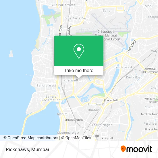
See Rickshaws, Vandre East, on the map
Public Transit to Rickshaws in Vandre East
Wondering how to get to Rickshaws in Vandre East? Moovit helps you find the best way to get to Rickshaws with step-by-step directions from the nearest public transit station.
Moovit provides free maps and live directions to help you navigate through your city. View schedules, routes, timetables, and find out how long does it take to get to Rickshaws in real time.
Looking for the nearest stop or station to Rickshaws? Check out this list of stops closest to your destination: Bandra Colony Bus Station; Hanuman Mandir (Kherwadi); Kherwadi Junction; Kherwadi (Bandra-E); Bandra Kurla Complex; Khar Road; Bandra.
Bus: 11, 255LTD, 316, 87 LTD, A-35, A-37, C-71, 2 LTD, 11 LTD, A-215, 317.Train: HR, WR, BR, WR-AC, WR-AC, CGDR, WR-AC, WR-AC, WR-AC, WR-AC.Metro: LINE 3.
Want to see if there’s another route that gets you there at an earlier time? Moovit helps you find alternative routes or times. Get directions from and directions to Rickshaws easily from the Moovit App or Website.
We make riding to Rickshaws easy, which is why over 1.7 million users, including users in Vandre East, trust Moovit as the best app for public transit. You don’t need to download an individual bus app or train app, Moovit is your all-in-one transit app that helps you find the best bus time or train time available.
For information on prices of bus, metro and train, costs and ride fares to Rickshaws, please check the Moovit app.
Use the app to navigate to popular places including to the airport, hospital, stadium, grocery store, mall, coffee shop, school, college, and university.
Rickshaws Address: Mumbai 400051 MH street in Vandre East
- Abhishek Motor Training School,
- Nagraj Typing Institute,
- Milan Enterprises,
- Rajdhani Express Bakery in Bandra East,
- 90ml Bar & Kitchen,
- Prof JL Shirsekar Marg,
- FM Fries Momos,
- Registrar of Firms,
- Ankita Jewelers,
- Mahatma Gandhi Vidya Mandir in Bandra East,
- Chetana College,
- New Bikaner Sweets in Kalanagar-Bandra East,
- Labor Court,
- Samaj Mandir Hall Marg,
- Chetana's Hazarimal Somani College of Commerce and Economics-SMT. Kusumtai Chaudhari College of Art,
- Budget Tempo Traveller on Rent Mumbai,
- Sane Guruji Ratra Vidyalaya,
- Mahatma Gandhi Vidyamandir,
- RNA Corporate Park,
- Chetana's Institutes of Management & Research
Places Near Rickshaws (Vandre East)
- Oberoi Mall, Dindoshi,
- TCS Olympus, Thane,
- Govardhan Ecovillage, Palghar (St),
- Gateway Of India,
- Malabar Hill, Malabar Hill,
- Ikea, Worli,
- Bhaucha Dhakka,
- Worli Sea Face,
- Oberoi Sky City, Borivali East,
- Shanmukhananda Hall, Sion , Mumbai, Sion Koliwada,
- NESCO, Goregaon,
- INFINITI Mall (Infinity Mall, andheri), Versova,
- Mumbai University, Kalina,
- Dome @ Nsci - Svp Stadium Mumbai, Worli,
- Bombay Exhibition Center, Goregaon,
- Rani Baug, Byculla,
- R CITY MALL, Ghatkopar East,
- Inorbit Mall, Malad West,
- Hinduja Hospital, Mahim,
- J. J. Hospital, Byculla
How to get to popular places in Mumbai with public transit
Get around Vandre East by public transit!
Traveling around Vandre East has never been so easy. See step by step directions as you travel to any attraction, street or major public transit station. View bus and train schedules, arrival times, service alerts and detailed routes on a map, so you know exactly how to get to anywhere in Vandre East.
When traveling to any destination around Vandre East use Moovit's Live Directions with Get Off Notifications to know exactly where and how far to walk, how long to wait for your line, and how many stops are left. Moovit will alert you when it's time to get off — no need to constantly re-check whether yours is the next stop.
Wondering how to use public transit in Vandre East or how to pay for public transit in Vandre East? Moovit public transit app can help you navigate your way with public transit easily, and at minimum cost. It includes public transit fees, ticket prices, and costs. Looking for a map of Vandre East public transit lines? Moovit public transit app shows all public transit maps in Vandre East with all Bus, Train, Metro and Ferry routes and stops on an interactive map.
Mumbai has 4 transit type(s), including: Bus, Train, Metro and Ferry, operated by several transit agencies, including MMMOCL (Maha Mumbai Metro Operation Corporation Ltd.), NMM CIDCO (Navi Mumbai Metro Maha Metro), Reliance Mumbai Metro, MMRCL (Mumbai Metro Rail Corporation Ltd), BEST (Brihanmumbai Electricity Supply & Transport), BEST AC Services, A.C.Trains (Air-Conditioning Trains), W.R. (Western Railways), C.R. (Central Railways), C.R.MEMU (Central Railways Shuttle MEMU Trains), H.R. (Harbour Railways), T.R.(Trans Harbour Railways), U.R.(Uran-Ulwe Railways), I.R.(Indian Railways) and TMT (Thane Municipal Transport)