How to get to Ricky Danco by bus?
Click on the bus route to see step by step directions with maps, line arrival times and updated time schedules.
From METRORail-Vizcaya (Vizcaya Metrorail Station), Miami
65 minFrom Hard Rock CAFE, Miami
38 minFrom Walmart, Miami
59 minFrom Clock Thermometer, Miami Beach
67 minFrom Walmart North Miami Beach, Miami
59 minFrom Collins Avenue & 5600 Block, Miami Beach
49 minFrom Cruise Port Terminal J, Miami
64 minFrom NE 125th St / N Miami Ave, Miami
41 minFrom Walmart North Miami Beach (Walmart Garden Center), Miami
59 minFrom Electroland USA Corp, Miami
42 min
Bus stops near Ricky Danco in Miami
Train stations near Ricky Danco in Miami
Bus lines to Ricky Danco in Miami
What are the closest stations to Ricky Danco?
The closest stations to Ricky Danco are:
- Nw 7 Av & Nw 71 St is 400 yards away, 5 min walk.
- Dr. Martin Luther King Jr. Plaza is 566 yards away, 7 min walk.
- Nw 2 Av & 71 St is 581 yards away, 8 min walk.
- Nw 2 Av @ Nw 69 St is 712 yards away, 9 min walk.
- Nw 7 Av & Nw 67 St is 792 yards away, 10 min walk.
- Allapattah Station is 1041 yards away, 13 min walk.
Which bus lines stop near Ricky Danco?
These bus lines stop near Ricky Danco: 77, 79, 9.
What’s the nearest train station to Ricky Danco in Miami?
The nearest train station to Ricky Danco in Miami is Dr. Martin Luther King Jr. Plaza. It’s a 7 min walk away.
What’s the nearest bus station to Ricky Danco in Miami?
The nearest bus station to Ricky Danco in Miami is Nw 7 Av & Nw 71 St. It’s a 5 min walk away.
What time is the first train to Ricky Danco in Miami?
The ORANGE is the first train that goes to Ricky Danco in Miami. It stops nearby at 5:10 AM.
What time is the last train to Ricky Danco in Miami?
The GREEN is the last train that goes to Ricky Danco in Miami. It stops nearby at 12:46 AM.
What time is the first bus to Ricky Danco in Miami?
The 77 is the first bus that goes to Ricky Danco in Miami. It stops nearby at 3:01 AM.
What time is the last bus to Ricky Danco in Miami?
The 77 is the last bus that goes to Ricky Danco in Miami. It stops nearby at 3:30 AM.
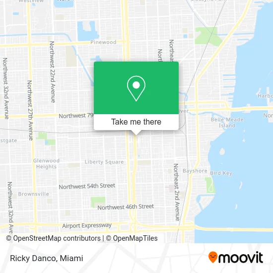
See Ricky Danco, Miami, on the map
Public Transit to Ricky Danco in Miami
Wondering how to get to Ricky Danco in Miami? Moovit helps you find the best way to get to Ricky Danco with step-by-step directions from the nearest public transit station.
Moovit provides free maps and live directions to help you navigate through your city. View schedules, routes, timetables, and find out how long does it take to get to Ricky Danco in real time.
Looking for the nearest stop or station to Ricky Danco? Check out this list of stops closest to your destination: Nw 7 Av & Nw 71 St; Dr. Martin Luther King Jr. Plaza; Nw 2 Av & 71 St; Nw 2 Av @ Nw 69 St; Nw 7 Av & Nw 67 St; Allapattah Station.
Bus: 77, 79, 9, MIAHAIT, 2, MIALIB.Train: GREEN, ORANGE.
Want to see if there’s another route that gets you there at an earlier time? Moovit helps you find alternative routes or times. Get directions from and directions to Ricky Danco easily from the Moovit App or Website.
We make riding to Ricky Danco easy, which is why over 1.5 million users, including users in Miami, trust Moovit as the best app for public transit. You don’t need to download an individual bus app or train app, Moovit is your all-in-one transit app that helps you find the best bus time or train time available.
For information on prices of bus and train, costs and ride fares to Ricky Danco, please check the Moovit app.
Use the app to navigate to popular places including to the airport, hospital, stadium, grocery store, mall, coffee shop, school, college, and university.
Ricky Danco Address: 7053 NW 5th Ct Miami, FL 33150 street in Miami
- Appliance Repair U-Line Repair Service,
- 95 Express - Brickell/Downtown,
- Michael Dawkins Group,
- Kosta Furniture,
- Do You Need A Good Plumber,
- The Church of God and Christ,
- Mr Freeze Automotive Air Conditioning,
- Pentagon Recording Studios,
- Church of God in Christ of the New Generation,
- Che Boluu,
- Fence and Welding,
- Suds & Bubs, LLC,
- Suddath Relocation Systems,
- American Shoe Factory,
- Nocturnal Press,
- Emerald Square,
- Bondi Cafe,
- Helmet One - Motor Co.,
- Tomas Redrado Art,
- Northwest 7th Avenue & Northwest 73rd Street
Places Near Ricky Danco (Miami)
- Wynwood, Miami,
- Port of Miami Cruise Terminal, Miami,
- Keiser University Flagship Campus, West Palm Beach,
- Little Havana, Miami,
- Miami VA Hospital, Miami,
- Brickell City Centre, Miami,
- Marlins Park, Miami,
- Miami Freedom Park, Miami,
- Aventura Mall, Miami,
- Bayside Marketplace, Miami,
- Richard E. Gerstein Justice Building, Miami,
- Miami-Dade County Courthouse, Miami,
- Zoo Miami, Miami,
- Miami Design District, Miami,
- Aventura Mall, Miami Beach,
- Hard Rock Stadium, Miami Gardens,
- Sawgrass mall ( FL ), Miami Beach,
- Dolphin Mall Bus, Miami,
- Dolphin Mall, Miami,
- Sawgrass Mall, Miami
How to get to popular places in Miami with public transit
Get around Miami by public transit!
Traveling around Miami has never been so easy. See step by step directions as you travel to any attraction, street or major public transit station. View bus and train schedules, arrival times, service alerts and detailed routes on a map, so you know exactly how to get to anywhere in Miami.
When traveling to any destination around Miami use Moovit's Live Directions with Get Off Notifications to know exactly where and how far to walk, how long to wait for your line, and how many stops are left. Moovit will alert you when it's time to get off — no need to constantly re-check whether yours is the next stop.
Wondering how to use public transit in Miami or how to pay for public transit in Miami? Moovit public transit app can help you navigate your way with public transit easily, and at minimum cost. It includes public transit fees, ticket prices, and costs. Looking for a map of Miami public transit lines? Moovit public transit app shows all public transit maps in Miami with all Bus, Train, Light Rail and Ferry routes and stops on an interactive map.
Miami has 4 transit type(s), including: Bus, Train, Light Rail and Ferry, operated by several transit agencies, including Broward County Transit, Miami-Dade Transit, Metrorail, Palm Tran, Tri-Rail, Brightline, MARTY, City of Homestead Trolley, Key West Transit, Treasure Coast Connector, GoLine IRT, Amtrak, Greyhound-us, FlixBus-us and Aventura Express Shuttle Bus