How to get to Ricopy by bus?
Click on the bus route to see step by step directions with maps, line arrival times and updated time schedules.
Bus stops near Ricopy in Badajoz
Bus lines to Ricopy in Badajoz
- L2, Drag. H. Cortés,VIEW
- L3, H. Clínico - Universidad,VIEW
- L21, Gurugú - Est. FF.CC.,VIEW
- LM1, Barriada de Llera,VIEW
- L13, Gévora - Badajoz,VIEW
- L5, Bda. de Llera,VIEW
- L7, Bda. San Miguel,VIEW
- L9, Pantano de la Serena,VIEW
- S1, Plaza Libertad,VIEW
- L6, Las Vaguadas,VIEW
- L11, Sagrajas - Gévora - Badajoz,VIEW
- L18, Cerro Gordo - San Roque,VIEW
What are the closest stations to Ricopy?
The closest stations to Ricopy are:
- Av. Santa Marina, 40 is 66 meters away, 2 min walk.
- Av. Antonio Masa Campos, 12 is 289 meters away, 4 min walk.
- Av. Santa Marina, 28 is 300 meters away, 4 min walk.
- Av. De Cristóbal Colón, 10 is 312 meters away, 5 min walk.
- Av. Santiago Ramón Y Cajal, 4 is 341 meters away, 5 min walk.
Which bus lines stop near Ricopy?
These bus lines stop near Ricopy: L13, L7, LM1.
What’s the nearest bus station to Ricopy in Badajoz?
The nearest bus station to Ricopy in Badajoz is Av. Santa Marina, 40. It’s a 2 min walk away.
What time is the first bus to Ricopy in Badajoz?
The LM1 is the first bus that goes to Ricopy in Badajoz. It stops nearby at 7:07 AM.
What time is the last bus to Ricopy in Badajoz?
The L9 is the last bus that goes to Ricopy in Badajoz. It stops nearby at 11:29 PM.
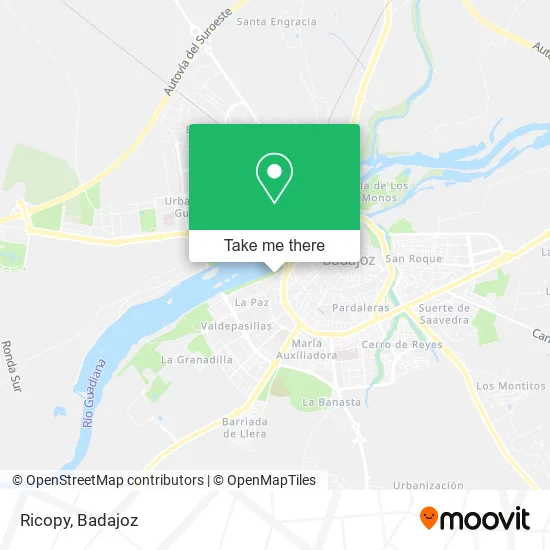
See Ricopy, Badajoz, on the map
Public Transit to Ricopy in Badajoz
Wondering how to get to Ricopy in Badajoz? Moovit helps you find the best way to get to Ricopy with step-by-step directions from the nearest public transit station.
Moovit provides free maps and live directions to help you navigate through your city. View schedules, routes, timetables, and find out how long does it take to get to Ricopy in real time.
Looking for the nearest stop or station to Ricopy? Check out this list of stops closest to your destination: Av. Santa Marina; Av. Antonio Masa Campos; Av. Santa Marina; Av. De Cristóbal Colón; Av. Santiago Ramón Y Cajal.
Bus: L13, L7, LM1, L2, L3, L21, L5, L9, S1, L6, L11, L18.
Want to see if there’s another route that gets you there at an earlier time? Moovit helps you find alternative routes or times. Get directions from and directions to Ricopy easily from the Moovit App or Website.
We make riding to Ricopy easy, which is why over 1.7 million users, including users in Badajoz, trust Moovit as the best app for public transit. You don’t need to download an individual bus app or train app, Moovit is your all-in-one transit app that helps you find the best bus time or train time available.
For information on prices of bus, costs and ride fares to Ricopy, please check the Moovit app.
Use the app to navigate to popular places including to the airport, hospital, stadium, grocery store, mall, coffee shop, school, college, and university.
Ricopy Address: Paseo Fluvial, 06011 Badajoz street in Badajoz
- Restaurante Simbo,
- Consulta Dermatológica,
- Pedro Munoz Piriz,
- Socar de Toros,
- Carrefour,
- Peluqueria Salomé,
- Piscina Granadilla 2,
- Cafe-Bar Ohana,
- Club Natacion Badajoz,
- Bm Tevisa sa,
- Lalola,
- Sevenfit,
- Gastro Bar 47,
- Pizzería Italia,
- Martinica,
- María Coqueta,
- Agenciser Badajoz S.L.,
- La Esquina Educativa,
- Carmona Promociones Inmobiliarias de Extremadura,
- Gabinete de Gestión Integral de Recursos
Places Near Ricopy (Badajoz)
- Balneario El Raposo S.l., Badajoz,
- Hospital Perpetuo Socorro, Badajoz,
- Leroy Merlin, Badajoz,
- San Roque, Badajoz,
- Centro Comercial El Faro, Badajoz,
- Polígono el Nevero, Badajoz,
- Recinto Ferial de Badajoz, Badajoz,
- Campus de la Universidad de Extremadura, Badajoz,
- Clinica Diagnosticos San Miguel S.l., Badajoz,
- Hospital Universitario De Badajoz, Badajoz,
- Poligono Industrial El Nevero, Badajoz,
- Hospital Infanta Cristina, Badajoz,
- Campos de Fútbol "Eusebio Bejarano", Badajoz,
- Mercadillo, Badajoz,
- Hospital Universitario, Badajoz,
- Renfe, Badajoz,
- EL Corte Ingles, Badajoz,
- Consulta de Psiquiatria y Psicoterapia Myriam Mendez Jimenez, Badajoz,
- Clideba, Badajoz,
- ESTACION DE AUTOBUSES DE BADAJOZ, S.A., Badajoz
How to get to popular places in Badajoz with public transit
Get around Badajoz by public transit!
Traveling around Badajoz has never been so easy. See step by step directions as you travel to any attraction, street or major public transit station. View bus and train schedules, arrival times, service alerts and detailed routes on a map, so you know exactly how to get to anywhere in Badajoz.
When traveling to any destination around Badajoz use Moovit's Live Directions with Get Off Notifications to know exactly where and how far to walk, how long to wait for your line, and how many stops are left. Moovit will alert you when it's time to get off — no need to constantly re-check whether yours is the next stop.
Wondering how to use public transit in Badajoz or how to pay for public transit in Badajoz? Moovit public transit app can help you navigate your way with public transit easily, and at minimum cost. It includes public transit fees, ticket prices, and costs. Looking for a map of Badajoz public transit lines? Moovit public transit app shows all public transit maps in Badajoz with all bus routes and stops on an interactive map.
Badajoz has 1 transit type(s), including: bus, operated by several transit agencies, including Tubasa