How to get to Rider South Orange Ave by bus?
Click on the bus route to see step by step directions with maps, line arrival times and updated time schedules.
From Nutley, NJ, Nutley
49 minFrom Jersey Gardens Metro Mall, Elizabeth
54 minFrom The Mills At Jersey Gardens, Elizabeth
56 minFrom Walmart, Jersey City
66 minFrom Newport Mall Bus, Jersey City
42 minFrom Secaucus Junction, Secaucus
86 minFrom Medieval Times, Lyndhurst
56 minFrom Journal Square, Jersey City
55 minFrom Hudson County Courthouse, Jersey City
57 minFrom Medieval Times Dinner & Tournament, Lyndhurst
56 min
How to get to Rider South Orange Ave by train?
Click on the train route to see step by step directions with maps, line arrival times and updated time schedules.
Bus stops near Rider South Orange Ave in Newark
Light Rail stations near Rider South Orange Ave in Newark
- Warren Street Light Rail Station, 5 min walk,VIEW
Bus lines to Rider South Orange Ave in Newark
What are the closest stations to Rider South Orange Ave?
The closest stations to Rider South Orange Ave are:
- W Market St at Wickliffe St is 48 yards away, 1 min walk.
- Springfield Ave at Branford Pl is 346 yards away, 5 min walk.
- Warren Street Light Rail Station is 390 yards away, 5 min walk.
- Springfield Ave at Mlk Jr Blvd is 557 yards away, 7 min walk.
- University Ave at William St is 635 yards away, 8 min walk.
Which bus lines stop near Rider South Orange Ave?
These bus lines stop near Rider South Orange Ave: 1, 31, 76.
Which train lines stop near Rider South Orange Ave?
These train lines stop near Rider South Orange Ave: NC, RED.
Which light rail line stops near Rider South Orange Ave?
NLR (Penn Station)
What’s the nearest light rail station to Rider South Orange Ave in Newark?
The nearest light rail station to Rider South Orange Ave in Newark is Warren Street Light Rail Station. It’s a 5 min walk away.
What’s the nearest bus station to Rider South Orange Ave in Newark?
The nearest bus station to Rider South Orange Ave in Newark is W Market St at Wickliffe St. It’s a 1 min walk away.
What time is the first light rail to Rider South Orange Ave in Newark?
The NLR is the first light rail that goes to Rider South Orange Ave in Newark. It stops nearby at 4:25 AM.
What time is the last light rail to Rider South Orange Ave in Newark?
The NLR is the last light rail that goes to Rider South Orange Ave in Newark. It stops nearby at 1:20 AM.
What time is the first bus to Rider South Orange Ave in Newark?
The 1 is the first bus that goes to Rider South Orange Ave in Newark. It stops nearby at 3:10 AM.
What time is the last bus to Rider South Orange Ave in Newark?
The 1 is the last bus that goes to Rider South Orange Ave in Newark. It stops nearby at 3:06 AM.
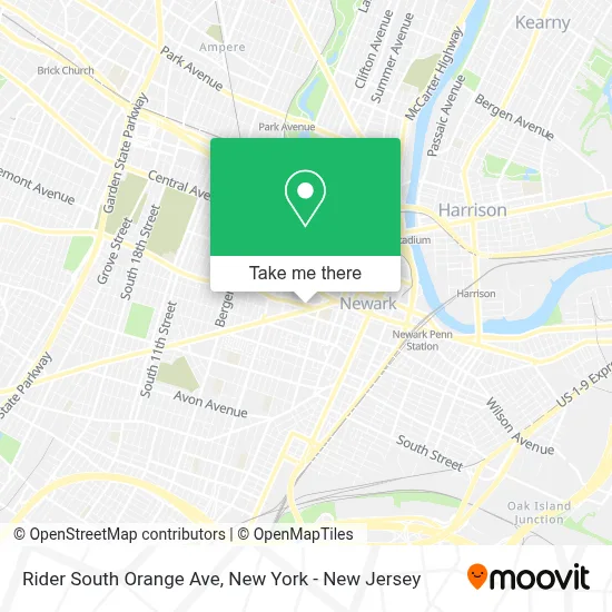
See Rider South Orange Ave, Newark, on the map
Public Transit to Rider South Orange Ave in Newark
Wondering how to get to Rider South Orange Ave in Newark? Moovit helps you find the best way to get to Rider South Orange Ave with step-by-step directions from the nearest public transit station.
Moovit provides free maps and live directions to help you navigate through your city. View schedules, routes, timetables, and find out how long does it take to get to Rider South Orange Ave in real time.
Looking for the nearest stop or station to Rider South Orange Ave? Check out this list of stops closest to your destination: W Market St at Wickliffe St; Springfield Ave at Branford Pl; Warren Street Light Rail Station; Springfield Ave at Mlk Jr Blvd; University Ave at William St.
Bus: 1, 31, 76, 21, 34, 25, 361, 375, GO25, 5.Train: NC, RED.Light Rail: NLR.
Want to see if there’s another route that gets you there at an earlier time? Moovit helps you find alternative routes or times. Get directions from and directions to Rider South Orange Ave easily from the Moovit App or Website.
We make riding to Rider South Orange Ave easy, which is why over 1.5 million users, including users in Newark, trust Moovit as the best app for public transit. You don’t need to download an individual bus app or train app, Moovit is your all-in-one transit app that helps you find the best bus time or train time available.
For information on prices of bus, train and light rail, costs and ride fares to Rider South Orange Ave, please check the Moovit app.
Use the app to navigate to popular places including to the airport, hospital, stadium, grocery store, mall, coffee shop, school, college, and university.
Rider South Orange Ave Address: Newark, NJ 07103 street in Newark
- Snap Back Seafood,
- Essex County Veterans Courthouse Jurors Parking Lot,
- Veteran Courthouse - Juror Parking,
- Society Hill II,
- Howard St South Orange Ave,
- Essex County Superior Courthouse,
- Taocarkeste,
- Robert Treat Elementary,
- Veterans Courthouse,
- Jury Duty Assembly Room, Veterans Courthouse,
- St. Benedicts Prep,
- Leroy F. Smith, Jr. Public Safety Building,
- Essex County Family Justice Center (Fjc),
- Springfield Ave and Dr Martin Luther King Jr Blvd,
- Newark Voters Registration,
- 465 Doctor Martin Luther King Junior Boulevard,
- Essex County Clerk,
- Essex County Clerk the Board,
- Springfield Belmont,
- St. Benedict's Preparatory School
Places Near Rider South Orange Ave (Newark)
- 26 Federal Plaza, Manhattan,
- SoHo, Manhattan,
- Queens Center Mall, Queens,
- 66 John Street, Manhattan,
- Bellevue Hospital, Manhattan,
- qqqq, Manhattan,
- Hudson Yards, Manhattan,
- Rockefeller Center, Manhattan,
- 1 Police Plaza, Manhattan,
- Chinatown, Manhattan,
- 911 Memorial, Manhattan,
- 111 Centre New York City Supreme Court, Manhattan,
- Times Square, Manhattan,
- San Gennaro Feast, Manhattan,
- 3 Stone St, Manhattan,
- Pier 83, Manhattan,
- Mountainside Hospital, Glen Ridge,
- Wall Street, Manhattan,
- 376 Hudson Street, Manhattan,
- Katz's Deli, Manhattan
How to get to popular places in New York - New Jersey with public transit
Get around Newark by public transit!
Traveling around Newark has never been so easy. See step by step directions as you travel to any attraction, street or major public transit station. View bus and train schedules, arrival times, service alerts and detailed routes on a map, so you know exactly how to get to anywhere in Newark.
When traveling to any destination around Newark use Moovit's Live Directions with Get Off Notifications to know exactly where and how far to walk, how long to wait for your line, and how many stops are left. Moovit will alert you when it's time to get off — no need to constantly re-check whether yours is the next stop.
Wondering how to use public transit in Newark or how to pay for public transit in Newark? Moovit public transit app can help you navigate your way with public transit easily, and at minimum cost. It includes public transit fees, ticket prices, and costs. Looking for a map of Newark public transit lines? Moovit public transit app shows all public transit maps in Newark with all Bus, Train, Subway, Light Rail, Ferry and Cable Car routes and stops on an interactive map.
New York - New Jersey has 6 transit type(s), including: Bus, Train, Subway, Light Rail, Ferry and Cable Car, operated by several transit agencies, including MTA Subway, Metro-North Railroad, LIRR, PATH, MTA New York City Transit - Express routes, MTA Bus, NJ Transit, NYC Ferry, NICE bus, Bee-Line Bus, NJ Transit Rail, Norwalk Transit District, Hartford Line, River Valley Transit and HART