How to get to Ridgecrest Mobile Home Park by bus?
Click on the bus route to see step by step directions with maps, line arrival times and updated time schedules.
From Stuart, Florida, Stuart
149 minFrom CVS Pharmacy - (Lyngate Dr), Port St. Lucie
100 minFrom US-1 / SE Port St Lucie Blvd, Port St. Lucie
109 minFrom Indian River State College, Fort Pierce
97 minFrom Hca Florida Lawnwood Hospital, Fort Pierce
53 minFrom US-1, Fort Pierce
67 minFrom Clover Park, Port St. Lucie
128 min
Bus stops near Ridgecrest Mobile Home Park in Fort Pierce North
Bus lines to Ridgecrest Mobile Home Park in Fort Pierce North
What are the closest stations to Ridgecrest Mobile Home Park?
The closest stations to Ridgecrest Mobile Home Park are:
- N Causeway & North US 1 is 1021 yards away, 12 min walk.
- Hwy A1A & North US 1 is 1058 yards away, 13 min walk.
Which bus lines stop near Ridgecrest Mobile Home Park?
These bus lines stop near Ridgecrest Mobile Home Park: 1, 7.
What’s the nearest bus station to Ridgecrest Mobile Home Park in Fort Pierce North?
The nearest bus station to Ridgecrest Mobile Home Park in Fort Pierce North is N Causeway & North US 1. It’s a 12 min walk away.
What time is the first bus to Ridgecrest Mobile Home Park in Fort Pierce North?
The 2 is the first bus that goes to Ridgecrest Mobile Home Park in Fort Pierce North. It stops nearby at 6:30 AM.
What time is the last bus to Ridgecrest Mobile Home Park in Fort Pierce North?
The 2 is the last bus that goes to Ridgecrest Mobile Home Park in Fort Pierce North. It stops nearby at 7:35 PM.
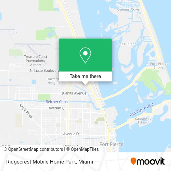
See Ridgecrest Mobile Home Park, Fort Pierce North, on the map
Public Transit to Ridgecrest Mobile Home Park in Fort Pierce North
Wondering how to get to Ridgecrest Mobile Home Park in Fort Pierce North? Moovit helps you find the best way to get to Ridgecrest Mobile Home Park with step-by-step directions from the nearest public transit station.
Moovit provides free maps and live directions to help you navigate through your city. View schedules, routes, timetables, and find out how long does it take to get to Ridgecrest Mobile Home Park in real time.
Looking for the nearest stop or station to Ridgecrest Mobile Home Park? Check out this list of stops closest to your destination: N Causeway & North US 1; Hwy A1A & North US 1.
Bus: 1, 7, 2.
Want to see if there’s another route that gets you there at an earlier time? Moovit helps you find alternative routes or times. Get directions from and directions to Ridgecrest Mobile Home Park easily from the Moovit App or Website.
We make riding to Ridgecrest Mobile Home Park easy, which is why over 1.5 million users, including users in Fort Pierce North, trust Moovit as the best app for public transit. You don’t need to download an individual bus app or train app, Moovit is your all-in-one transit app that helps you find the best bus time or train time available.
For information on prices of bus, costs and ride fares to Ridgecrest Mobile Home Park, please check the Moovit app.
Use the app to navigate to popular places including to the airport, hospital, stadium, grocery store, mall, coffee shop, school, college, and university.
Ridgecrest Mobile Home Park Address: 2251 N US Highway 1 Fort Pierce, FL 34946 street in Fort Pierce North
- Accurate Pool Plastering,
- Pink Campaigns Thrift Store / Boutique,
- Rea Technical Services,
- Virto Detailing,
- Mike's Towing Service,
- McFarlane Canvas,
- Mainland Welding,
- Price Fire Protection, Inc.,
- Island Hopper International Boats Works Inc.,
- Kings World Automotive,
- Bruno Chocolates,
- Super Store Video News,
- Gflex Dental Lab,
- Heritage Boatyard,
- Tillman's Famous BarBQ,
- Interstate RV,
- Fort Pierce Commercial Real Estate,
- Generett Prince Auto D,
- German American Bank Itm,
- Life Celebrations Mortuary
Places Near Ridgecrest Mobile Home Park (Fort Pierce North)
- Brickell City Centre, Miami,
- Miami Freedom Park, Miami,
- Dolphin Mall Bus, Miami,
- Miami Design District, Miami,
- Aventura Mall, Miami Beach,
- Little Havana, Miami,
- Richard E. Gerstein Justice Building, Miami,
- Marlins Park, Miami,
- Sawgrass mall ( FL ), Miami Beach,
- Sawgrass Mall, Miami,
- Zoo Miami, Miami,
- Dolphin Mall, Miami,
- Aventura Mall, Miami,
- Miami VA Hospital, Miami,
- Hard Rock Stadium, Miami Gardens,
- Bayside Marketplace, Miami,
- Miami-Dade County Courthouse, Miami,
- Port of Miami Cruise Terminal, Miami,
- Wynwood, Miami,
- Keiser University Flagship Campus, West Palm Beach
How to get to popular places in Miami with public transit
Get around Fort Pierce North by public transit!
Traveling around Fort Pierce North has never been so easy. See step by step directions as you travel to any attraction, street or major public transit station. View bus and train schedules, arrival times, service alerts and detailed routes on a map, so you know exactly how to get to anywhere in Fort Pierce North.
When traveling to any destination around Fort Pierce North use Moovit's Live Directions with Get Off Notifications to know exactly where and how far to walk, how long to wait for your line, and how many stops are left. Moovit will alert you when it's time to get off — no need to constantly re-check whether yours is the next stop.
Wondering how to use public transit in Fort Pierce North or how to pay for public transit in Fort Pierce North? Moovit public transit app can help you navigate your way with public transit easily, and at minimum cost. It includes public transit fees, ticket prices, and costs. Looking for a map of Fort Pierce North public transit lines? Moovit public transit app shows all public transit maps in Fort Pierce North with all Bus, Train, Light Rail and Ferry routes and stops on an interactive map.
Miami has 4 transit type(s), including: Bus, Train, Light Rail and Ferry, operated by several transit agencies, including Broward County Transit, Miami-Dade Transit, Metrorail, Palm Tran, Tri-Rail, Brightline, MARTY, City of Homestead Trolley, Key West Transit, Treasure Coast Connector, GoLine IRT, Amtrak, Greyhound-us, FlixBus-us and Aventura Express Shuttle Bus