Directions to Ridgeley Volunteer Fire Department (Mineral County) with public transportation
The following transit lines have routes that pass near Ridgeley Volunteer Fire Department
 Bus: SILVER LINE, RED LINE.
- Train: FLORIDIAN.
Bus stops near Ridgeley Volunteer Fire Department in Mineral County
Train station near Ridgeley Volunteer Fire Department in Mineral County
- Cumberland Amtrak Station, 45 min walk,VIEW
Bus lines to Ridgeley Volunteer Fire Department in Mineral County
- Miller's Window Washing Services,
- Cutesy Balloonz Boutique,
- Ridgeley VFW Post 6452,
- La Tia Carmen Restaurant,
- Desperado's,
- St Anthony's Catholic Church,
- J&B's Beer & Tobacco Depot,
- Big Poppys Fireworks R,
- Apothecarium of Maryland,
- Libertyx Bitcoin ATM,
- Rusco Home Improvement,
- Dr Khanna Internal Medicine,
- Klot's Mill Lofts,
- Rehab Builders,
- FedEx,
- Hamilton & Staggs Dental Lab,
- Snurr's Meat Company,
- Farm Service Agency,
- Cindy's Discount Outlet,
- Cafe Y
Places Near Ridgeley Volunteer Fire Department (Mineral County)
- Pennsylvania Ave NW (3rd st and pennsylvania), Washington,
- PG Mall, Prince George's County,
- Washington DC VA Medical Center, Washington,
- Sibley Memorial Hospital, Washington,
- Georgetown, Washington,
- Museum Of The Bible, Washington,
- National Zoo, Washington,
- Camden Yards, Baltimore,
- Rock Creek Tennis Center, Washington,
- M&T Bank Stadium, Baltimore,
- National Museum of African American History and Culture, Washington,
- The Anthem, Washington,
- Warner Theatre, Washington,
- Westfield Montgomery Mall, Montgomery County,
- Amazon Hq2, Arlington County,
- Washington National Cathedral, Washington,
- Marriott Marquis Washington, DC, Washington,
- Capital One Arena, Washington,
- National Mall, Washington,
- Basilica of the National Shrine, Washington
How to get to popular places in Washington, D.C. - Baltimore, MD with public transit
What are the closest stations to Ridgeley Volunteer Fire Department?
The closest stations to Ridgeley Volunteer Fire Department are:
- Lee St & Paca St (Queen City Towers) is 1622 yards away, 20 min walk.
- Hrdc Virginia Avenue (North) is 3385 yards away, 40 min walk.
- Cumberland Amtrak Station is 3784 yards away, 45 min walk.
Which train line stops near Ridgeley Volunteer Fire Department?
FLORIDIAN (Chicago)
What time is the first train to Ridgeley Volunteer Fire Department in Mineral County?
The FLORIDIAN is the first train that goes to Ridgeley Volunteer Fire Department in Mineral County. It stops nearby at 9:37 AM.
What time is the last train to Ridgeley Volunteer Fire Department in Mineral County?
The FLORIDIAN is the last train that goes to Ridgeley Volunteer Fire Department in Mineral County. It stops nearby at 7:16 PM.
What time is the first bus to Ridgeley Volunteer Fire Department in Mineral County?
The RED LINE is the first bus that goes to Ridgeley Volunteer Fire Department in Mineral County. It stops nearby at 7:20 AM.
What time is the last bus to Ridgeley Volunteer Fire Department in Mineral County?
The RED LINE is the last bus that goes to Ridgeley Volunteer Fire Department in Mineral County. It stops nearby at 3:47 PM.
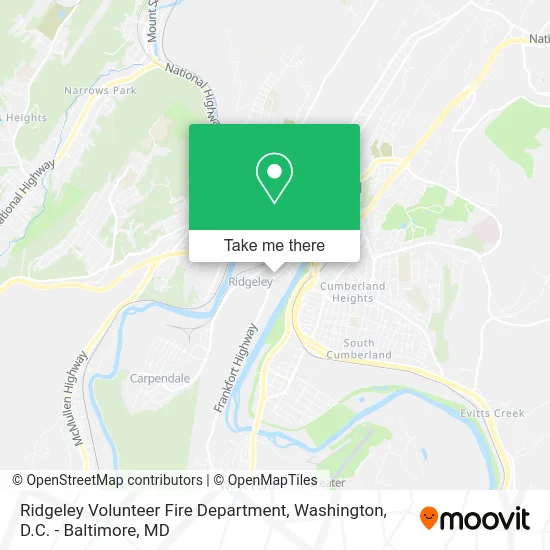
See Ridgeley Volunteer Fire Department, Mineral County, on the map
Public Transit to Ridgeley Volunteer Fire Department in Mineral County
Wondering how to get to Ridgeley Volunteer Fire Department in Mineral County? Moovit helps you find the best way to get to Ridgeley Volunteer Fire Department with step-by-step directions from the nearest public transit station.
Moovit provides free maps and live directions to help you navigate through your city. View schedules, routes, timetables, and find out how long does it take to get to Ridgeley Volunteer Fire Department in real time.
Looking for the nearest stop or station to Ridgeley Volunteer Fire Department? Check out this list of stops closest to your destination: Lee St & Paca St (Queen City Towers); Hrdc Virginia Avenue (North); Cumberland Amtrak Station.
Bus: SILVER LINE, RED LINE.Train: FLORIDIAN.
Want to see if there’s another route that gets you there at an earlier time? Moovit helps you find alternative routes or times. Get directions from and directions to Ridgeley Volunteer Fire Department easily from the Moovit App or Website.
We make riding to Ridgeley Volunteer Fire Department easy, which is why over 1.5 million users, including users in Mineral County, trust Moovit as the best app for public transit. You don’t need to download an individual bus app or train app, Moovit is your all-in-one transit app that helps you find the best bus time or train time available.
For information on prices of train and bus, costs and ride fares to Ridgeley Volunteer Fire Department, please check the Moovit app.
Use the app to navigate to popular places including to the airport, hospital, stadium, grocery store, mall, coffee shop, school, college, and university.
Ridgeley Volunteer Fire Department Address: 568 Veterans Memorial Hwy Ridgeley, WV 26753 street in Mineral County
Get around Mineral County by public transit!
Traveling around Mineral County has never been so easy. See step by step directions as you travel to any attraction, street or major public transit station. View bus and train schedules, arrival times, service alerts and detailed routes on a map, so you know exactly how to get to anywhere in Mineral County.
When traveling to any destination around Mineral County use Moovit's Live Directions with Get Off Notifications to know exactly where and how far to walk, how long to wait for your line, and how many stops are left. Moovit will alert you when it's time to get off — no need to constantly re-check whether yours is the next stop.
Wondering how to use public transit in Mineral County or how to pay for public transit in Mineral County? Moovit public transit app can help you navigate your way with public transit easily, and at minimum cost. It includes public transit fees, ticket prices, and costs. Looking for a map of Mineral County public transit lines? Moovit public transit app shows all public transit maps in Mineral County with all Bus, Train, Metro, Light Rail and Ferry routes and stops on an interactive map.
Washington, D.C. - Baltimore, MD has 5 transit type(s), including: Bus, Train, Metro, Light Rail and Ferry, operated by several transit agencies, including WMATA, Montgomery County Ride On, Fairfax Connector, TheBus, PRTC, DASH - Alexandria, Arlington Transit (ART), RTA of Central Maryland, MDOT MTA, MDOT MTA Light RailLink, MDOT MTA Commuter Bus, MDOT MTA Local Bus, FXBGO!, Virginia Railway Express (VRE) and MARC