How to get to Riedbaum I by bus?
Click on the bus route to see step by step directions with maps, line arrival times and updated time schedules.
From Kloster Untermarchtal, Verwaltungsgemeinschaft Munderkingen
104 minFrom Stadion an der Kreuzeiche, Reutlingen
262 minFrom Wellenfreibad Markwasen (Wellen Freibad), Reutlingen
204 minFrom D 78333 Stockach, Verwaltungsgemeinschaft Stockach
91 minFrom Freibad, Reutlingen
277 minFrom 72793, Pfullingen
222 minFrom Antiquariat Trenkle, Aach
143 minFrom Freibad Pfullingen, Pfullingen
212 minFrom Kaufland, Pfullingen
219 min
How to get to Riedbaum I by train?
Click on the train route to see step by step directions with maps, line arrival times and updated time schedules.
Bus stops near Riedbaum I in Sigmaringen
Train stations near Riedbaum I in Sigmaringen
Bus lines to Riedbaum I in Sigmaringen
- 5, Sigmaringen Leopoldplatz,VIEW
- 9, Sigmaringen Volkwinhalde,VIEW
- 2, Inneringen Volksbank,VIEW
- 390, Riedlingen Zob/Bahnhof,VIEW
- 2, Sigmaringen Leopoldplatz,VIEW
- 393, Mengen Bahnhof,VIEW
- 101, Oberschmeien Rathaus,VIEW
- 104, Sigmaringen Liebfrauenschule,VIEW
- 667, Sigmaringen Liebfrauenschule,VIEW
- 668, Sigmaringen Bahnhof,VIEW
- 3, Sigmaringen Leopoldplatz,VIEW
What are the closest stations to Riedbaum I?
The closest stations to Riedbaum I are:
- Sigmaringen Riedbaum I is 8 meters away, 1 min walk.
- Sigmaringen Volkwinhalde is 278 meters away, 4 min walk.
- Sigmaringendorf Bahnhof is 423 meters away, 6 min walk.
- Sigmaringen am Schönenberg is 479 meters away, 7 min walk.
- Sigmaringen Hochschule is 551 meters away, 8 min walk.
- Sigmaringen Unt. Fideliskirche is 627 meters away, 9 min walk.
- Sigmaringen Hanfertal Bhf. is 1498 meters away, 20 min walk.
- Sigmaringen Bahnhof is 4087 meters away, 53 min walk.
Which bus lines stop near Riedbaum I?
These bus lines stop near Riedbaum I: 2, 393, 5.
Which train lines stop near Riedbaum I?
These train lines stop near Riedbaum I: RE 55, RE55.
What’s the nearest train station to Riedbaum I in Sigmaringen?
The nearest train station to Riedbaum I in Sigmaringen is Sigmaringendorf Bahnhof. It’s a 6 min walk away.
What’s the nearest bus station to Riedbaum I in Sigmaringen?
The nearest bus station to Riedbaum I in Sigmaringen is Sigmaringen Riedbaum I. It’s a 1 min walk away.
What time is the first train to Riedbaum I in Sigmaringen?
The RB 51 is the first train that goes to Riedbaum I in Sigmaringen. It stops nearby at 4:59 AM.
What time is the last train to Riedbaum I in Sigmaringen?
The RE 55 is the last train that goes to Riedbaum I in Sigmaringen. It stops nearby at 12:42 AM.
What time is the first bus to Riedbaum I in Sigmaringen?
The 393 is the first bus that goes to Riedbaum I in Sigmaringen. It stops nearby at 5:32 AM.
What time is the last bus to Riedbaum I in Sigmaringen?
The 393 is the last bus that goes to Riedbaum I in Sigmaringen. It stops nearby at 7:02 PM.
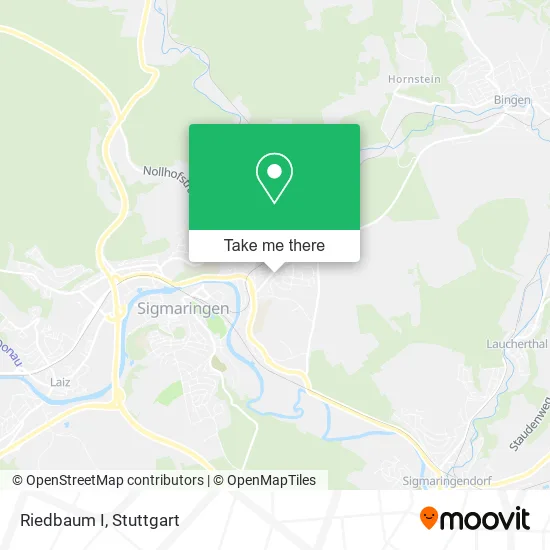
See Riedbaum I, Sigmaringen, on the map
Public Transit to Riedbaum I in Sigmaringen
Wondering how to get to Riedbaum I in Sigmaringen? Moovit helps you find the best way to get to Riedbaum I with step-by-step directions from the nearest public transit station.
Moovit provides free maps and live directions to help you navigate through your city. View schedules, routes, timetables, and find out how long does it take to get to Riedbaum I in real time.
Looking for the nearest stop or station to Riedbaum I? Check out this list of stops closest to your destination: Sigmaringen Riedbaum I; Sigmaringen Volkwinhalde; Sigmaringendorf Bahnhof; Sigmaringen am Schönenberg; Sigmaringen Hochschule; Sigmaringen Unt. Fideliskirche; Sigmaringen Hanfertal Bhf.; Sigmaringen Bahnhof.
Bus: 2, 393, 5, 9, 390.Train: RE 55, RE55, RS 3, RB 51, RB59A, RB68, RB68, RB68A, RS3, RE6A, RB43A, RB53, RB 68.
Want to see if there’s another route that gets you there at an earlier time? Moovit helps you find alternative routes or times. Get directions from and directions to Riedbaum I easily from the Moovit App or Website.
We make riding to Riedbaum I easy, which is why over 1.5 million users, including users in Sigmaringen, trust Moovit as the best app for public transit. You don’t need to download an individual bus app or train app, Moovit is your all-in-one transit app that helps you find the best bus time or train time available.
For information on prices of bus and train, costs and ride fares to Riedbaum I, please check the Moovit app.
Use the app to navigate to popular places including to the airport, hospital, stadium, grocery store, mall, coffee shop, school, college, and university.
Riedbaum I Address: Am Riedbaum 2 72488 Sigmaringen street in Sigmaringen
- Pizza Haus,
- Stehle,
- Bäckerei Stehle,
- Ev. Pfarramt II,
- Aweat Gesellschaft für Waren- und Erfahrungsaustausch,
- Werner Bollendorf Immobilien,
- Hack Hedwig Damenschneiderei,
- Willi Chevalier,
- Sport-Club Sigmaringen,
- Kirchturm,
- Ev. Kreuzkirche,
- Herzog Gisela Steuerberaterin,
- H. S. Office,
- Evangelische Kreuzkirche,
- Pfarrbücherei des,
- Militärpfarramt Kreuzkirche,
- Jehovas Zeugen Versammlung Sigmaringen,
- Allianz Versicherungen Franz,
- Rosemarie Fisel-Oexle,
- Hannspeter Kunz
Places Near Riedbaum I (Sigmaringen)
- FlixBus Haltestelle, Stuttgart,
- Geilhaus Haus 33a, Reutlingen-Betzingen,
- Porsche Museum, Zuffenhausen,
- Hanns-Martin-Schleyer-Halle (Stuttgart Hans-Martin-Schleyerhalle), Bad Cannstatt,
- Klinikum Stuttgart - Katharinenhospital, Stuttgart-Mitte,
- Gasometer Pforzheim, Pforzheim,
- Im Wizemann (Halle), Bad Cannstatt,
- Wilhelma (U-Bahn Wilhelma), Bad Cannstatt,
- SI-Centrum, Möhringen,
- Mettingen Eros-Center Puff Laufhaus, Esslingen Am Neckar,
- Mercedes-Benz Museum, Bad Cannstatt,
- Hanns-Martin-Schleyer-Halle, Bad Cannstatt,
- Schleyerhalle, Bad Cannstatt,
- Waldfriedhof, Degerloch,
- Hauptbahnhof Stuttgart, Stuttgart-Mitte,
- Pariser Platz Stuttgart, Stuttgart-Mitte,
- Porsche-Arena, Bad Cannstatt,
- Gleis 101/102 (tief), Stuttgart-Mitte,
- Mercedes-Benz Museum (Mercedes Museum Stuttgart), Bad Cannstatt,
- Marmorsaal Im Weissenburgpark, Stuttgart-Süd
How to get to popular places in Stuttgart with public transit
Get around Sigmaringen by public transit!
Traveling around Sigmaringen has never been so easy. See step by step directions as you travel to any attraction, street or major public transit station. View bus and train schedules, arrival times, service alerts and detailed routes on a map, so you know exactly how to get to anywhere in Sigmaringen.
When traveling to any destination around Sigmaringen use Moovit's Live Directions with Get Off Notifications to know exactly where and how far to walk, how long to wait for your line, and how many stops are left. Moovit will alert you when it's time to get off — no need to constantly re-check whether yours is the next stop.
Wondering how to use public transit in Sigmaringen or how to pay for public transit in Sigmaringen? Moovit public transit app can help you navigate your way with public transit easily, and at minimum cost. It includes public transit fees, ticket prices, and costs. Looking for a map of Sigmaringen public transit lines? Moovit public transit app shows all public transit maps in Sigmaringen with all Bus, Train, Subway, Light Rail, Ferry, S-Bahn and Funicular routes and stops on an interactive map.
Stuttgart has 7 transit type(s), including: Bus, Train, Subway, Light Rail, Ferry, S-Bahn and Funicular, operated by several transit agencies, including SSB - Stadtbahn, SSB, SSB - Seilbahn / Zacke, S-Bahn Stuttgart, Rhein-Neckar-Verkehr GmbH (rnv), Karlsruher Verkehrsverbund, DB AG, DB Regiobus BW, Arverio Baden-Württemberg GmbH, DB RegioNetz Verkehrs GmbH Westfrankenbahn, DB Regio AG Baden-Württemberg, Südwestdeutsche Verkehrs-AG, DB Regio AG Mitte Region Hessen, DB and Bodensee-Oberschwaben-Bahn