How to get to Riedweg by bus?
Click on the bus route to see step by step directions with maps, line arrival times and updated time schedules.
From Berufsbildende Schule Technik 2, Ludwigshafen-Mundenheim
216 minFrom MVV Energie Ladestation, Käfertal
74 minFrom Neuenheimer Feld, Neuenheim
100 minFrom Hans-Warsch-Platz,Ludwigshafen Oggersheim, Ludwigshafen-Oggersheim
134 minFrom Luxor Filmpalast, Bahnstadt
103 minFrom Universitätsklinikum Heidelberg-Notaufnahme, Neuenheim
117 minFrom Thingstätte, Handschuhsheim
127 minFrom Agaplesion Bethanien Krankenhaus Heidelberg, Südstadt
111 min
How to get to Riedweg by train?
Click on the train route to see step by step directions with maps, line arrival times and updated time schedules.
From Berufsbildende Schule Technik 2, Ludwigshafen-Mundenheim
67 minFrom MVV Energie Ladestation, Käfertal
80 minFrom Neuenheimer Feld, Neuenheim
65 minFrom Hans-Warsch-Platz,Ludwigshafen Oggersheim, Ludwigshafen-Oggersheim
89 minFrom Luxor Filmpalast, Bahnstadt
56 minFrom Krankenhaus GRN, Weinheim
67 minFrom Agaplesion Bethanien Krankenhaus Heidelberg, Südstadt
68 min
Bus stops near Riedweg in Seckenheim
Light Rail stations near Riedweg in Seckenheim
Bus lines to Riedweg in Seckenheim
What are the closest stations to Riedweg?
The closest stations to Riedweg are:
- Seckenheim, Innerer Heckweg is 426 meters away, 6 min walk.
- Seckenheim, Zähringer Straße is 550 meters away, 8 min walk.
- Seckenheim, Oeg-Bahnhof Bstg Gl2 is 1068 meters away, 14 min walk.
- Seckenheim, Deutscher Hof Bstg 2 is 1159 meters away, 15 min walk.
Which bus lines stop near Riedweg?
These bus lines stop near Riedweg: 40, 43, 628, RNV 40, RNV 50, RNV 6.
Which train lines stop near Riedweg?
These train lines stop near Riedweg: RB68, RE60, S3.
Which light rail lines stop near Riedweg?
These light rail lines stop near Riedweg: 5, RNV 5.
What’s the nearest light rail station to Riedweg in Seckenheim?
The nearest light rail station to Riedweg in Seckenheim is Seckenheim, Oeg-Bahnhof Bstg Gl2. It’s a 14 min walk away.
What’s the nearest bus station to Riedweg in Seckenheim?
The nearest bus station to Riedweg in Seckenheim is Seckenheim, Innerer Heckweg. It’s a 6 min walk away.
What time is the first light rail to Riedweg in Seckenheim?
The RNV 5 is the first light rail that goes to Riedweg in Seckenheim. It stops nearby at 4:29 AM.
What time is the last light rail to Riedweg in Seckenheim?
The E is the last light rail that goes to Riedweg in Seckenheim. It stops nearby at 1:31 AM.
What time is the first bus to Riedweg in Seckenheim?
The 40 is the first bus that goes to Riedweg in Seckenheim. It stops nearby at 4:08 AM.
What time is the last bus to Riedweg in Seckenheim?
The RNV 40 is the last bus that goes to Riedweg in Seckenheim. It stops nearby at 1:44 AM.
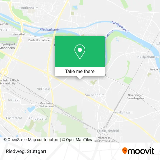
See Riedweg, Seckenheim, on the map
Public Transit to Riedweg in Seckenheim
Wondering how to get to Riedweg in Seckenheim? Moovit helps you find the best way to get to Riedweg with step-by-step directions from the nearest public transit station.
Moovit provides free maps and live directions to help you navigate through your city. View schedules, routes, timetables, and find out how long does it take to get to Riedweg in real time.
Looking for the nearest stop or station to Riedweg? Check out this list of stops closest to your destination: Seckenheim, Innerer Heckweg; Seckenheim, Zähringer Straße; Seckenheim, Oeg-Bahnhof Bstg Gl2; Seckenheim, Deutscher Hof Bstg 2.
Bus: 40, 43, 628, RNV 40, RNV 50, RNV 6, RNV 43, RNV 43/46.Train: RB68, RE60, S3.Light Rail: 5, RNV 5.
Want to see if there’s another route that gets you there at an earlier time? Moovit helps you find alternative routes or times. Get directions from and directions to Riedweg easily from the Moovit App or Website.
We make riding to Riedweg easy, which is why over 1.5 million users, including users in Seckenheim, trust Moovit as the best app for public transit. You don’t need to download an individual bus app or train app, Moovit is your all-in-one transit app that helps you find the best bus time or train time available.
For information on prices of bus, light rail and train, costs and ride fares to Riedweg, please check the Moovit app.
Use the app to navigate to popular places including to the airport, hospital, stadium, grocery store, mall, coffee shop, school, college, and university.
Riedweg Address: Riedweg 68239 Mannheim street in Seckenheim
- Griechische Taverne,
- Verein für Hundesport, Mannheim-Seckenheim,
- Mampf&Schmatz,
- Mampf Und Schmatz,
- Manuel Dosch Finanzdienstleistungen,
- Hildebrandt Dunja Immobilien,
- Effekte Unternehmensberatung,
- Kopatz Fotografie,
- Viktoria Versicherungen,
- Media Marketing - Smj,
- Schneider Vermögensverwaltung und Unternehmensberatung,
- Sportkurier,
- Anil Zappold - Lean Leadership Coaching,
- Elektro Wenzel,
- Ralf Wichmann Immobilien,
- Sergej Gräbe,
- Ponzo Nicola,
- Ig Seckenheim,
- Text- und Tonstudio & Musikverlag,
- Rüdiger Bischoff
Places Near Riedweg (Seckenheim)
- Wilhelma (U-Bahn Wilhelma), Bad Cannstatt,
- Marmorsaal Im Weissenburgpark, Stuttgart-Süd,
- Pariser Platz Stuttgart, Stuttgart-Mitte,
- Gasometer Pforzheim, Pforzheim,
- SI-Centrum, Möhringen,
- FlixBus Haltestelle, Stuttgart,
- Schleyerhalle, Bad Cannstatt,
- Porsche-Arena, Bad Cannstatt,
- Gleis 101/102 (tief), Stuttgart-Mitte,
- Hanns-Martin-Schleyer-Halle, Bad Cannstatt,
- Klinikum Stuttgart - Katharinenhospital, Stuttgart-Mitte,
- Geilhaus Haus 33a, Reutlingen-Betzingen,
- Mercedes-Benz Museum (Mercedes Museum Stuttgart), Bad Cannstatt,
- Mettingen Eros-Center Puff Laufhaus, Esslingen Am Neckar,
- Waldfriedhof, Degerloch,
- Hauptbahnhof Stuttgart, Stuttgart-Mitte,
- Im Wizemann (Halle), Bad Cannstatt,
- Hanns-Martin-Schleyer-Halle (Stuttgart Hans-Martin-Schleyerhalle), Bad Cannstatt,
- Mercedes-Benz Museum, Bad Cannstatt,
- Porsche Museum, Zuffenhausen
How to get to popular places in Stuttgart with public transit
Get around Seckenheim by public transit!
Traveling around Seckenheim has never been so easy. See step by step directions as you travel to any attraction, street or major public transit station. View bus and train schedules, arrival times, service alerts and detailed routes on a map, so you know exactly how to get to anywhere in Seckenheim.
When traveling to any destination around Seckenheim use Moovit's Live Directions with Get Off Notifications to know exactly where and how far to walk, how long to wait for your line, and how many stops are left. Moovit will alert you when it's time to get off — no need to constantly re-check whether yours is the next stop.
Wondering how to use public transit in Seckenheim or how to pay for public transit in Seckenheim? Moovit public transit app can help you navigate your way with public transit easily, and at minimum cost. It includes public transit fees, ticket prices, and costs. Looking for a map of Seckenheim public transit lines? Moovit public transit app shows all public transit maps in Seckenheim with all Bus, Train, Subway, Light Rail, Ferry, S-Bahn and Funicular routes and stops on an interactive map.
Stuttgart has 7 transit type(s), including: Bus, Train, Subway, Light Rail, Ferry, S-Bahn and Funicular, operated by several transit agencies, including SSB - Stadtbahn, SSB, SSB - Seilbahn / Zacke, S-Bahn Stuttgart, Rhein-Neckar-Verkehr GmbH (rnv), Karlsruher Verkehrsverbund, DB AG, DB Regiobus BW, Arverio Baden-Württemberg GmbH, DB RegioNetz Verkehrs GmbH Westfrankenbahn, DB Regio AG Baden-Württemberg, Südwestdeutsche Verkehrs-AG, DB Regio AG Mitte Region Hessen, DB and Bodensee-Oberschwaben-Bahn