How to get to Riesenhuber Tina by bus?
Click on the bus route to see step by step directions with maps, line arrival times and updated time schedules.
From Swingerclub Bellevue, Werfen
134 minFrom Laufhaus Roma Braunau, Braunau am Inn
136 minFrom Lammerklamm, Scheffau am Tennengebirge
101 minFrom Gosaukammbahn, Gosau
181 minFrom Gosau Gosausee, Gosau
183 minFrom Krankenhaus Der Barmherzigen Schwestern Ried, Ried Im Innkreis
472 minFrom Vöcklamarkt Lokalbf, Vöcklamarkt
103 minFrom Red Bull Base, Elsbethen
34 min
How to get to Riesenhuber Tina by train?
Click on the train route to see step by step directions with maps, line arrival times and updated time schedules.
Bus stops near Riesenhuber Tina in Austria
Train stations near Riesenhuber Tina in Austria
- Salzburg Hauptbahnhof, 9 min walk,VIEW
Bus lines to Riesenhuber Tina in Austria
- 6, Rathaus,VIEW
- SEV E1, SEV E1,VIEW
- SEV X1, SEV X1,VIEW
- SEV X11, SEV X11,VIEW
- 270, Radstadt Bahnhof,VIEW
- 111, Feldkirchen Via Bergheim Schule - Michaelbeuern,VIEW
- 3, Salzburg Nord,VIEW
- 5, Birkensiedlung,VIEW
- 120, Salzburg Hbf Via Mitterhof - Htl Itzling,VIEW
- 130, Salzburg Hbf Via Eugendorf - A1 - Htl Itzling,VIEW
What are the closest stations to Riesenhuber Tina?
The closest stations to Riesenhuber Tina are:
- Salzburg Itzling West is 157 meters away, 3 min walk.
- Salzburg Plainbrücke is 215 meters away, 3 min walk.
- Salzburg Andreas-Hofer-Straße/Postbus is 333 meters away, 5 min walk.
- Salzburg Austraße is 379 meters away, 6 min walk.
- Salzburg Hauptbahnhof is 507 meters away, 9 min walk.
- Salzburg Goethestraße is 764 meters away, 11 min walk.
- Salzburg Kirchenstraße/Htl is 888 meters away, 12 min walk.
Which train lines stop near Riesenhuber Tina?
These train lines stop near Riesenhuber Tina: A13, R3, S1.
Which bus lines stop near Riesenhuber Tina?
These bus lines stop near Riesenhuber Tina: 111, 121, 150, 6.
What’s the nearest train station to Riesenhuber Tina in Austria?
The nearest train station to Riesenhuber Tina in Austria is Salzburg Hauptbahnhof. It’s a 9 min walk away.
What’s the nearest bus station to Riesenhuber Tina in Austria?
The nearest bus stations to Riesenhuber Tina in Austria are Salzburg Itzling West and Salzburg Plainbrücke. The closest one is a 3 min walk away.
What time is the first train to Riesenhuber Tina in Austria?
The A3 is the first train that goes to Riesenhuber Tina in Austria. It stops nearby at 3:50 AM.
What time is the last train to Riesenhuber Tina in Austria?
The D10 is the last train that goes to Riesenhuber Tina in Austria. It stops nearby at 3:55 AM.
What time is the first bus to Riesenhuber Tina in Austria?
The 3 is the first bus that goes to Riesenhuber Tina in Austria. It stops nearby at 5:28 AM.
What time is the last bus to Riesenhuber Tina in Austria?
The 3 is the last bus that goes to Riesenhuber Tina in Austria. It stops nearby at 11:42 PM.
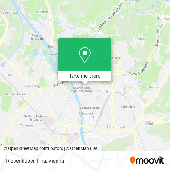
See Riesenhuber Tina, Austria, on the map
Public Transit to Riesenhuber Tina in Austria
Wondering how to get to Riesenhuber Tina in Austria? Moovit helps you find the best way to get to Riesenhuber Tina with step-by-step directions from the nearest public transit station.
Moovit provides free maps and live directions to help you navigate through your city. View schedules, routes, timetables, and find out how long does it take to get to Riesenhuber Tina in real time.
Looking for the nearest stop or station to Riesenhuber Tina? Check out this list of stops closest to your destination: Salzburg Itzling West; Salzburg Plainbrücke; Salzburg Andreas-Hofer-Straße/Postbus; Salzburg Austraße; Salzburg Hauptbahnhof; Salzburg Goethestraße; Salzburg Kirchenstraße/Htl.
Train: A13, R3, S1, 951-D, A1, A1, A3, A3, LEX11.Bus: 111, 121, 150, 6, SEV E1, SEV X1, SEV X11, 270.
Want to see if there’s another route that gets you there at an earlier time? Moovit helps you find alternative routes or times. Get directions from and directions to Riesenhuber Tina easily from the Moovit App or Website.
We make riding to Riesenhuber Tina easy, which is why over 1.5 million users, including users in Austria, trust Moovit as the best app for public transit. You don’t need to download an individual bus app or train app, Moovit is your all-in-one transit app that helps you find the best bus time or train time available.
For information on prices of bus and train, costs and ride fares to Riesenhuber Tina, please check the Moovit app.
Use the app to navigate to popular places including to the airport, hospital, stadium, grocery store, mall, coffee shop, school, college, and university.
Riesenhuber Tina Address: Goethestraße 35 5020 Salzburg street in Austria
- Heimat Österrreich,
- Gemeinnützige Salzburg,
- Amici OG,
- Nockstein,
- Salzburg Maria Plain-Plainbrücke,
- Sms - Salzburger Mietwagen & Reise Service GmbH,
- Bipa,
- Berufsinfozentrum (Biz),
- Billa Dankt,
- Ams,
- Ladestation für Elektrofahrzeuge,
- Raiffeisen Technik Zentrum,
- NVZ GmbH,
- Ing. Claudio Dorigo,
- Salzburg City Austraße,
- Cafe+Co at,
- Basler Haar-Kosmetik,
- Sonja Seiwaldstätter,
- Jugendzentrum Corner,
- Goethestraße - Hügelgelände
Places Near Riesenhuber Tina (Austria)
- Setagayapark, Döbling,
- 10er Marie, Ottakring,
- Türkenschanzpark, Währing,
- Auhof-Center, Penzing,
- Lugner City, Rudolfsheim-Fünfhaus,
- Feuerhalle Simmering, Simmering,
- Ghegastraße 3, Landstraße,
- Schweizerhaus (Karl Kolariks Schweizerhaus), Leopoldstadt,
- Donauzentrum, Donaustadt,
- Leopoldauer Alm, Floridsdorf,
- Raimund-Theater, Mariahilf,
- Schiffsanleger Wien-Nussdorf, Döbling,
- Strandbad Gänsehäufel, Donaustadt,
- Wien Rennbahn Freudenau, Leopoldstadt,
- Klinik Floridsdorf (Krankenhaus Nord), Floridsdorf,
- Thomas-Klestil-Platz, Landstraße,
- Zentralfriedhof Halle 3, Simmering,
- Mariahilfer Strasse, Mariahilf,
- Ronacher, 1., Innere Stadt,
- Kabarett Simpl, 1., Innere Stadt
How to get to popular places in Austria with public transit
Get around Austria by public transit!
Traveling around Austria has never been so easy. See step by step directions as you travel to any attraction, street or major public transit station. View bus and train schedules, arrival times, service alerts and detailed routes on a map, so you know exactly how to get to anywhere in Austria.
When traveling to any destination around Austria use Moovit's Live Directions with Get Off Notifications to know exactly where and how far to walk, how long to wait for your line, and how many stops are left. Moovit will alert you when it's time to get off — no need to constantly re-check whether yours is the next stop.
Wondering how to use public transit in Austria or how to pay for public transit in Austria? Moovit public transit app can help you navigate your way with public transit easily, and at minimum cost. It includes public transit fees, ticket prices, and costs. Looking for a map of Austria public transit lines? Moovit public transit app shows all public transit maps in Austria with all Bus, Train, Subway, Light Rail, Ferry and Funicular routes and stops on an interactive map.
Austria has 6 transit type(s), including: Bus, Train, Subway, Light Rail, Ferry and Funicular, operated by several transit agencies, including Wiener Linien GmbH & Co KG, Vienna Airport Lines, OEBB Personenverkehr AG Kundenservice, Wiener Lokalbahnen GmbH, City Air Terminal Betriebsgesellschaft m.b.H., CAT, Österreichische Postbus AG, VOR GmbH, Graz Linien, Graz-Köflacher Bahn und Busbetrieb GmbH, Steiermarkbahn und Bus GmbH, Linz Linien GmbH, Salzburg AG (Salzburger Lokalbahn), Salzburg AG (OBus) and KMG Klagenfurt Mobil GmbH