How to get to Rifle Range G Block by bus?
Click on the bus route to see step by step directions with maps, line arrival times and updated time schedules.
From Kedai Jeruk Sungai Ara, Pulau Pinang
39 minFrom Jabil, Pulau Pinang
60 minFrom Pantai Hospital Penang, Pulau Pinang
67 minFrom Love Lane, Pulau Pinang
26 minFrom Sekolah Agama Sungai Ara, Pulau Pinang
42 minFrom Giant Hypermarket, Pulau Pinang
67 minFrom Rumah Peranginan Kilat TNB, Pulau Pinang
66 minFrom Global Business Services (Gbs@Mayang), Pulau Pinang
58 minFrom Universiti Sains Malaysia-Entrance Sg Dua, Pulau Pinang
68 minFrom Robert Bosch (M) Sdn. Bhd., Pulau Pinang
69 min
Bus stops near Rifle Range G Block in Pulau Pinang
Funicular station near Rifle Range G Block in Pulau Pinang
- Middle Station, 54 min walk,VIEW
Bus lines to Rifle Range G Block in Pulau Pinang
What are the closest stations to Rifle Range G Block?
The closest stations to Rifle Range G Block are:
- Flat Padang Tembak is 36 meters away, 1 min walk.
- Bhp Kampung Baru is 950 meters away, 13 min walk.
- SMK Chung Ling (P)(Kampung Baru) is 1346 meters away, 18 min walk.
- Middle Station is 4226 meters away, 54 min walk.
Which bus lines stop near Rifle Range G Block?
These bus lines stop near Rifle Range G Block: 201, 202.
What’s the nearest bus station to Rifle Range G Block in Pulau Pinang?
The nearest bus station to Rifle Range G Block in Pulau Pinang is Flat Padang Tembak. It’s a 1 min walk away.
What time is the first bus to Rifle Range G Block in Pulau Pinang?
The 306 is the first bus that goes to Rifle Range G Block in Pulau Pinang. It stops nearby at 5:40 AM.
What time is the last bus to Rifle Range G Block in Pulau Pinang?
The 502. is the last bus that goes to Rifle Range G Block in Pulau Pinang. It stops nearby at 12:31 AM.
What time is the first funicular to Rifle Range G Block in Pulau Pinang?
The PHC is the first funicular that goes to Rifle Range G Block in Pulau Pinang. It stops nearby at 6:30 AM.
What time is the last funicular to Rifle Range G Block in Pulau Pinang?
The PHC is the last funicular that goes to Rifle Range G Block in Pulau Pinang. It stops nearby at 11:04 PM.
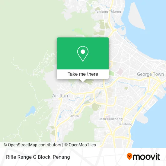
See Rifle Range G Block, Pulau Pinang, on the map
Public Transit to Rifle Range G Block in Pulau Pinang
Wondering how to get to Rifle Range G Block in Pulau Pinang? Moovit helps you find the best way to get to Rifle Range G Block with step-by-step directions from the nearest public transit station.
Moovit provides free maps and live directions to help you navigate through your city. View schedules, routes, timetables, and find out how long does it take to get to Rifle Range G Block in real time.
Looking for the nearest stop or station to Rifle Range G Block? Check out this list of stops closest to your destination: Flat Padang Tembak; Bhp Kampung Baru; SMK Chung Ling (P)(Kampung Baru); Middle Station.
Bus: 201, 202, 204, 502., 203, 306.Funicular: PHC.
Want to see if there’s another route that gets you there at an earlier time? Moovit helps you find alternative routes or times. Get directions from and directions to Rifle Range G Block easily from the Moovit App or Website.
We make riding to Rifle Range G Block easy, which is why over 1.5 million users, including users in Pulau Pinang, trust Moovit as the best app for public transit. You don’t need to download an individual bus app or train app, Moovit is your all-in-one transit app that helps you find the best bus time or train time available.
For information on prices of bus, costs and ride fares to Rifle Range G Block, please check the Moovit app.
Use the app to navigate to popular places including to the airport, hospital, stadium, grocery store, mall, coffee shop, school, college, and university.
Rifle Range G Block Address: Rifle Range G Block, Taman Rifle, 11400 Air Hitam, Penang street in Pulau Pinang
- C.J. Coffee Corner,
- Rifle Range Flats,
- Jalan Sempadan-Lorong Sempadan 2-Nb,
- Padang Tembak Block F,
- SM Barbershop,
- HCH Egg Wholesaler,
- Kedai Ubat Wei on,
- Kompleks Gerai Padang Tembak,
- 芯宁治疗中心,
- Rifle Range Basketball Court,
- Dim Sum House Rifle Range,
- Klinik Bersatu Rifle Range,
- KAFA Book Store,
- Topkids Pt 佳儿幼儿园,
- Maxtron Enterprise,
- Rumah Pangsa Padang Tembak,
- Rifle Range Flat Block H,
- Alisan Market,
- Federal Reserve Unit 3,
- Sekolah Kebangsaan Padang Tembak Pulau Pinang
Places Near Rifle Range G Block (Pulau Pinang)
- Shopee Express Butterworth Hub, Pulau Pinang,
- Golden B2B Reflexology, Pulau Pinang,
- Queensbay Mall, Pulau Pinang,
- Bayan Lepas, Pulau Pinang,
- Batu Kawan, Pulau Pinang,
- Gurney Plaza, Pulau Pinang,
- Terminal Jetty Rapid Penang, Pulau Pinang,
- Sg Nibong Rapid Penang Bus Hub, Pulau Pinang,
- IKEA Batu Kawan, Pulau Pinang,
- Hospital Pulau Pinang, Pulau Pinang,
- Bertam, Pulau Pinang,
- Padang Kota Lama, Pulau Pinang,
- ESCAPE, Pulau Pinang,
- Touch N Go Service Centre, Pulau Pinang,
- KOMTAR, Pulau Pinang,
- Han Chiang High School, Pulau Pinang,
- Sunway Carnival Mall , Pulau Pinang,
- Design Village, Pulau Pinang,
- Batu Ferringhi, Pulau Pinang,
- UITM Permatang Pauh, Pulau Pinang
How to get to popular places in Penang with public transit
Get around Pulau Pinang by public transit!
Traveling around Pulau Pinang has never been so easy. See step by step directions as you travel to any attraction, street or major public transit station. View bus and train schedules, arrival times, service alerts and detailed routes on a map, so you know exactly how to get to anywhere in Pulau Pinang.
When traveling to any destination around Pulau Pinang use Moovit's Live Directions with Get Off Notifications to know exactly where and how far to walk, how long to wait for your line, and how many stops are left. Moovit will alert you when it's time to get off — no need to constantly re-check whether yours is the next stop.
Wondering how to use public transit in Pulau Pinang or how to pay for public transit in Pulau Pinang? Moovit public transit app can help you navigate your way with public transit easily, and at minimum cost. It includes public transit fees, ticket prices, and costs. Looking for a map of Pulau Pinang public transit lines? Moovit public transit app shows all public transit maps in Pulau Pinang with all Bus, Train, Ferry and Funicular routes and stops on an interactive map.
Penang has 4 transit type(s), including: Bus, Train, Ferry and Funicular, operated by several transit agencies, including Keretapi Tanah Melayu, Rapid Penang, Penang CAT, Penang Port, BAS.MY Kota Setar, BAS.MY Kangar, Penang Hill Corporation, Lean Hock Company Sdn Bhd, Maraliner, The Kulim-Baling Road Transport, Red Omnibus, Gopi Travel Tours Sdn Bhd and Shuttle Bus