How to get to Rigel Studios by bus?
Click on the bus route to see step by step directions with maps, line arrival times and updated time schedules.
From Faith Lutheran Middle School & High School, Summerlin South
47 minFrom Dean Martin @ Blue Diamond (N), Enterprise
93 minFrom Las Vegas Ballpark, Summerlin South
49 minFrom Buffet Asia (Buffet at Asia), Las Vegas
48 minFrom Spring Valley High School, Spring Valley
42 minFrom RTC Sunset Operations and Maintenance Facility, Enterprise
43 minFrom Downtown Summerlin, Summerlin South
51 minFrom Krazy Buffet, Spring Valley
43 minFrom Durango High School, Spring Valley
58 minFrom Allegiant Stadium, Spring Valley
55 min
Bus stops near Rigel Studios in Spring Valley
Bus lines to Rigel Studios in Spring Valley
What are the closest stations to Rigel Studios?
The closest stations to Rigel Studios are:
- Wb Sunset After Quarterhorse is 372 yards away, 5 min walk.
- Nb Fort Apache After Sunset is 469 yards away, 6 min walk.
Which bus lines stop near Rigel Studios?
These bus lines stop near Rigel Studios: 120, 212.
What’s the nearest bus station to Rigel Studios in Spring Valley?
The nearest bus station to Rigel Studios in Spring Valley is Wb Sunset After Quarterhorse. It’s a 5 min walk away.
What time is the first bus to Rigel Studios in Spring Valley?
The 120 is the first bus that goes to Rigel Studios in Spring Valley. It stops nearby at 4:21 AM.
What time is the last bus to Rigel Studios in Spring Valley?
The 212 is the last bus that goes to Rigel Studios in Spring Valley. It stops nearby at 1:58 AM.
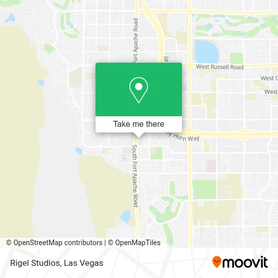
See Rigel Studios, Spring Valley, on the map
Public Transit to Rigel Studios in Spring Valley
Wondering how to get to Rigel Studios in Spring Valley? Moovit helps you find the best way to get to Rigel Studios with step-by-step directions from the nearest public transit station.
Moovit provides free maps and live directions to help you navigate through your city. View schedules, routes, timetables, and find out how long does it take to get to Rigel Studios in real time.
Looking for the nearest stop or station to Rigel Studios? Check out this list of stops closest to your destination: Wb Sunset After Quarterhorse; Nb Fort Apache After Sunset.
Bus: 120, 212.
Want to see if there’s another route that gets you there at an earlier time? Moovit helps you find alternative routes or times. Get directions from and directions to Rigel Studios easily from the Moovit App or Website.
We make riding to Rigel Studios easy, which is why over 1.7 million users, including users in Spring Valley, trust Moovit as the best app for public transit. You don’t need to download an individual bus app or train app, Moovit is your all-in-one transit app that helps you find the best bus time or train time available.
For information on prices of bus, costs and ride fares to Rigel Studios, please check the Moovit app.
Use the app to navigate to popular places including to the airport, hospital, stadium, grocery store, mall, coffee shop, school, college, and university.
Rigel Studios Address: S Fort Apache Rd street in Spring Valley
- Faiss Middle School,
- Dr. Andrew M. Cash, MD,
- Sunset Road and Ft Apache,
- Cowabunga Canyon,
- Comprehensive Cancer Centers of Nevada, Southwest (Kildea James-Comprehensive Cancer Center),
- LBC Fort Apache Vegas,
- Southern Hills Hospital & Medical Center - Main Entrance,
- Southern Hills Hosp & Medl Ctr,
- #302,
- IKEA - Las Vegas,
- IKEA,
- Durango Casino & Resort Las Vegas,
- I-215 & Durango,
- W Sunset Rd / S Durango Dr,
- Rhodes Ranch Town Center,
- S Durango Dr / W Warm Springs Rd,
- Durango & Warm Springs,
- 7195 Advanced Way,
- Armstrong Relocation,
- Rhodes Ranch Community
Places Near Rigel Studios (Spring Valley)
- The Neon Museum, Las Vegas,
- Las Vegas Premium Outlets-North, Enterprise,
- Las Vegas South Premium Outlets, Enterprise,
- Koolsville Tattoos, Las Vegas,
- Allegiant Stadium, Paradise,
- The Palms Casino Resort, Paradise,
- Las Vegas North Premium Outlets, Las Vegas,
- The Deuce Bus Stop at Fremont St, Las Vegas,
- Area15, Las Vegas,
- Trump International Hotel Las Vegas, Paradise,
- Walmart, Las Vegas,
- Meow Wolf - Las Vegas (Meow Wolf's Omega Mart), Las Vegas,
- Welcome To Fabulous Las Vegas Sign, Paradise,
- Omega Mart, Las Vegas,
- Lee Canyon, Las Vegas,
- Walmart Supercenter, Las Vegas,
- Zak Bagans Haunted Museum, Las Vegas,
- Town Square, Enterprise,
- Arte Museum Las Vegas, Paradise,
- Gold & Silver Pawn Shop, Las Vegas
How to get to popular places in Las Vegas with public transit
Get around Spring Valley by public transit!
Traveling around Spring Valley has never been so easy. See step by step directions as you travel to any attraction, street or major public transit station. View bus and train schedules, arrival times, service alerts and detailed routes on a map, so you know exactly how to get to anywhere in Spring Valley.
When traveling to any destination around Spring Valley use Moovit's Live Directions with Get Off Notifications to know exactly where and how far to walk, how long to wait for your line, and how many stops are left. Moovit will alert you when it's time to get off — no need to constantly re-check whether yours is the next stop.
Wondering how to use public transit in Spring Valley or how to pay for public transit in Spring Valley? Moovit public transit app can help you navigate your way with public transit easily, and at minimum cost. It includes public transit fees, ticket prices, and costs. Looking for a map of Spring Valley public transit lines? Moovit public transit app shows all public transit maps in Spring Valley with all Bus and Monorail routes and stops on an interactive map.
Las Vegas has 2 transit type(s), including: Bus and Monorail, operated by several transit agencies, including RTCSNV, City of Las Vegas, Alvand Transportation, Vegas Airporter, Las Vegas Monorail, FlixBus-us and Greyhound-us