How to get to Righthand by bus?
Click on the bus route to see step by step directions with maps, line arrival times and updated time schedules.
From Indy Go Gas, Indianapolis City (Balance)
33 minFrom Butler University, Indianapolis City (Balance)
40 minFrom WorkOne Indianapolis, Indianapolis City (Balance)
73 minFrom Lot 7 (North 40), Indianapolis City (Balance)
51 minFrom Shorty's Taller Mecanico, Indianapolis City (Balance)
33 minFrom Chuck E Cheese's, Southport
32 minFrom Messiah Cares Child Development Center, Indianapolis City (Balance)
56 minFrom Butler University Jordan Hall, Indianapolis City (Balance)
41 minFrom Allison Transmission Plant 3 Medical, Speedway
38 minFrom The Dehaan Estate, Indianapolis City (Balance)
41 min
Bus stops near Righthand in Indianapolis City (Balance)
Bus lines to Righthand in Indianapolis City (Balance)
What are the closest stations to Righthand?
The closest stations to Righthand are:
- Virginia Ave & Mccarty Ct is 720 yards away, 9 min walk.
- English Ave & Leota St is 837 yards away, 11 min walk.
- East St & Prospect St is 926 yards away, 11 min walk.
- Virginia Ave & Woodlawn Ave - Fountain Square Station Nb is 1252 yards away, 15 min walk.
Which bus line stops near Righthand?
90 (66th)
What’s the nearest bus station to Righthand in Indianapolis City (Balance)?
The nearest bus station to Righthand in Indianapolis City (Balance) is Virginia Ave & Mccarty Ct. It’s a 9 min walk away.
What time is the first bus to Righthand in Indianapolis City (Balance)?
The 90 is the first bus that goes to Righthand in Indianapolis City (Balance). It stops nearby at 5:00 AM.
What time is the last bus to Righthand in Indianapolis City (Balance)?
The 90 is the last bus that goes to Righthand in Indianapolis City (Balance). It stops nearby at 12:47 AM.
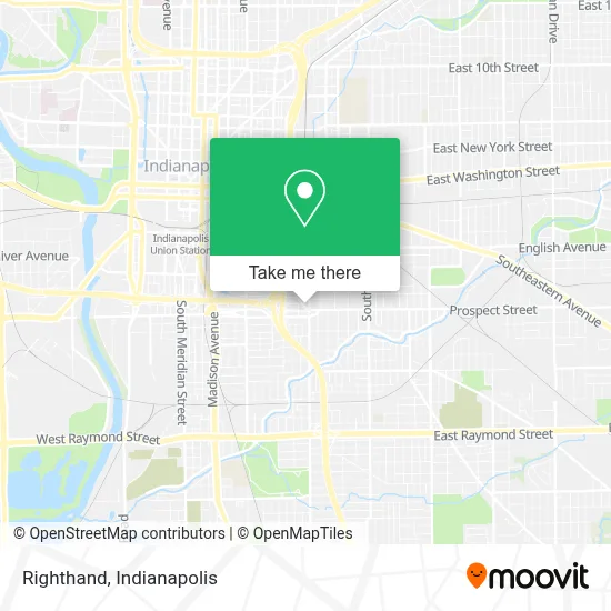
See Righthand, Indianapolis City (Balance), on the map
Public Transit to Righthand in Indianapolis City (Balance)
Wondering how to get to Righthand in Indianapolis City (Balance)? Moovit helps you find the best way to get to Righthand with step-by-step directions from the nearest public transit station.
Moovit provides free maps and live directions to help you navigate through your city. View schedules, routes, timetables, and find out how long does it take to get to Righthand in real time.
Looking for the nearest stop or station to Righthand? Check out this list of stops closest to your destination: Virginia Ave & Mccarty Ct; English Ave & Leota St; East St & Prospect St; Virginia Ave & Woodlawn Ave - Fountain Square Station Nb.
Bus: 90, 26, 56, 13.
Want to see if there’s another route that gets you there at an earlier time? Moovit helps you find alternative routes or times. Get directions from and directions to Righthand easily from the Moovit App or Website.
We make riding to Righthand easy, which is why over 1.5 million users, including users in Indianapolis City (Balance), trust Moovit as the best app for public transit. You don’t need to download an individual bus app or train app, Moovit is your all-in-one transit app that helps you find the best bus time or train time available.
For information on prices of bus, costs and ride fares to Righthand, please check the Moovit app.
Use the app to navigate to popular places including to the airport, hospital, stadium, grocery store, mall, coffee shop, school, college, and university.
Righthand Address: 1054 Virginia Ave street in Indianapolis City (Balance)
- Fountain Square,
- Bowie Kitty,
- Little Builders Academy,
- Darlin' Hair+Home,
- Museum of Psychphonics,
- Lux & Ivy,
- Indy Pride Festiva,
- Paradox Lounge,
- A Cup of Chai,
- BX Indiana,
- Flipside Estates,
- Audiophile Interiors,
- A & M Auto,
- Mystery Fun Club,
- Devious Robot,
- Wildfyre Tap,
- Prints on Tap by Shane Brown,
- Creation of Adam,
- Square Rootz Deli,
- Ogd Overhead Garage Door
Places Near Righthand (Indianapolis City (Balance))
- I U Health Methodist Hospital, Indianapolis City (Balance),
- THE BALT, Indianapolis City (Balance),
- St. Vincent entrance #1, Indianapolis City (Balance),
- 119 W 19th St Parking, Indianapolis City (Balance),
- Methodist Hospital of Indianapolis, Indianapolis City (Balance),
- Indiana, Indianapolis City (Balance),
- Jersey Barn, Indianapolis City (Balance),
- Eskenazi Hospital, Indianapolis City (Balance),
- Indianapolis Motor Speedway, Speedway,
- Gainbridge Fieldhouse, Indianapolis City (Balance),
- Indianapolis Airport Zone 2, Indianapolis City (Balance),
- Train Ride At Castleton Mall, Indianapolis City (Balance),
- St. Vincent Hospital - Indianapolis, Indianapolis City (Balance),
- Lilly Corporate Center (Eli Lilly & Co), Indianapolis City (Balance),
- I-465 / I-65 Interchange, Indianapolis City (Balance),
- Cotter's Massage Parlor With Happy Endings, Indianapolis City (Balance),
- Lucas Oil Stadium, Indianapolis City (Balance),
- Indiana Convention Center, Indianapolis City (Balance),
- Plainfield, IN, Plainfield,
- Castleton Square Mall, Indianapolis
How to get to popular places in Indianapolis with public transit
Get around Indianapolis City (Balance) by public transit!
Traveling around Indianapolis City (Balance) has never been so easy. See step by step directions as you travel to any attraction, street or major public transit station. View bus and train schedules, arrival times, service alerts and detailed routes on a map, so you know exactly how to get to anywhere in Indianapolis City (Balance).
When traveling to any destination around Indianapolis City (Balance) use Moovit's Live Directions with Get Off Notifications to know exactly where and how far to walk, how long to wait for your line, and how many stops are left. Moovit will alert you when it's time to get off — no need to constantly re-check whether yours is the next stop.
Wondering how to use public transit in Indianapolis City (Balance) or how to pay for public transit in Indianapolis City (Balance)? Moovit public transit app can help you navigate your way with public transit easily, and at minimum cost. It includes public transit fees, ticket prices, and costs. Looking for a map of Indianapolis City (Balance) public transit lines? Moovit public transit app shows all public transit maps in Indianapolis City (Balance) with all bus routes and stops on an interactive map.
Indianapolis has 1 transit type(s), including: bus, operated by several transit agencies, including IndyGo, FlixBus-us and Greyhound-us