How to get to Rigorma Grafica by bus?
Click on the bus route to see step by step directions with maps, line arrival times and updated time schedules.
From Hospital Universitario HM Puerta del Sur, Móstoles
36 minFrom Parque Coimbra, Área Metropolitana De Madrid Y Corredor Del Henares
64 minFrom Parque Finca Liana, Área Metropolitana De Madrid Y Corredor Del Henares
36 minFrom Villaviciosa de Odón, Villaviciosa De Odón
58 minFrom Calle Granada 9, Móstoles
38 minFrom Tanatorio De Móstoles, Área Metropolitana De Madrid Y Corredor Del Henares
76 minFrom Centro Comercial Xanadú, Arroyomolinos
37 minFrom Poligono Industrial Las Nieves, Móstoles
60 minFrom Universidad Europea De Madrid, Área Metropolitana De Madrid Y Corredor Del Henares
93 minFrom Hospital Universitario De Móstoles., Área Metropolitana De Madrid Y Corredor Del Henares
36 min
Bus stops near Rigorma Grafica in Navalcarnero
Bus lines to Rigorma Grafica in Navalcarnero
What are the closest stations to Rigorma Grafica?
The closest stations to Rigorma Grafica are:
- Av. Mari Martín - Arcángel Gabriel is 186 meters away, 3 min walk.
- Av. Dehesa - Av. Mari Martín is 270 meters away, 4 min walk.
- Arcángel Gabriel - Av. Mari Martín is 341 meters away, 5 min walk.
- Ctra. M-600 - Cementerio is 676 meters away, 9 min walk.
Which bus lines stop near Rigorma Grafica?
These bus lines stop near Rigorma Grafica: 1, 531.
What’s the nearest bus station to Rigorma Grafica in Navalcarnero?
The nearest bus station to Rigorma Grafica in Navalcarnero is Av. Mari Martín - Arcángel Gabriel. It’s a 3 min walk away.
What time is the first bus to Rigorma Grafica in Navalcarnero?
The N505 is the first bus that goes to Rigorma Grafica in Navalcarnero. It stops nearby at 3:05 AM.
What time is the last bus to Rigorma Grafica in Navalcarnero?
The 538 is the last bus that goes to Rigorma Grafica in Navalcarnero. It stops nearby at 12:05 AM.
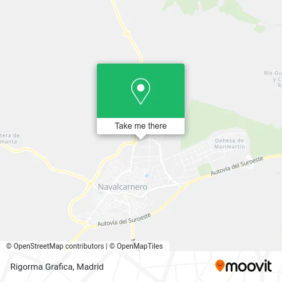
See Rigorma Grafica, Navalcarnero, on the map
Public Transit to Rigorma Grafica in Navalcarnero
Wondering how to get to Rigorma Grafica in Navalcarnero? Moovit helps you find the best way to get to Rigorma Grafica with step-by-step directions from the nearest public transit station.
Moovit provides free maps and live directions to help you navigate through your city. View schedules, routes, timetables, and find out how long does it take to get to Rigorma Grafica in real time.
Looking for the nearest stop or station to Rigorma Grafica? Check out this list of stops closest to your destination: Av. Mari Martín - Arcángel Gabriel; Av. Dehesa - Av. Mari Martín; Arcángel Gabriel - Av. Mari Martín; Ctra. M-600 - Cementerio.
Bus: 1, 531, 531A, N505, 538, 530.
Want to see if there’s another route that gets you there at an earlier time? Moovit helps you find alternative routes or times. Get directions from and directions to Rigorma Grafica easily from the Moovit App or Website.
We make riding to Rigorma Grafica easy, which is why over 1.5 million users, including users in Navalcarnero, trust Moovit as the best app for public transit. You don’t need to download an individual bus app or train app, Moovit is your all-in-one transit app that helps you find the best bus time or train time available.
For information on prices of bus, costs and ride fares to Rigorma Grafica, please check the Moovit app.
Use the app to navigate to popular places including to the airport, hospital, stadium, grocery store, mall, coffee shop, school, college, and university.
Rigorma Grafica Address: Avenida de Marí Martín, 28600 Navalcarnero street in Navalcarnero
- 28600,
- Avenida Mari-Martín,
- Parque de San Juan Bautista,
- Avenida de la Dehesa 1,
- Calle del Arcángel Gabriel 6,
- Lt 6447,
- Autos Niclar,
- Erika Zarco Peluqueros,
- Dist Beb Centro Sur,
- Instalaciones y Reparaciones Zuar,
- Ajtf,
- Calle Rio Jordan,
- Calle de la Rastrojera s/n,
- C/ Avda de la Dehesa 3,
- Silo De Navalcarnero,
- Colegio Sei Nuestra Señora de la Concepción,
- Ani Can Mascotas,
- Américan Royal Pizza Navalcarnero,
- Pasteleria Cafeteria Nicoleta,
- La Taberna de Paquito
Places Near Rigorma Grafica (Navalcarnero)
- Sala La Riviera, Madrid,
- Hospital Universitario La Paz, Madrid,
- Centro Comercial La Vaguada, Área Metropolitana De Madrid Y Corredor Del Henares,
- Calle de López de Hoyos 169, Madrid,
- Centro Comercial Islazul, Área Metropolitana De Madrid Y Corredor Del Henares,
- Plaza Mayor, Madrid,
- Rastro De Madrid, Área Metropolitana De Madrid Y Corredor Del Henares,
- Hospital Clínico Universitario San Carlos, Madrid,
- Estadio Wanda Metropolitano, Área Metropolitana De Madrid Y Corredor Del Henares,
- Hospital Universitario Ramón y Cajal, Madrid,
- Mendez Alvaro, Madrid,
- Wizink Center, Madrid,
- Nassica, Área Metropolitana De Madrid Y Corredor Del Henares,
- Palacio De Vistalegre, Área Metropolitana De Madrid Y Corredor Del Henares,
- Mercadillo de Majadahonda, Majadahonda,
- Plenilunio, Área Metropolitana De Madrid Y Corredor Del Henares,
- Centro Comercial La Gavia, Área Metropolitana De Madrid Y Corredor Del Henares,
- Tres Aguas, Alcorcón,
- Centro Comercial Oasiz Madrid, Área Metropolitana De Madrid Y Corredor Del Henares,
- Estacion de Chamartin, Madrid
How to get to popular places in Madrid with public transit
Get around Navalcarnero by public transit!
Traveling around Navalcarnero has never been so easy. See step by step directions as you travel to any attraction, street or major public transit station. View bus and train schedules, arrival times, service alerts and detailed routes on a map, so you know exactly how to get to anywhere in Navalcarnero.
When traveling to any destination around Navalcarnero use Moovit's Live Directions with Get Off Notifications to know exactly where and how far to walk, how long to wait for your line, and how many stops are left. Moovit will alert you when it's time to get off — no need to constantly re-check whether yours is the next stop.
Wondering how to use public transit in Navalcarnero or how to pay for public transit in Navalcarnero? Moovit public transit app can help you navigate your way with public transit easily, and at minimum cost. It includes public transit fees, ticket prices, and costs. Looking for a map of Navalcarnero public transit lines? Moovit public transit app shows all public transit maps in Navalcarnero with all Bus, Train, Metro and Light Rail routes and stops on an interactive map.
Madrid has 4 transit type(s), including: Bus, Train, Metro and Light Rail, operated by several transit agencies, including Metro de Madrid, Metro Ligero, Tranvía de Parla, Renfe Cercanías - Servicios de Autobús especiales, Renfe Cercanias, Renfe Cercanías, EMT, Interurbanos, Urbanos de Alcalá de Henares, Urbanos de Alcobendas, Urbanos de Alcorcón, Urbanos de Algete, Urbanos de Aranjuez, Urbanos de Arganda del Rey and Urbanos de Arroyomolinos