Directions to Rilassare Spa (Henderson) with public transportation
The following transit lines have routes that pass near Rilassare Spa
 Bus: 115, 212, FLIXBUS N2030, FLIXBUS 2030, FLIXBUS 2040.
How to get to Rilassare Spa by bus?
Click on the bus route to see step by step directions with maps, line arrival times and updated time schedules.
From University of Nevada-Las Vegas, Paradise
67 minFrom Nevada State College, Henderson
45 minFrom E Sahara Ave / S Nellis Blvd, Sunrise Manor
41 minFrom Del Sol Academy of the Performing Arts, Paradise
38 minFrom Aveda Institute Las Vegas, Paradise
52 minFrom Thomas & Mack Center, Paradise
53 minFrom Motel 6-Las Vegas-Boulder Highway (Las Vegas Motel 6), Sunrise Manor
59 minFrom William E. Orr Middle School, Paradise
68 minFrom Seafood City Supermarket, Paradise
64 minFrom S Maryland Pkwy / E Flamingo Rd, Paradise
64 min
Bus stops near Rilassare Spa in Henderson
Bus lines to Rilassare Spa in Henderson
What are the closest stations to Rilassare Spa?
The closest stations to Rilassare Spa are:
- Henderson (Galleria at Sunset) is 13 yards away, 1 min walk.
- Eb Sunset After Whitney Ranch is 278 yards away, 4 min walk.
- Sb Stephanie After Power Center is 676 yards away, 9 min walk.
Which bus lines stop near Rilassare Spa?
These bus lines stop near Rilassare Spa: 115, 212, FLIXBUS N2030.
What’s the nearest bus station to Rilassare Spa in Henderson?
The nearest bus station to Rilassare Spa in Henderson is Henderson (Galleria at Sunset). It’s a 1 min walk away.
What time is the first bus to Rilassare Spa in Henderson?
The 115 is the first bus that goes to Rilassare Spa in Henderson. It stops nearby at 4:26 AM.
What time is the last bus to Rilassare Spa in Henderson?
The FLIXBUS N2030 is the last bus that goes to Rilassare Spa in Henderson. It stops nearby at 9:10 AM.
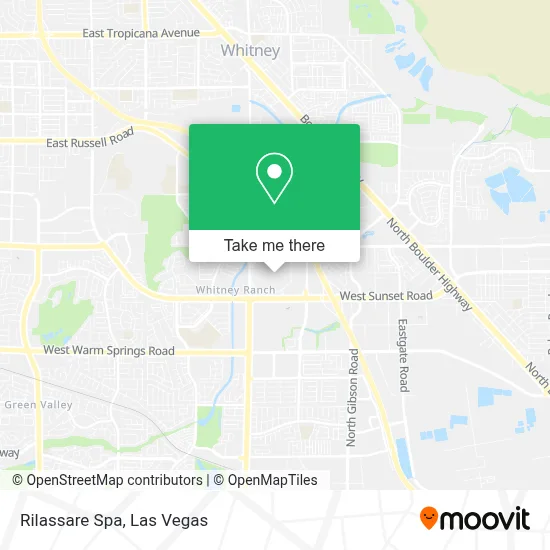
See Rilassare Spa, Henderson, on the map
Public Transit to Rilassare Spa in Henderson
Wondering how to get to Rilassare Spa in Henderson? Moovit helps you find the best way to get to Rilassare Spa with step-by-step directions from the nearest public transit station.
Moovit provides free maps and live directions to help you navigate through your city. View schedules, routes, timetables, and find out how long does it take to get to Rilassare Spa in real time.
Looking for the nearest stop or station to Rilassare Spa? Check out this list of stops closest to your destination: Henderson (Galleria at Sunset); Eb Sunset After Whitney Ranch; Sb Stephanie After Power Center.
Bus: 115, 212, FLIXBUS N2030, FLIXBUS 2030, FLIXBUS 2040.
Want to see if there’s another route that gets you there at an earlier time? Moovit helps you find alternative routes or times. Get directions from and directions to Rilassare Spa easily from the Moovit App or Website.
We make riding to Rilassare Spa easy, which is why over 1.7 million users, including users in Henderson, trust Moovit as the best app for public transit. You don’t need to download an individual bus app or train app, Moovit is your all-in-one transit app that helps you find the best bus time or train time available.
For information on prices of bus, costs and ride fares to Rilassare Spa, please check the Moovit app.
Use the app to navigate to popular places including to the airport, hospital, stadium, grocery store, mall, coffee shop, school, college, and university.
Rilassare Spa Address: 1300 W Sunset Rd street in Henderson
- Galleria at Sunset ,
- Galleria at Sunset,
- Galleria Mall Dr,
- Samsonite,
- Regal Sunset Station,
- Costco Wholesale,
- Dollar Loan Center,
- N Stephanie St / W Sunset Rd,
- Whitney Ranch, Nevada,
- Sunset Station Bingo Room,
- Seville Bar,
- Nordstrom Rack,
- Sunset Station Hotel And Casino Valet Parking,
- Sunset Station Hotel & Casino,
- Golden Corral,
- Nip N Tuck Alterations,
- Sunset Station,
- Golden Corral Buffet & Grill,
- Walmart Supercenter,
- Henderson Hospital
Places Near Rilassare Spa (Henderson)
- Lee Canyon, Las Vegas,
- Gold & Silver Pawn Shop, Las Vegas,
- Las Vegas Premium Outlets-North, Enterprise,
- Area15, Las Vegas,
- Walmart Supercenter, Las Vegas,
- Trump International Hotel Las Vegas, Paradise,
- The Palms Casino Resort, Paradise,
- Las Vegas North Premium Outlets, Las Vegas,
- Allegiant Stadium, Paradise,
- Town Square, Enterprise,
- Walmart, Las Vegas,
- Omega Mart, Las Vegas,
- Koolsville Tattoos, Las Vegas,
- Zak Bagans Haunted Museum, Las Vegas,
- Las Vegas South Premium Outlets, Enterprise,
- The Deuce Bus Stop at Fremont St, Las Vegas,
- Welcome To Fabulous Las Vegas Sign, Paradise,
- Meow Wolf - Las Vegas (Meow Wolf's Omega Mart), Las Vegas,
- Arte Museum Las Vegas, Paradise,
- The Neon Museum, Las Vegas
How to get to popular places in Las Vegas with public transit
Get around Henderson by public transit!
Traveling around Henderson has never been so easy. See step by step directions as you travel to any attraction, street or major public transit station. View bus and train schedules, arrival times, service alerts and detailed routes on a map, so you know exactly how to get to anywhere in Henderson.
When traveling to any destination around Henderson use Moovit's Live Directions with Get Off Notifications to know exactly where and how far to walk, how long to wait for your line, and how many stops are left. Moovit will alert you when it's time to get off — no need to constantly re-check whether yours is the next stop.
Wondering how to use public transit in Henderson or how to pay for public transit in Henderson? Moovit public transit app can help you navigate your way with public transit easily, and at minimum cost. It includes public transit fees, ticket prices, and costs. Looking for a map of Henderson public transit lines? Moovit public transit app shows all public transit maps in Henderson with all Bus and Monorail routes and stops on an interactive map.
Las Vegas has 2 transit type(s), including: Bus and Monorail, operated by several transit agencies, including RTCSNV, City of Las Vegas, Alvand Transportation, Vegas Airporter, Las Vegas Monorail, FlixBus-us and Greyhound-us