How to get to Rincon Caribeno Cafe by bus?
Click on the bus route to see step by step directions with maps, line arrival times and updated time schedules.
From Tropicana Flea Market, Miami
84 minFrom Government Center, Miami
75 minFrom Turnpike Exit @ Doral Blvd. (NW 41 Street), North Westside
80 minFrom Flamingo Parking Garage, Miami
74 minFrom 3801 NW 21st St, Miami
49 minFrom SW 122 Ave & Coral Way, Kendale Lakes-Tamiami
79 minFrom NW 54th St / SE Le Jeune Rd, Hialeah
56 minFrom Goodwill, Miami
84 minFrom The Casino at Dania Beach, Miami
55 minFrom Douglas Road Station, Miami
34 min
Bus stops near Rincon Caribeno Cafe in Miami
Bus lines to Rincon Caribeno Cafe in Miami
What are the closest stations to Rincon Caribeno Cafe?
The closest stations to Rincon Caribeno Cafe are:
- Sw 24 St & Sw 72 Av is 902 yards away, 11 min walk.
- Sw 67 Av & Sw 32 Te is 963 yards away, 12 min walk.
Which bus lines stop near Rincon Caribeno Cafe?
These bus lines stop near Rincon Caribeno Cafe: 24, 40, 73.
What’s the nearest bus station to Rincon Caribeno Cafe in Miami?
The nearest bus station to Rincon Caribeno Cafe in Miami is Sw 24 St & Sw 72 Av. It’s a 11 min walk away.
What time is the first bus to Rincon Caribeno Cafe in Miami?
The 24 is the first bus that goes to Rincon Caribeno Cafe in Miami. It stops nearby at 5:02 AM.
What time is the last bus to Rincon Caribeno Cafe in Miami?
The 24 is the last bus that goes to Rincon Caribeno Cafe in Miami. It stops nearby at 12:38 AM.
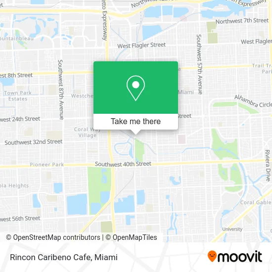
See Rincon Caribeno Cafe, Miami, on the map
Public Transit to Rincon Caribeno Cafe in Miami
Wondering how to get to Rincon Caribeno Cafe in Miami? Moovit helps you find the best way to get to Rincon Caribeno Cafe with step-by-step directions from the nearest public transit station.
Moovit provides free maps and live directions to help you navigate through your city. View schedules, routes, timetables, and find out how long does it take to get to Rincon Caribeno Cafe in real time.
Looking for the nearest stop or station to Rincon Caribeno Cafe? Check out this list of stops closest to your destination: Sw 24 St & Sw 72 Av; Sw 67 Av & Sw 32 Te.
Bus: 24, 40, 73.
Want to see if there’s another route that gets you there at an earlier time? Moovit helps you find alternative routes or times. Get directions from and directions to Rincon Caribeno Cafe easily from the Moovit App or Website.
We make riding to Rincon Caribeno Cafe easy, which is why over 1.5 million users, including users in Miami, trust Moovit as the best app for public transit. You don’t need to download an individual bus app or train app, Moovit is your all-in-one transit app that helps you find the best bus time or train time available.
For information on prices of bus and light rail, costs and ride fares to Rincon Caribeno Cafe, please check the Moovit app.
Use the app to navigate to popular places including to the airport, hospital, stadium, grocery store, mall, coffee shop, school, college, and university.
Rincon Caribeno Cafe Address: 7143 N Waterway Dr Miami, FL 33155 street in Miami
- Eating by V,
- The Sub Ologist,
- Simple Yummy Meals,
- Mechaditos,
- Nuvoform,
- The Cocoplum,
- Lasagna Shop,
- Azafran,
- Wild Caribbean Seafood,
- Sense Art,
- Conexpar Trading,
- Borkat Plumbing Services,
- A Plus Y Collision,
- Sun Speed Transport,
- A.D. /Doug/ Barnes Park,
- Great Florida Birding Trail,
- A.D. Doug Barnes Park North,
- Simple Yummy Meals,
- Miez Ebenezer Miami,
- Montealegre Senior High
Places Near Rincon Caribeno Cafe (Miami)
- Sawgrass mall ( FL ), Miami Beach,
- Hard Rock Stadium, Miami Gardens,
- Marlins Park, Miami,
- Sawgrass Mall, Miami,
- Dolphin Mall Bus, Miami,
- Zoo Miami, Miami,
- Dolphin Mall, Miami,
- Aventura Mall, Miami Beach,
- Miami Freedom Park, Miami,
- Wynwood, Miami,
- Bayside Marketplace, Miami,
- Miami VA Hospital, Miami,
- Port of Miami Cruise Terminal, Miami,
- Miami-Dade County Courthouse, Miami,
- Richard E. Gerstein Justice Building, Miami,
- Keiser University Flagship Campus, West Palm Beach,
- Brickell City Centre, Miami,
- Little Havana, Miami,
- Miami Design District, Miami,
- Aventura Mall, Miami
How to get to popular places in Miami with public transit
Get around Miami by public transit!
Traveling around Miami has never been so easy. See step by step directions as you travel to any attraction, street or major public transit station. View bus and train schedules, arrival times, service alerts and detailed routes on a map, so you know exactly how to get to anywhere in Miami.
When traveling to any destination around Miami use Moovit's Live Directions with Get Off Notifications to know exactly where and how far to walk, how long to wait for your line, and how many stops are left. Moovit will alert you when it's time to get off — no need to constantly re-check whether yours is the next stop.
Wondering how to use public transit in Miami or how to pay for public transit in Miami? Moovit public transit app can help you navigate your way with public transit easily, and at minimum cost. It includes public transit fees, ticket prices, and costs. Looking for a map of Miami public transit lines? Moovit public transit app shows all public transit maps in Miami with all Bus, Train, Light Rail and Ferry routes and stops on an interactive map.
Miami has 4 transit type(s), including: Bus, Train, Light Rail and Ferry, operated by several transit agencies, including Broward County Transit, Miami-Dade Transit, Metrorail, Palm Tran, Tri-Rail, Brightline, MARTY, City of Homestead Trolley, Key West Transit, Treasure Coast Connector, GoLine IRT, Amtrak, Greyhound-us, FlixBus-us and Aventura Express Shuttle Bus