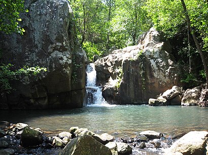
Directions to Rio De La Miel (Algeciras) with public transportation
The following transit lines have routes that pass near Rio De La Miel
 Bus: AL-5, 5.
How to get to Rio De La Miel by bus?
Click on the bus route to see step by step directions with maps, line arrival times and updated time schedules.
Bus stop near Rio De La Miel in Algeciras
- Calle Maestra María Luisa 2, 14 min walk,
Bus lines to Rio De La Miel in Algeciras
- 5, Centro Penitenciario,
What are the closest stations to Rio De La Miel?
The closest stations to Rio De La Miel are:
- Calle Maestra María Luisa 2 is 1062 meters away, 14 min walk.
Which bus line stops near Rio De La Miel?
AL-5
What’s the nearest bus station to Rio De La Miel in Algeciras?
The nearest bus station to Rio De La Miel in Algeciras is Calle Maestra María Luisa 2. It’s a 14 min walk away.
What time is the first train to Rio De La Miel in Algeciras?
The MD-70 is the first train that goes to Rio De La Miel in Algeciras. It stops nearby at 6:30 AM.
What time is the last train to Rio De La Miel in Algeciras?
The MD-70 is the last train that goes to Rio De La Miel in Algeciras. It stops nearby at 12:17 AM.
What time is the first bus to Rio De La Miel in Algeciras?
The AL-5 is the first bus that goes to Rio De La Miel in Algeciras. It stops nearby at 7:00 AM.
What time is the last bus to Rio De La Miel in Algeciras?
The AL-5 is the last bus that goes to Rio De La Miel in Algeciras. It stops nearby at 8:01 PM.
See Rio De La Miel, Algeciras, on the map
Public Transit to Rio De La Miel in Algeciras
How to get to Rio De La Miel in Algeciras, Spain?
It’s easy with Moovit. Type in your street address and Moovit’s route finder will locate the fastest way to get you there! Not sure where to get off on the street? Download the Moovit App to find live directions (including where to get off on Rio De La Miel), see timetables and get the estimated arrival times for your favorite bus lines.
Looking for the nearest stop or station to Rio De La Miel? Check out this list of closest stops available to your destination: Calle Maestra María Luisa 2.
Bus: AL-5, 5.
Download the Moovit App to see the current schedule and routes available for Algeciras. No need to install a special bus app to check the bus time or a train app to get train time. Moovit is the only all-in-one transit app that helps you get where you need to go.
We make riding on public transit to Rio De La Miel easy, which is why over 1.5 million users, including users in Algeciras trust Moovit as the best app for public transit.
Use the app to navigate to popular places including to the airport, hospital, stadium, grocery store, mall, coffee shop, school, college, and university.
Location: Algeciras, Campo de Gibraltar
Get around Algeciras by public transit!
Traveling around Algeciras has never been so easy. See step by step directions as you travel to any attraction, street or major public transit station. View bus and train schedules, arrival times, service alerts and detailed routes on a map, so you know exactly how to get to anywhere in Algeciras.
When traveling to any destination around Algeciras use Moovit's Live Directions with Get Off Notifications to know exactly where and how far to walk, how long to wait for your line, and how many stops are left. Moovit will alert you when it's time to get off — no need to constantly re-check whether yours is the next stop.
Wondering how to use public transit in Algeciras or how to pay for public transit in Algeciras? Moovit public transit app can help you navigate your way with public transit easily, and at minimum cost. It includes public transit fees, ticket prices, and costs. Looking for a map of Algeciras public transit lines? Moovit public transit app shows all public transit maps in Algeciras with all Bus, Train, Ferry and Gondola routes and stops on an interactive map.
Campo de Gibraltar has 4 transit type(s), including: Bus, Train, Ferry and Gondola, operated by several transit agencies, including Renfe, Red de Consorcios de Transporte de Andalucía - Campo de Gibraltar, Transporte Urbano de Algeciras (Algesa), Urbanos de Tarifa (Horizonte Sur Viajes, S. L.), Urbanos de Los Barrios (Autocares Ríos), Transportes Generales Comes (VJA-147), Gibraltar Bus Company & Citybus, Urbanos de San Roque (Horizonte Sur Viajes, S. L.), Urbano de La Línea de la Concepción (Socibus), Socibus, Intershipping, Ferrys Rápidos del Sur (FRS Iberia), Monbus, ALSA Grupo (VJA-167) and Interbus