How to get to Rio Grande, New Jersey by bus?
Click on the bus route to see step by step directions with maps, line arrival times and updated time schedules.
From Rutgers, New Brunswick
321 minFrom Long Branch Beach & Boardwalk, Long Branch
352 minFrom Pop Pop Park Park Pl, Atlantic City
72 minFrom PNC Bank Arts Center, Holmdel
305 minFrom Toms River, NJ, Toms River
189 minFrom Monster Truck Ice Cream Truck, Pacific Ave, Wildwood Crest, Nj
29 minFrom Freehold, NJ, Freehold
296 min
Bus stops near Rio Grande, New Jersey in Middle
Bus lines to Rio Grande, New Jersey in Middle
What are the closest stations to Rio Grande, New Jersey?
The closest stations to Rio Grande, New Jersey are:
- Us-9 at Maryland Ave# is 195 yards away, 3 min walk.
- Rt-47 at 1st St (Dunkin Donuts Bus Stop) is 484 yards away, 7 min walk.
Which bus line stops near Rio Grande, New Jersey?
552 (Atlantic City)
What’s the nearest bus station to Rio Grande, New Jersey in Middle?
The nearest bus station to Rio Grande, New Jersey in Middle is Us-9 at Maryland Ave#. It’s a 3 min walk away.
What time is the first bus to Rio Grande, New Jersey in Middle?
The 552 is the first bus that goes to Rio Grande, New Jersey in Middle. It stops nearby at 3:24 AM.
What time is the last bus to Rio Grande, New Jersey in Middle?
The 552 is the last bus that goes to Rio Grande, New Jersey in Middle. It stops nearby at 3:44 AM.
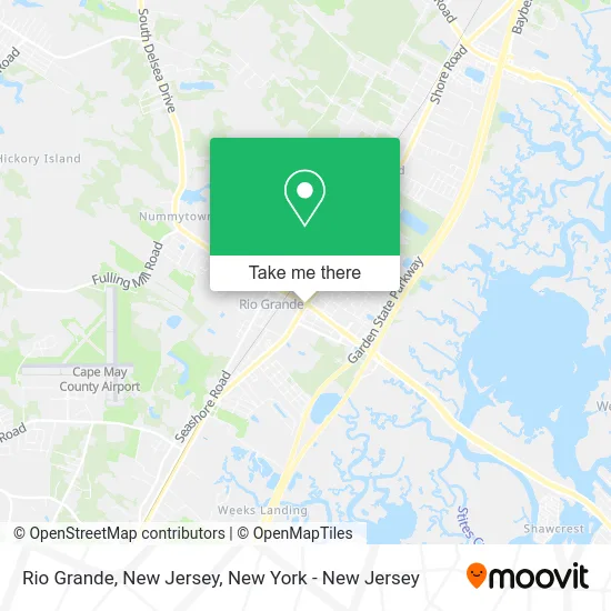
See Rio Grande, New Jersey, Middle, on the map
Public Transit to Rio Grande, New Jersey in Middle
Wondering how to get to Rio Grande, New Jersey in Middle? Moovit helps you find the best way to get to Rio Grande, New Jersey with step-by-step directions from the nearest public transit station.
Moovit provides free maps and live directions to help you navigate through your city. View schedules, routes, timetables, and find out how long does it take to get to Rio Grande, New Jersey in real time.
Looking for the nearest stop or station to Rio Grande, New Jersey? Check out this list of stops closest to your destination: Us-9 at Maryland Ave#; Rt-47 at 1st St (Dunkin Donuts Bus Stop).
Bus: 552, 313, 315.
Want to see if there’s another route that gets you there at an earlier time? Moovit helps you find alternative routes or times. Get directions from and directions to Rio Grande, New Jersey easily from the Moovit App or Website.
We make riding to Rio Grande, New Jersey easy, which is why over 1.5 million users, including users in Middle, trust Moovit as the best app for public transit. You don’t need to download an individual bus app or train app, Moovit is your all-in-one transit app that helps you find the best bus time or train time available.
For information on prices of bus and train, costs and ride fares to Rio Grande, New Jersey, please check the Moovit app.
Use the app to navigate to popular places including to the airport, hospital, stadium, grocery store, mall, coffee shop, school, college, and university.
Rio Grande, New Jersey Address: Cape May, NJ street in Middle
- George's Place West,
- DUNKIN',
- Bestlife Counseling,
- Rio Grande Gulf,
- Rent-A-Center,
- Cartridge World Of Rio Grande,
- El Compita Llc.,
- Easter Seal of NJ-Rio Grande Adult Training Center,
- Bestlife Counseling Services,
- Wawa,
- Wise Wellness Center,
- Marine Corps Recruiting,
- Walmart,
- PNC Atm,
- Atm Wawa,
- Air Conditioning Ventilation & Heating,
- Cape May County Welfare Fraud,
- Insurance Agency,
- Rio Realty,
- Zane's Home Entertainment Center
Places Near Rio Grande, New Jersey (Middle)
- 111 Centre New York City Supreme Court, Manhattan,
- Times Square, Manhattan,
- San Gennaro Feast, Manhattan,
- Wall Street, Manhattan,
- Hudson Yards, Manhattan,
- 911 Memorial, Manhattan,
- Queens Center Mall, Queens,
- Pier 83, Manhattan,
- SoHo, Manhattan,
- Bellevue Hospital, Manhattan,
- Rockefeller Center, Manhattan,
- Chinatown, Manhattan,
- qqqq, Manhattan,
- 66 John Street, Manhattan,
- 3 Stone St, Manhattan,
- 376 Hudson Street, Manhattan,
- 1 Police Plaza, Manhattan,
- 26 Federal Plaza, Manhattan,
- Katz's Deli, Manhattan,
- Mountainside Hospital, Glen Ridge
How to get to popular places in New York - New Jersey with public transit
Get around Middle by public transit!
Traveling around Middle has never been so easy. See step by step directions as you travel to any attraction, street or major public transit station. View bus and train schedules, arrival times, service alerts and detailed routes on a map, so you know exactly how to get to anywhere in Middle.
When traveling to any destination around Middle use Moovit's Live Directions with Get Off Notifications to know exactly where and how far to walk, how long to wait for your line, and how many stops are left. Moovit will alert you when it's time to get off — no need to constantly re-check whether yours is the next stop.
Wondering how to use public transit in Middle or how to pay for public transit in Middle? Moovit public transit app can help you navigate your way with public transit easily, and at minimum cost. It includes public transit fees, ticket prices, and costs. Looking for a map of Middle public transit lines? Moovit public transit app shows all public transit maps in Middle with all Bus, Train, Subway, Light Rail, Ferry and Cable Car routes and stops on an interactive map.
New York - New Jersey has 6 transit type(s), including: Bus, Train, Subway, Light Rail, Ferry and Cable Car, operated by several transit agencies, including MTA Subway, Metro-North Railroad, LIRR, PATH, MTA New York City Transit - Express routes, MTA Bus, NJ Transit, NYC Ferry, NICE bus, Bee-Line Bus, NJ Transit Rail, Norwalk Transit District, Hartford Line, River Valley Transit and HART