How to get to Rio Tinto by bus?
Click on the bus route to see step by step directions with maps, line arrival times and updated time schedules.
From Barcelos, Barcelos
59 minFrom Várzea, Barcelos
79 minFrom Santuário de Alexandrina de Balasar, Balazar
104 minFrom Central de Camionagem de Barcelos, Barcelos
58 minFrom Central de Camionagem Póvoa de Varzim, Póvoa de Varzim, Beiriz e Argivai
49 minFrom Hospital da Luz Póvoa de Varzim, A Ver-O-Mar, Amorim e Terroso
62 minFrom IPCA - Escola Superior de Gestão, Barcelos, Vila Boa e Vila Frescainha (São Martinho e São Pedro)
57 minFrom Trofa Saúde Hospital Central - Senhor do Bonfim, Touguinha e Touguinhó
82 minFrom Aver-o-Mar, A Ver-O-Mar, Amorim e Terroso
93 minFrom Beiriz, Póvoa de Varzim, Beiriz e Argivai
90 min
Bus stop near Rio Tinto in Fonte Boa e Rio Tinto
- Rio Tinto (Aldeia de Baixo), 2 min walk,VIEW
Bus lines to Rio Tinto in Fonte Boa e Rio Tinto
What are the closest stations to Rio Tinto?
The closest stations to Rio Tinto are:
- Rio Tinto (Aldeia de Baixo) is 87 meters away, 2 min walk.
Which bus line stops near Rio Tinto?
111 (Póvoa de Varzim (Terminal))
What’s the nearest bus station to Rio Tinto in Fonte Boa e Rio Tinto?
The nearest bus station to Rio Tinto in Fonte Boa e Rio Tinto is Rio Tinto (Aldeia de Baixo). It’s a 2 min walk away.
What time is the first bus to Rio Tinto in Fonte Boa e Rio Tinto?
The 216 is the first bus that goes to Rio Tinto in Fonte Boa e Rio Tinto. It stops nearby at 7:07 AM.
What time is the last bus to Rio Tinto in Fonte Boa e Rio Tinto?
The 216 is the last bus that goes to Rio Tinto in Fonte Boa e Rio Tinto. It stops nearby at 7:29 PM.
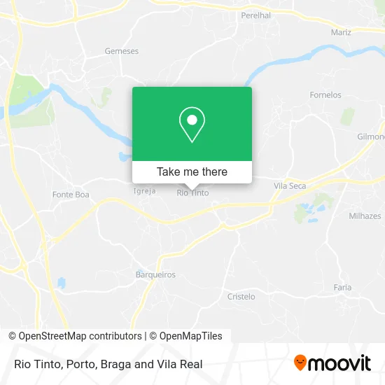
See Rio Tinto, Fonte Boa e Rio Tinto, on the map
Public Transit to Rio Tinto in Fonte Boa e Rio Tinto
Wondering how to get to Rio Tinto in Fonte Boa e Rio Tinto? Moovit helps you find the best way to get to Rio Tinto with step-by-step directions from the nearest public transit station.
Moovit provides free maps and live directions to help you navigate through your city. View schedules, routes, timetables, and find out how long does it take to get to Rio Tinto in real time.
Looking for the nearest stop or station to Rio Tinto? Check out this list of stops closest to your destination: Rio Tinto (Aldeia de Baixo).
Bus: 111, 216, 407.
Want to see if there’s another route that gets you there at an earlier time? Moovit helps you find alternative routes or times. Get directions from and directions to Rio Tinto easily from the Moovit App or Website.
We make riding to Rio Tinto easy, which is why over 1.5 million users, including users in Fonte Boa e Rio Tinto, trust Moovit as the best app for public transit. You don’t need to download an individual bus app or train app, Moovit is your all-in-one transit app that helps you find the best bus time or train time available.
For information on prices of bus, costs and ride fares to Rio Tinto, please check the Moovit app.
Use the app to navigate to popular places including to the airport, hospital, stadium, grocery store, mall, coffee shop, school, college, and university.
Rio Tinto Address: Rua da Fonte street in Fonte Boa e Rio Tinto
- Rey & Gonzaga,
- Junta de Freguesia de Rio Tinto,
- Madalena Bravo de Faria,
- Cemitério de Rio Tinto,
- Dom Sebastião,
- Multibanco,
- Restaurante Papa Fina,
- Cachada, Nuno Miguel Igreja,
- Joaquim Neves Azevedo, Unipessoal,
- Meia Lua,
- Acarf-Associação Sócio Cultural, Artística e Recreativa de Forjães,
- Xpz Madeiras, S.a.,
- Sousa & Boaventura,
- Conkista O Restaurante,
- SOS 1105,
- Piscina do Marachão,
- Campo de Ténis do Marachão,
- Jardim do Marachão,
- Lagoa do Marachão,
- Anteface
Places Near Rio Tinto (Fonte Boa e Rio Tinto)
- Maia, Maia,
- Espinho, Espinho,
- Hospital de Santo António, Cedofeita, Santo Ildefonso, Sé, Miragaia, São Nicolau e Vitória,
- MAR Shopping, Matosinhos e Leça da Palmeira,
- Hospital da Prelada, Ramalde,
- Hospital Santos Silva, Vila Nova De Gaia,
- El Corte Inglés de Gaia, Mafamude e Vilar do Paraíso,
- Acesso ao Shopping Parque Nascente, Campanhã,
- Avintes, Vila Nova De Gaia,
- Zoo Santo Inácio, Vila Nova De Gaia,
- Parque Aquatico Amarante - Aqua Aventura, Amarante,
- Rua Calouste Gulbenkian, Lordelo do Ouro e Massarelos,
- Palácio de Cristal, Lordelo do Ouro e Massarelos,
- VILA do CONDE PORTO FASHION OUTLET, Modivas,
- Leça da Palmeira, Matosinhos e Leça da Palmeira,
- Valongo, Valongo,
- Senhor de Matosinhos, Matosinhos e Leça da Palmeira,
- Canidelo, Vila Nova De Gaia,
- Arrábida Shopping, Santa Marinha e São Pedro da Afurada,
- Estádio do Dragão, Campanhã
How to get to popular places in Porto, Braga and Vila Real with public transit
Get around Fonte Boa e Rio Tinto by public transit!
Traveling around Fonte Boa e Rio Tinto has never been so easy. See step by step directions as you travel to any attraction, street or major public transit station. View bus and train schedules, arrival times, service alerts and detailed routes on a map, so you know exactly how to get to anywhere in Fonte Boa e Rio Tinto.
When traveling to any destination around Fonte Boa e Rio Tinto use Moovit's Live Directions with Get Off Notifications to know exactly where and how far to walk, how long to wait for your line, and how many stops are left. Moovit will alert you when it's time to get off — no need to constantly re-check whether yours is the next stop.
Wondering how to use public transit in Fonte Boa e Rio Tinto or how to pay for public transit in Fonte Boa e Rio Tinto? Moovit public transit app can help you navigate your way with public transit easily, and at minimum cost. It includes public transit fees, ticket prices, and costs. Looking for a map of Fonte Boa e Rio Tinto public transit lines? Moovit public transit app shows all public transit maps in Fonte Boa e Rio Tinto with all Bus, Train, Metro, Ferry, Funicular and Gondola routes and stops on an interactive map.
Porto, Braga and Vila Real has 6 transit type(s), including: Bus, Train, Metro, Ferry, Funicular and Gondola, operated by several transit agencies, including Metro do Porto, Metro do Porto - Metrobus, CP - Comboios de Portugal, STCP, UNIR Mobilidade da Area Metropolitana do Porto, Getbus - Aerobus, Mobiave, Valpibus, TUB - Transportes Urbanos de Braga, TuViana, Guimabus, Ave Mobilidade, Cávado Mobilidade, Transdev and Câmara Municipal de Santo Tirso