Directions to Riosole (Paulista) with public transportation
The following transit lines have routes that pass near Riosole
How to get to Riosole by bus?
Click on the bus route to see step by step directions with maps, line arrival times and updated time schedules.
From Shopping Paulista, Paulista
49 minFrom Avenida Senador Salgado Filho, Paulista
54 minFrom BR 101 Sentido Paulista/Recife, Paulista
63 minFrom Artur Lundgren I, Paulista
62 minFrom Forte Orange, Ilha De Itamaraca
161 minFrom Avenida Antônio Cabral de Souza, Paulista
37 minFrom Av. Dr. Cláudio José Gueiros Leite, Paulista
36 minFrom Abreu e Lima, Abreu E Lima
70 minFrom Av. Mané Pá (Janga), Paulista
42 minFrom Terminal Integrado De Paulista, Paulista
38 min
Bus stop near Riosole in Paulista
- Av. Dr. Cláudio José Gueiros Leite (Pe-001), 812, 4 min walk,VIEW
Bus lines to Riosole in Paulista
What are the closest stations to Riosole?
The closest stations to Riosole are:
- Av. Dr. Cláudio José Gueiros Leite (Pe-001), 812 is 243 meters away, 4 min walk.
Which bus line stops near Riosole?
1944 LOTEAMENTO CONCEIÇÃO / TI PELÓPIDAS (Via Maria Farinha)
What’s the nearest bus station to Riosole in Paulista?
The nearest bus station to Riosole in Paulista is Av. Dr. Cláudio José Gueiros Leite (Pe-001), 812. It’s a 4 min walk away.
What time is the first bus to Riosole in Paulista?
The 1944 LOTEAMENTO CONCEIÇÃO / TI PELÓPIDAS is the first bus that goes to Riosole in Paulista. It stops nearby at 4:28 AM.
What time is the last bus to Riosole in Paulista?
The 1944 LOTEAMENTO CONCEIÇÃO / TI PELÓPIDAS is the last bus that goes to Riosole in Paulista. It stops nearby at 12:46 AM.
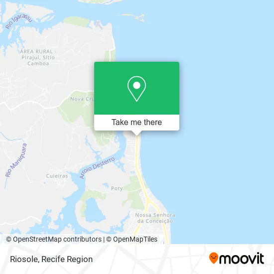
See Riosole, Paulista, on the map
Public Transit to Riosole in Paulista
Wondering how to get to Riosole in Paulista? Moovit helps you find the best way to get to Riosole with step-by-step directions from the nearest public transit station.
Moovit provides free maps and live directions to help you navigate through your city. View schedules, routes, timetables, and find out how long does it take to get to Riosole in real time.
Looking for the nearest stop or station to Riosole? Check out this list of stops closest to your destination: Av. Dr. Cláudio José Gueiros Leite (Pe-001).
Bus: 1944 LOTEAMENTO CONCEIÇÃO / TI PELÓPIDAS, 1960 TI RIO DOCE / MARIA FARINHA (CASA CAIADA).
Want to see if there’s another route that gets you there at an earlier time? Moovit helps you find alternative routes or times. Get directions from and directions to Riosole easily from the Moovit App or Website.
We make riding to Riosole easy, which is why over 1.5 million users, including users in Paulista, trust Moovit as the best app for public transit. You don’t need to download an individual bus app or train app, Moovit is your all-in-one transit app that helps you find the best bus time or train time available.
For information on prices of bus, costs and ride fares to Riosole, please check the Moovit app.
Use the app to navigate to popular places including to the airport, hospital, stadium, grocery store, mall, coffee shop, school, college, and university.
Riosole Address: Avenida Doutor Cláudio José Gueiros Leite, 10183 Maria Farinha Paulista-PE 53427-000 street in Paulista
- Sole Mare,
- Dr Serviços de Engenharia,
- Condomínio Jardim dos Coqueirais II,
- Okakoaras Hotel Maria Farinha,
- E2 Hotéis,
- Caiaque Mania PE,
- Perolas,
- Avenida Cláudio José Gueiros Leite (PE - 001) 128,
- Copias & Impressão,
- Banda Arreio de Ouro Producoes Artisticas,
- Cleide Cabelos,
- Titan,
- Grupo Sizar,
- Bella Roma,
- Mr Bbq,
- Crossfit Paulista J4,
- Kanan Sushi Janga,
- Madeireira e Serraria Jatobá,
- Mercadinho Pau Amarelo,
- Página Art das Cortinas
Places Near Riosole (Paulista)
- Imip (Instituto Materno-Infantil De Pernambuco), Coelhos,
- Marco Zero, Bairro Do Recife,
- Parque da Jaqueira, Jaqueira,
- hospital otavio de freitas - UTI, Tejipió,
- SHOPPING GUARARAPES, Jaboatão Dos Guararapes,
- Hospital Geral De Areias, Areias,
- Arena de Pernambuco, São Lourenço Da Mata,
- Hospital Altino Ventura, Iputinga,
- Imbiribeira, Imbiribeira,
- Shopping Patteo Olinda, Olinda,
- Hospital Agamenon Magalhães, Tamarineira,
- Shopping RioMar Recife, Pina,
- Hospital Maria Lucinda, Parnamirim,
- Centro de Convenções de Pernambuco, Olinda,
- SHOPPING TACARUNA, Santo Amaro,
- llll, Fundão,
- Shopping Recife, Boa Viagem,
- Hospital Eduardo Campus Da Pessoa Idosa, Areias,
- tuuuuu, Olinda,
- Hospital Universitário Oswaldo Cruz, Santo Amaro
How to get to popular places in Recife Region with public transit
Get around Paulista by public transit!
Traveling around Paulista has never been so easy. See step by step directions as you travel to any attraction, street or major public transit station. View bus and train schedules, arrival times, service alerts and detailed routes on a map, so you know exactly how to get to anywhere in Paulista.
When traveling to any destination around Paulista use Moovit's Live Directions with Get Off Notifications to know exactly where and how far to walk, how long to wait for your line, and how many stops are left. Moovit will alert you when it's time to get off — no need to constantly re-check whether yours is the next stop.
Wondering how to use public transit in Paulista or how to pay for public transit in Paulista? Moovit public transit app can help you navigate your way with public transit easily, and at minimum cost. It includes public transit fees, ticket prices, and costs. Looking for a map of Paulista public transit lines? Moovit public transit app shows all public transit maps in Paulista with all Bus, Train and Subway routes and stops on an interactive map.
Recife Region has 3 transit type(s), including: Bus, Train and Subway, operated by several transit agencies, including CBTU (Metrorec), BRT (Via Livre), Grande Recife, BORBOREMA IMPERIAL (TIP), BORBOREMA IMPERIAL (B.V), RODOVIÁRIA POTENGY, EMPRESA METROPOLITANA, CONSÓRCIO RECIFE, SÃO JUDAS TADEU, Expresso 1002, Rodotur Turismo, Complementar Recife, Sistema Municipal - Jaboatão, Sistema Municipal - Cabo and Sistema Municipal - Ipojuca