How to get to Rippin Ltd by bus?
Click on the bus route to see step by step directions with maps, line arrival times and updated time schedules.
From HI New York Hostel, Manhattan
104 minFrom Frank Sinatra School of the Arts, Queens
121 minFrom Eugene O'Neill Theatre, Manhattan
59 minFrom Mt Sinai, Manhattan
82 minFrom Woodside, Queens
108 minFrom Consulado Mexicano en New York, Manhattan
64 minFrom Bellevue Hospital, Manhattan
99 minFrom Warwick Hotel, Manhattan
65 minFrom Mount Sinai Hospital, Manhattan
82 minFrom Museum Of the Moving Image, Queens
120 min
How to get to Rippin Ltd by train?
Click on the train route to see step by step directions with maps, line arrival times and updated time schedules.
Bus stops near Rippin Ltd in Jersey City
Light Rail stations near Rippin Ltd in Jersey City
- Newport Light Rail Station, 8 min walk,VIEW
Bus lines to Rippin Ltd in Jersey City
What are the closest stations to Rippin Ltd?
The closest stations to Rippin Ltd are:
- Grove Street is 174 yards away, 3 min walk.
- Washington Blvd at Target Driveway is 190 yards away, 3 min walk.
- Washington Blvd at Newport Pkwy is 208 yards away, 3 min walk.
- Newport is 493 yards away, 7 min walk.
- Washington Blvd @ Pavonia Station (Northbound) is 527 yards away, 7 min walk.
- Washington Blvd at Path Station is 528 yards away, 7 min walk.
- Newport Light Rail Station is 583 yards away, 8 min walk.
Which bus lines stop near Rippin Ltd?
These bus lines stop near Rippin Ltd: 126, 86.
Which train line stops near Rippin Ltd?
YEL (Journal Square - 33rd Street)
What’s the nearest light rail station to Rippin Ltd in Jersey City?
The nearest light rail station to Rippin Ltd in Jersey City is Newport Light Rail Station. It’s a 8 min walk away.
What’s the nearest train station to Rippin Ltd in Jersey City?
The nearest train station to Rippin Ltd in Jersey City is Grove Street. It’s a 3 min walk away.
What’s the nearest bus station to Rippin Ltd in Jersey City?
The nearest bus stations to Rippin Ltd in Jersey City are Washington Blvd at Target Driveway and Washington Blvd at Newport Pkwy. The closest one is a 3 min walk away.
What time is the first light rail to Rippin Ltd in Jersey City?
The HBLR is the first light rail that goes to Rippin Ltd in Jersey City. It stops nearby at 4:47 AM.
What time is the last light rail to Rippin Ltd in Jersey City?
The HBLR is the last light rail that goes to Rippin Ltd in Jersey City. It stops nearby at 2:12 AM.
What time is the first train to Rippin Ltd in Jersey City?
The ATW is the first train that goes to Rippin Ltd in Jersey City. It stops nearby at 3:10 AM.
What time is the last train to Rippin Ltd in Jersey City?
The ATW is the last train that goes to Rippin Ltd in Jersey City. It stops nearby at 3:14 AM.
What time is the first bus to Rippin Ltd in Jersey City?
The 16 is the first bus that goes to Rippin Ltd in Jersey City. It stops nearby at 6:00 AM.
What time is the last bus to Rippin Ltd in Jersey City?
The 126 is the last bus that goes to Rippin Ltd in Jersey City. It stops nearby at 11:42 PM.
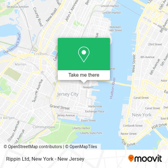
See Rippin Ltd, Jersey City, on the map
Public Transit to Rippin Ltd in Jersey City
Wondering how to get to Rippin Ltd in Jersey City? Moovit helps you find the best way to get to Rippin Ltd with step-by-step directions from the nearest public transit station.
Moovit provides free maps and live directions to help you navigate through your city. View schedules, routes, timetables, and find out how long does it take to get to Rippin Ltd in real time.
Looking for the nearest stop or station to Rippin Ltd? Check out this list of stops closest to your destination: Grove Street; Washington Blvd at Target Driveway; Washington Blvd at Newport Pkwy; Newport; Washington Blvd @ Pavonia Station (Northbound); Washington Blvd at Path Station; Newport Light Rail Station.
Bus: 126, 86, 9, 16, 63, 64, 68, 206.Train: YEL, ATW, RED, GRE.
Want to see if there’s another route that gets you there at an earlier time? Moovit helps you find alternative routes or times. Get directions from and directions to Rippin Ltd easily from the Moovit App or Website.
We make riding to Rippin Ltd easy, which is why over 1.5 million users, including users in Jersey City, trust Moovit as the best app for public transit. You don’t need to download an individual bus app or train app, Moovit is your all-in-one transit app that helps you find the best bus time or train time available.
For information on prices of bus, train and subway, costs and ride fares to Rippin Ltd, please check the Moovit app.
Use the app to navigate to popular places including to the airport, hospital, stadium, grocery store, mall, coffee shop, school, college, and university.
Rippin Ltd Address: 30 Mall Dr W street in Jersey City
- Frostrecords,
- Enrique Lara,
- Ross Russell,
- Smyw Uz,
- Bodega Montsecano,
- Jet Lyfe,
- American Eagle Store,
- Charleys Cheesesteaks,
- Pizzastudio,
- Fluffy Fluffy Go!,
- Lame.,
- True Religion,
- Carter's,
- Gong Cha Usa,
- Wet Seal,
- At&T Store,
- Charleys Philly Steaks,
- Crisp,
- Disney Store,
- Simon Malls
Places Near Rippin Ltd (Jersey City)
- Hudson Yards, Manhattan,
- 1 Police Plaza, Manhattan,
- Wall Street, Manhattan,
- Katz's Deli, Manhattan,
- 111 Centre New York City Supreme Court, Manhattan,
- Queens Center Mall, Queens,
- qqqq, Manhattan,
- Pier 83, Manhattan,
- 3 Stone St, Manhattan,
- Bellevue Hospital, Manhattan,
- 66 John Street, Manhattan,
- San Gennaro Feast, Manhattan,
- Times Square, Manhattan,
- Chinatown, Manhattan,
- Mountainside Hospital, Glen Ridge,
- 26 Federal Plaza, Manhattan,
- Rockefeller Center, Manhattan,
- 911 Memorial, Manhattan,
- 376 Hudson Street, Manhattan,
- SoHo, Manhattan
How to get to popular places in New York - New Jersey with public transit
Get around Jersey City by public transit!
Traveling around Jersey City has never been so easy. See step by step directions as you travel to any attraction, street or major public transit station. View bus and train schedules, arrival times, service alerts and detailed routes on a map, so you know exactly how to get to anywhere in Jersey City.
When traveling to any destination around Jersey City use Moovit's Live Directions with Get Off Notifications to know exactly where and how far to walk, how long to wait for your line, and how many stops are left. Moovit will alert you when it's time to get off — no need to constantly re-check whether yours is the next stop.
Wondering how to use public transit in Jersey City or how to pay for public transit in Jersey City? Moovit public transit app can help you navigate your way with public transit easily, and at minimum cost. It includes public transit fees, ticket prices, and costs. Looking for a map of Jersey City public transit lines? Moovit public transit app shows all public transit maps in Jersey City with all Bus, Train, Subway, Light Rail, Ferry and Cable Car routes and stops on an interactive map.
New York - New Jersey has 6 transit type(s), including: Bus, Train, Subway, Light Rail, Ferry and Cable Car, operated by several transit agencies, including MTA Subway, Metro-North Railroad, LIRR, PATH, MTA New York City Transit - Express routes, MTA Bus, NJ Transit, NYC Ferry, NICE bus, Bee-Line Bus, NJ Transit Rail, Norwalk Transit District, Hartford Line, River Valley Transit and HART