Directions to Risberga (Stockholm) with public transportation
The following transit lines have routes that pass near Risberga
 Bus: 689.
- Ferry: 13, 2, 5, 8, 9.
Ferry stations near Risberga in Stockholm
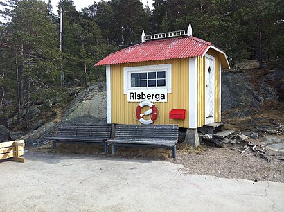
- Risberga Brygga, 0 min walk,
- Furuholmen Brygga, 0 min walk,
- Koviksudde Brygga, 56 min walk,
- Koviksudde, 56 min walk,
- Risholmen,
- Storholmen,
- Kattholmen,
- Getfoten Restaurang,
- Getfoten,
- Stora Getfoten,
- Kungsborg,
- Käringsund,
- Stockholms skärgård,
- Koviks Udde,
- Waxholmen,
- Bergholmen,
- Vasholmen,
- Baltic Sea,
- Tynningö,
- Villa Björkudden,
- Tynningø,
- Fredriksro,
- Osqvik,
- Fortsättning Tgef-Led Gul
Places Near Risberga (Stockholm)
- Djurgården, Stockholm,
- Fryshuset, Stockholm,
- Hammarby Sjöstad, Stockholm,
- Avicii Arena, Stockholm,
- 3Arena, Stockholm,
- SSSB, Stockholm,
- Viking Line Terminal, Stockholm,
- Gärdet, Stockholm,
- Göta Lejon, Stockholm,
- Frihamnen, Stockholm,
- Westfield Mall of Scandinavia, Solna,
- Älvsjömässan, Stockholm,
- Stadsgården, Tegelvikshamn, Stockholm,
- Vikingterminalen, Stockholm,
- Spår 11-12, Stockholm,
- Älvsjö, Stockholm,
- Monitor Erp Arena, Gävle,
- Globen T-Bana, Stockholm,
- Clarion Hotel Stockholm, Stockholm,
- Flygbussarna Fridhemsplan (B), Stockholm
How to get to popular places in Stockholm with public transit
What are the closest stations to Risberga?
The closest stations to Risberga are:
- Risberga Brygga is 0 meters away, 0 min walk.
- Furuholmen Brygga is 0 meters away, 0 min walk.
- Koviksudde Brygga is 4390 meters away, 56 min walk.
- Koviksudde is 4392 meters away, 56 min walk.
Which bus line stops near Risberga?
689 (Östra Tynningö)
Which ferry lines stop near Risberga?
These ferry lines stop near Risberga: 13, 2.
What’s the nearest ferry station to Risberga in Stockholm?
The nearest ferry stations to Risberga in Stockholm are Risberga Brygga and Furuholmen Brygga. The closest one is a 0 min walk away.
What time is the first ferry to Risberga in Stockholm?
The 84 is the first ferry that goes to Risberga in Stockholm. It stops nearby at 10:05 AM.
What time is the last ferry to Risberga in Stockholm?
The 84 is the last ferry that goes to Risberga in Stockholm. It stops nearby at 5:28 PM.
See Risberga, Stockholm, on the map
Public Transit to Risberga in Stockholm
Wondering how to get to Risberga in Stockholm? Moovit helps you find the best way to get to Risberga with step-by-step directions from the nearest public transit station.
Moovit provides free maps and live directions to help you navigate through your city. View schedules, routes, timetables, and find out how long does it take to get to Risberga in real time.
Looking for the nearest stop or station to Risberga? Check out this list of stops closest to your destination: Risberga Brygga; Furuholmen Brygga; Koviksudde Brygga; Koviksudde.
Bus: 689.Ferry: 13, 2, 5, 8, 9, 12, 11, 84, 84.
Want to see if there’s another route that gets you there at an earlier time? Moovit helps you find alternative routes or times. Get directions from and directions to Risberga easily from the Moovit App or Website.
We make riding to Risberga easy, which is why over 1.5 million users, including users in Stockholm, trust Moovit as the best app for public transit. You don’t need to download an individual bus app or train app, Moovit is your all-in-one transit app that helps you find the best bus time or train time available.
For information on prices of bus, ferry and light rail, costs and ride fares to Risberga, please check the Moovit app.
Use the app to navigate to popular places including to the airport, hospital, stadium, grocery store, mall, coffee shop, school, college, and university.
Location: Stockholm
Get around Stockholm by public transit!
Traveling around Stockholm has never been so easy. See step by step directions as you travel to any attraction, street or major public transit station. View bus and train schedules, arrival times, service alerts and detailed routes on a map, so you know exactly how to get to anywhere in Stockholm.
When traveling to any destination around Stockholm use Moovit's Live Directions with Get Off Notifications to know exactly where and how far to walk, how long to wait for your line, and how many stops are left. Moovit will alert you when it's time to get off — no need to constantly re-check whether yours is the next stop.
Wondering how to use public transit in Stockholm or how to pay for public transit in Stockholm? Moovit public transit app can help you navigate your way with public transit easily, and at minimum cost. It includes public transit fees, ticket prices, and costs. Looking for a map of Stockholm public transit lines? Moovit public transit app shows all public transit maps in Stockholm with all Bus, Train, Metro, Light Rail, Ferry and Cable Car routes and stops on an interactive map.
Stockholm has 6 transit type(s), including: Bus, Train, Metro, Light Rail, Ferry and Cable Car, operated by several transit agencies, including SL, SL Rail, UL, Flygbussarna, Sörmlandstrafiken, Region Gotland, VL, SJ AB, Flixbus, Länstrafiken Örebro, Mälartåg, X-trafik, Waxholmsbolaget Ångfartygs AB, Trafikverket Färjerederiet and Krösatåg