Directions to Rise N Shine Daycare (Baltimore County) with public transportation
The following transit lines have routes that pass near Rise N Shine Daycare
 Bus: 78, 31, CITYLINK BLUE, 37, 40.
How to get to Rise N Shine Daycare by bus?
Click on the bus route to see step by step directions with maps, line arrival times and updated time schedules.
From B&O Railroad Museum, Baltimore
48 minFrom Baltimore Polytechnic Institute, Baltimore
70 minFrom Maryland, Baltimore
53 minFrom Guinness Open Gate Brewery & Barrel House, Baltimore County
79 minFrom Sinai Hospital, Baltimore
53 minFrom Saint Agnes Hospital, Baltimore
58 minFrom The Maryland Zoo In Baltimore, Baltimore
56 minFrom Western High School, Baltimore
71 minFrom Baltimore Poly Tech High School, Baltimore
72 minFrom University Of Maryland Baltimore (Umbc), Baltimore County
33 min
Bus stops near Rise N Shine Daycare in Baltimore County
Bus lines to Rise N Shine Daycare in Baltimore County
What are the closest stations to Rise N Shine Daycare?
The closest stations to Rise N Shine Daycare are:
- Rolling Rd & Johnnycake Rd Sb is 250 yards away, 4 min walk.
- Rolling Rd & Rolling Bend Rd FS Nb is 888 yards away, 11 min walk.
- Security Blvd & Rolling Rd Eb is 1242 yards away, 15 min walk.
Which bus line stops near Rise N Shine Daycare?
78 (Downtown)
What’s the nearest bus station to Rise N Shine Daycare in Baltimore County?
The nearest bus station to Rise N Shine Daycare in Baltimore County is Rolling Rd & Johnnycake Rd Sb. It’s a 4 min walk away.
What time is the first bus to Rise N Shine Daycare in Baltimore County?
The 31 is the first bus that goes to Rise N Shine Daycare in Baltimore County. It stops nearby at 4:02 AM.
What time is the last bus to Rise N Shine Daycare in Baltimore County?
The 78 is the last bus that goes to Rise N Shine Daycare in Baltimore County. It stops nearby at 2:34 AM.
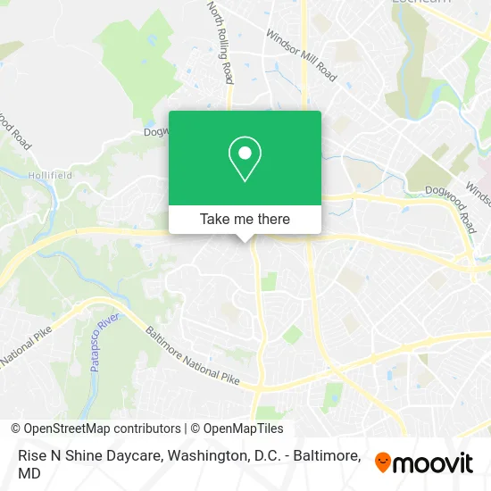
See Rise N Shine Daycare, Baltimore County, on the map
Public Transit to Rise N Shine Daycare in Baltimore County
Wondering how to get to Rise N Shine Daycare in Baltimore County? Moovit helps you find the best way to get to Rise N Shine Daycare with step-by-step directions from the nearest public transit station.
Moovit provides free maps and live directions to help you navigate through your city. View schedules, routes, timetables, and find out how long does it take to get to Rise N Shine Daycare in real time.
Looking for the nearest stop or station to Rise N Shine Daycare? Check out this list of stops closest to your destination: Rolling Rd & Johnnycake Rd Sb; Rolling Rd & Rolling Bend Rd FS Nb; Security Blvd & Rolling Rd Eb.
Bus: 78, 31, CITYLINK BLUE, 37, 40, 79.
Want to see if there’s another route that gets you there at an earlier time? Moovit helps you find alternative routes or times. Get directions from and directions to Rise N Shine Daycare easily from the Moovit App or Website.
We make riding to Rise N Shine Daycare easy, which is why over 1.5 million users, including users in Baltimore County, trust Moovit as the best app for public transit. You don’t need to download an individual bus app or train app, Moovit is your all-in-one transit app that helps you find the best bus time or train time available.
For information on prices of bus, costs and ride fares to Rise N Shine Daycare, please check the Moovit app.
Use the app to navigate to popular places including to the airport, hospital, stadium, grocery store, mall, coffee shop, school, college, and university.
Rise N Shine Daycare Address: 5 Skipworth Ct Catonsville, MD 21228 street in Baltimore County
- Healthy Folks Medical Clinic,
- Heartland Hospice Serving Central Maryland / Baltimore Metro Area,
- Rolling Road Pharmacy,
- Potomac Physicians,
- Robinson Ramonia MD,
- Potomac Physicians, (Potomac Physicians Pa),
- Dr. Hoffman And Associates,
- Maidpro,
- Corlissa A Little Board Certified Licensed Massage Therapist,
- Bright Futures Ahead, LLC.,
- Cynthia Cesaire MD,
- OneMain Financial,
- Affinity Dental,
- Egert, Riley, DeRoo & Assoc.,
- Dr. Hraky, OB/GYN,
- Esterson , Associates,
- Maurice Rudow,
- CJ Diamond World,
- The Heart Center,
- ADT
Places Near Rise N Shine Daycare (Baltimore County)
- Camden Yards, Baltimore,
- Rock Creek Tennis Center, Washington,
- Basilica of the National Shrine, Washington,
- The Anthem, Washington,
- Capital One Arena, Washington,
- National Zoo, Washington,
- National Museum of African American History and Culture, Washington,
- PG Mall, Prince George's County,
- Westfield Montgomery Mall, Montgomery County,
- M&T Bank Stadium, Baltimore,
- Washington National Cathedral, Washington,
- Washington DC VA Medical Center, Washington,
- Marriott Marquis Washington, DC, Washington,
- National Mall, Washington,
- Museum Of The Bible, Washington,
- Warner Theatre, Washington,
- Sibley Memorial Hospital, Washington,
- Pennsylvania Ave NW (3rd st and pennsylvania), Washington,
- Georgetown, Washington,
- Amazon Hq2, Arlington County
How to get to popular places in Washington, D.C. - Baltimore, MD with public transit
Get around Baltimore County by public transit!
Traveling around Baltimore County has never been so easy. See step by step directions as you travel to any attraction, street or major public transit station. View bus and train schedules, arrival times, service alerts and detailed routes on a map, so you know exactly how to get to anywhere in Baltimore County.
When traveling to any destination around Baltimore County use Moovit's Live Directions with Get Off Notifications to know exactly where and how far to walk, how long to wait for your line, and how many stops are left. Moovit will alert you when it's time to get off — no need to constantly re-check whether yours is the next stop.
Wondering how to use public transit in Baltimore County or how to pay for public transit in Baltimore County? Moovit public transit app can help you navigate your way with public transit easily, and at minimum cost. It includes public transit fees, ticket prices, and costs. Looking for a map of Baltimore County public transit lines? Moovit public transit app shows all public transit maps in Baltimore County with all Bus, Train, Metro, Light Rail and Ferry routes and stops on an interactive map.
Washington, D.C. - Baltimore, MD has 5 transit type(s), including: Bus, Train, Metro, Light Rail and Ferry, operated by several transit agencies, including WMATA, Montgomery County Ride On, Fairfax Connector, TheBus, PRTC, DASH - Alexandria, Arlington Transit (ART), RTA of Central Maryland, MDOT MTA, MDOT MTA Light RailLink, MDOT MTA Commuter Bus, MDOT MTA Local Bus, FXBGO!, Virginia Railway Express (VRE) and MARC