Directions to Rise'n Roll Bakery (Indianapolis City (Balance)) with public transportation
The following transit lines have routes that pass near Rise'n Roll Bakery
 Bus: 82.
How to get to Rise'n Roll Bakery by bus?
Click on the bus route to see step by step directions with maps, line arrival times and updated time schedules.
From Copyfire Type, Indianapolis City (Balance)
45 minFrom Facade Tek, Indianapolis City (Balance)
139 minFrom Topwot, Indianapolis City (Balance)
39 minFrom Crown Hill Funeral Home & Cemetery, Indianapolis City (Balance)
55 minFrom Minds Edge, Indianapolis City (Balance)
126 minFrom 4600 Sunset Ave Parking, Indianapolis City (Balance)
45 minFrom Pepsico, Indianapolis City (Balance)
139 minFrom First Call Staffing, Indianapolis City (Balance)
134 minFrom Shadeland Ave & 82nd St, Indianapolis City (Balance)
35 minFrom No-Nuisince- Pet Carrier, Indianapolis City (Balance)
135 min
Bus stop near Rise'n Roll Bakery in Indianapolis City (Balance)
- 86th St & Monon Trail, 3 min walk,VIEW
Bus lines to Rise'n Roll Bakery in Indianapolis City (Balance)
- 82, Community Hosp North,VIEW
What are the closest stations to Rise'n Roll Bakery?
The closest stations to Rise'n Roll Bakery are:
- 86th St & Monon Trail is 198 yards away, 3 min walk.
Which bus line stops near Rise'n Roll Bakery?
82 (Community Hosp North)
What’s the nearest bus station to Rise'n Roll Bakery in Indianapolis City (Balance)?
The nearest bus station to Rise'n Roll Bakery in Indianapolis City (Balance) is 86th St & Monon Trail. It’s a 3 min walk away.
What time is the first bus to Rise'n Roll Bakery in Indianapolis City (Balance)?
The 82 is the first bus that goes to Rise'n Roll Bakery in Indianapolis City (Balance). It stops nearby at 5:15 AM.
What time is the last bus to Rise'n Roll Bakery in Indianapolis City (Balance)?
The 82 is the last bus that goes to Rise'n Roll Bakery in Indianapolis City (Balance). It stops nearby at 10:57 PM.
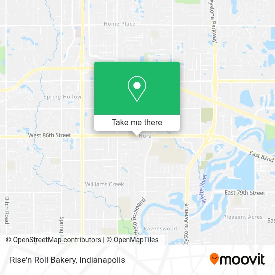
See Rise'n Roll Bakery, Indianapolis City (Balance), on the map
Public Transit to Rise'n Roll Bakery in Indianapolis City (Balance)
Wondering how to get to Rise'n Roll Bakery in Indianapolis City (Balance)? Moovit helps you find the best way to get to Rise'n Roll Bakery with step-by-step directions from the nearest public transit station.
Moovit provides free maps and live directions to help you navigate through your city. View schedules, routes, timetables, and find out how long does it take to get to Rise'n Roll Bakery in real time.
Looking for the nearest stop or station to Rise'n Roll Bakery? Check out this list of stops closest to your destination: 86th St & Monon Trail.
Bus: 82.
Want to see if there’s another route that gets you there at an earlier time? Moovit helps you find alternative routes or times. Get directions from and directions to Rise'n Roll Bakery easily from the Moovit App or Website.
We make riding to Rise'n Roll Bakery easy, which is why over 1.5 million users, including users in Indianapolis City (Balance), trust Moovit as the best app for public transit. You don’t need to download an individual bus app or train app, Moovit is your all-in-one transit app that helps you find the best bus time or train time available.
For information on prices of bus, costs and ride fares to Rise'n Roll Bakery, please check the Moovit app.
Use the app to navigate to popular places including to the airport, hospital, stadium, grocery store, mall, coffee shop, school, college, and university.
Rise'n Roll Bakery Address: 1115 E 86th St Indianapolis, IN 46240 street in Indianapolis City (Balance)
- All Shipping & Packing Services,
- Greendell Landscape Solutions,
- CBD Jubilee,
- The UPS Store,
- David K. Lee, Attorney at Law,
- Myway Logistics Llc,
- Cellular Sales,
- Your Choice Home Buyer,
- Dodson Law Firm, Llc,
- Peter Murphy CPA,
- Bmv Connect Kiosk,
- PNC Mortgage,
- National City Bank,
- Kroger #998,
- Max Dye & Associates,
- Coinme,
- Duncan Duncan Rogers,
- Culinary Dropout Indianapolis - Coming Soon,
- Williams-Sonoma,
- Passport Health Indiana, Vaccination And Immunizations Travel Medicine Clinics
Places Near Rise'n Roll Bakery (Indianapolis City (Balance))
- 119 W 19th St Parking, Indianapolis City (Balance),
- Castleton Square Mall, Indianapolis,
- Gainbridge Fieldhouse, Indianapolis City (Balance),
- Methodist Hospital of Indianapolis, Indianapolis City (Balance),
- I-465 / I-65 Interchange, Indianapolis City (Balance),
- Train Ride At Castleton Mall, Indianapolis City (Balance),
- Cotter's Massage Parlor With Happy Endings, Indianapolis City (Balance),
- Jersey Barn, Indianapolis City (Balance),
- St. Vincent Hospital - Indianapolis, Indianapolis City (Balance),
- Lilly Corporate Center (Eli Lilly & Co), Indianapolis City (Balance),
- THE BALT, Indianapolis City (Balance),
- Indiana, Indianapolis City (Balance),
- Indianapolis Airport Zone 2, Indianapolis City (Balance),
- Eskenazi Hospital, Indianapolis City (Balance),
- I U Health Methodist Hospital, Indianapolis City (Balance),
- Plainfield, IN, Plainfield,
- Indianapolis Motor Speedway, Speedway,
- Lucas Oil Stadium, Indianapolis City (Balance),
- Indiana Convention Center, Indianapolis City (Balance),
- St. Vincent entrance #1, Indianapolis City (Balance)
How to get to popular places in Indianapolis with public transit
Get around Indianapolis City (Balance) by public transit!
Traveling around Indianapolis City (Balance) has never been so easy. See step by step directions as you travel to any attraction, street or major public transit station. View bus and train schedules, arrival times, service alerts and detailed routes on a map, so you know exactly how to get to anywhere in Indianapolis City (Balance).
When traveling to any destination around Indianapolis City (Balance) use Moovit's Live Directions with Get Off Notifications to know exactly where and how far to walk, how long to wait for your line, and how many stops are left. Moovit will alert you when it's time to get off — no need to constantly re-check whether yours is the next stop.
Wondering how to use public transit in Indianapolis City (Balance) or how to pay for public transit in Indianapolis City (Balance)? Moovit public transit app can help you navigate your way with public transit easily, and at minimum cost. It includes public transit fees, ticket prices, and costs. Looking for a map of Indianapolis City (Balance) public transit lines? Moovit public transit app shows all public transit maps in Indianapolis City (Balance) with all bus routes and stops on an interactive map.
Indianapolis has 1 transit type(s), including: bus, operated by several transit agencies, including IndyGo, FlixBus-us and Greyhound-us