How to get to Rising Stars Elc by bus?
Click on the bus route to see step by step directions with maps, line arrival times and updated time schedules.
From The Yellow House, Indianapolis City (Balance)
70 minFrom Machine Co Depend, Indianapolis City (Balance)
28 minFrom College Avenue & 54th Street, Indianapolis City (Balance)
54 minFrom Knights of Columbus, Indianapolis City (Balance)
77 minFrom IndyGo Bus #17, Indianapolis City (Balance)
53 minFrom Black Orchid Barbers, Indianapolis City (Balance)
55 minFrom Krispy Krunchy Chicken, Indianapolis City (Balance)
37 minFrom Alumbaugh, Staci L, Indianapolis City (Balance)
64 minFrom 1629 Roosevelt Ave Parking, Indianapolis City (Balance)
45 minFrom Begreat Fitness / Strongnotskinny LLC, Indianapolis City (Balance)
58 min
Bus stops near Rising Stars Elc in Lawrence
What are the closest stations to Rising Stars Elc?
The closest stations to Rising Stars Elc are:
- 42nd St & Arborcrest Dr is 507 yards away, 6 min walk.
- 38th & Franklin Station Wb is 1477 yards away, 18 min walk.
Which bus line stops near Rising Stars Elc?
30 (Sunnyside Rd)
What’s the nearest bus station to Rising Stars Elc in Lawrence?
The nearest bus station to Rising Stars Elc in Lawrence is 42nd St & Arborcrest Dr. It’s a 6 min walk away.
What time is the first bus to Rising Stars Elc in Lawrence?
The 30 is the first bus that goes to Rising Stars Elc in Lawrence. It stops nearby at 4:19 AM.
What time is the last bus to Rising Stars Elc in Lawrence?
The 92 is the last bus that goes to Rising Stars Elc in Lawrence. It stops nearby at 12:57 AM.
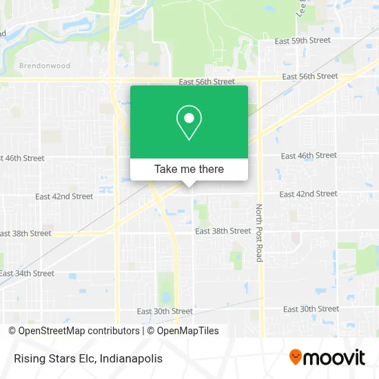
See Rising Stars Elc, Lawrence, on the map
Public Transit to Rising Stars Elc in Lawrence
Wondering how to get to Rising Stars Elc in Lawrence? Moovit helps you find the best way to get to Rising Stars Elc with step-by-step directions from the nearest public transit station.
Moovit provides free maps and live directions to help you navigate through your city. View schedules, routes, timetables, and find out how long does it take to get to Rising Stars Elc in real time.
Looking for the nearest stop or station to Rising Stars Elc? Check out this list of stops closest to your destination: 42nd St & Arborcrest Dr; 38th & Franklin Station Wb.
Bus: 30, 92.
Want to see if there’s another route that gets you there at an earlier time? Moovit helps you find alternative routes or times. Get directions from and directions to Rising Stars Elc easily from the Moovit App or Website.
We make riding to Rising Stars Elc easy, which is why over 1.5 million users, including users in Lawrence, trust Moovit as the best app for public transit. You don’t need to download an individual bus app or train app, Moovit is your all-in-one transit app that helps you find the best bus time or train time available.
For information on prices of bus, costs and ride fares to Rising Stars Elc, please check the Moovit app.
Use the app to navigate to popular places including to the airport, hospital, stadium, grocery store, mall, coffee shop, school, college, and university.
Rising Stars Elc Address: 4240 N Franklin Rd street in Lawrence
- Sophisticated Sistas,
- Apu Homecare,
- Nationwide Insurance - Dalessandro Insurance Agency,
- Compunet Llc,
- Burse Transports And Trucking,
- Botanica Obatala,
- Estética Paris,
- Revol Wireless,
- Cruz Insurance Solutions,
- A & P Granite & Concrete,
- Upon This Rock Outreach Ministries,
- Clinica Dental Dr. Avila,
- Sinclair Gas Station,
- N Franklin Rd / E 42nd St,
- Rockitcoin,
- Noah,
- Arsh Gas & Food,
- Prime Motors Llc,
- 42nd Marathon Inc.,
- Sunrise Kitchen
Places Near Rising Stars Elc (Lawrence)
- Plainfield, IN, Plainfield,
- Lucas Oil Stadium, Indianapolis City (Balance),
- Indiana, Indianapolis City (Balance),
- Train Ride At Castleton Mall, Indianapolis City (Balance),
- Jersey Barn, Indianapolis City (Balance),
- Indianapolis Motor Speedway, Speedway,
- St. Vincent Hospital - Indianapolis, Indianapolis City (Balance),
- Cotter's Massage Parlor With Happy Endings, Indianapolis City (Balance),
- 119 W 19th St Parking, Indianapolis City (Balance),
- Lilly Corporate Center (Eli Lilly & Co), Indianapolis City (Balance),
- Methodist Hospital of Indianapolis, Indianapolis City (Balance),
- I U Health Methodist Hospital, Indianapolis City (Balance),
- Eskenazi Hospital, Indianapolis City (Balance),
- Indiana Convention Center, Indianapolis City (Balance),
- THE BALT, Indianapolis City (Balance),
- I-465 / I-65 Interchange, Indianapolis City (Balance),
- St. Vincent entrance #1, Indianapolis City (Balance),
- Gainbridge Fieldhouse, Indianapolis City (Balance),
- Castleton Square Mall, Indianapolis,
- Indianapolis Airport Zone 2, Indianapolis City (Balance)
How to get to popular places in Indianapolis with public transit
Get around Lawrence by public transit!
Traveling around Lawrence has never been so easy. See step by step directions as you travel to any attraction, street or major public transit station. View bus and train schedules, arrival times, service alerts and detailed routes on a map, so you know exactly how to get to anywhere in Lawrence.
When traveling to any destination around Lawrence use Moovit's Live Directions with Get Off Notifications to know exactly where and how far to walk, how long to wait for your line, and how many stops are left. Moovit will alert you when it's time to get off — no need to constantly re-check whether yours is the next stop.
Wondering how to use public transit in Lawrence or how to pay for public transit in Lawrence? Moovit public transit app can help you navigate your way with public transit easily, and at minimum cost. It includes public transit fees, ticket prices, and costs. Looking for a map of Lawrence public transit lines? Moovit public transit app shows all public transit maps in Lawrence with all bus routes and stops on an interactive map.
Indianapolis has 1 transit type(s), including: bus, operated by several transit agencies, including IndyGo, FlixBus-us and Greyhound-us