Directions to Risk Barbell (Wichita) with public transportation
The following transit lines have routes that pass near Risk Barbell
 Bus: ROUTE12: DOUGLAS.
How to get to Risk Barbell by bus?
Click on the bus route to see step by step directions with maps, line arrival times and updated time schedules.
From Breakthrough Club of Sedgwick County, Wichita
43 minFrom Dollar General, Wichita
68 minFrom Tim Warren Dr, Wichita
67 minFrom Lot 4, Wichita
30 minFrom Granny Square, Wichita
44 minFrom Bodybar Pilates, Wichita
39 minFrom Neuro ICU @St Francis Hospital, Wichita
54 minFrom Friends University, Wichita
40 minFrom State Banking Department, Wichita
37 minFrom 535 S Emporia St Parking, Wichita
35 min
Bus stop near Risk Barbell in Wichita
- Tyler&Central Inbound, 5 min walk,VIEW
Bus lines to Risk Barbell in Wichita
- ROUTE12: DOUGLAS, Route 12 Inbound,VIEW
What are the closest stations to Risk Barbell?
The closest stations to Risk Barbell are:
- Tyler&Central Inbound is 344 yards away, 5 min walk.
Which bus line stops near Risk Barbell?
ROUTE12: DOUGLAS (Route 12 Outboun)
What’s the nearest bus station to Risk Barbell in Wichita?
The nearest bus station to Risk Barbell in Wichita is Tyler&Central Inbound. It’s a 5 min walk away.
What time is the first bus to Risk Barbell in Wichita?
The ROUTE12: DOUGLAS is the first bus that goes to Risk Barbell in Wichita. It stops nearby at 5:11 AM.
What time is the last bus to Risk Barbell in Wichita?
The ROUTE12: DOUGLAS is the last bus that goes to Risk Barbell in Wichita. It stops nearby at 7:06 PM.
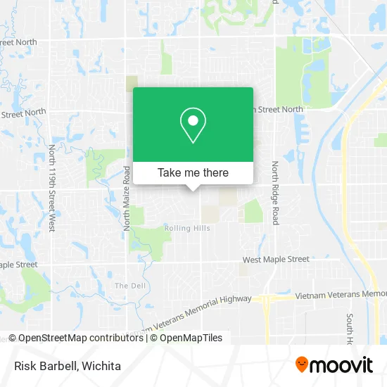
See Risk Barbell, Wichita, on the map
Public Transit to Risk Barbell in Wichita
Wondering how to get to Risk Barbell in Wichita? Moovit helps you find the best way to get to Risk Barbell with step-by-step directions from the nearest public transit station.
Moovit provides free maps and live directions to help you navigate through your city. View schedules, routes, timetables, and find out how long does it take to get to Risk Barbell in real time.
Looking for the nearest stop or station to Risk Barbell? Check out this list of stops closest to your destination: Tyler&Central Inbound.
Bus: ROUTE12: DOUGLAS.
Want to see if there’s another route that gets you there at an earlier time? Moovit helps you find alternative routes or times. Get directions from and directions to Risk Barbell easily from the Moovit App or Website.
We make riding to Risk Barbell easy, which is why over 1.5 million users, including users in Wichita, trust Moovit as the best app for public transit. You don’t need to download an individual bus app or train app, Moovit is your all-in-one transit app that helps you find the best bus time or train time available.
For information on prices of bus, costs and ride fares to Risk Barbell, please check the Moovit app.
Use the app to navigate to popular places including to the airport, hospital, stadium, grocery store, mall, coffee shop, school, college, and university.
Risk Barbell Address: 8903 W Central Ave Wichita, KS 67212 street in Wichita
- Mustard Roots Boutique,
- STARBUCKS,
- FedEx,
- TACO BELL,
- Paquita Dance Center,
- Play It Again Sports,
- Superior Play & Learn,
- Apothecary Essentials & More,
- Husam Bakdash, MD,
- Hussam Farhoud, MD,
- Heartland Cardiology (West),
- Shilpa Kshatriya, MD,
- Via Christi Clinic,
- Venkata S. Boppana, MD,
- Saad Farhat, MD,
- Yazan Alkawaleet, MD,
- W Central Ave,
- Eddie's Cafe,
- Carpe Diem Cafe,
- Headrush Salon & Boutique Parlor
Places Near Risk Barbell (Wichita)
- McConnell Air Force Base, Mcconnell Afb,
- Ratcliff Auto and Truck Repair, Wichita,
- Sena African Hair Braiding LLC, Wichita,
- Hubb's glory hole, Wichita,
- East 21st Street North and Webb Road, Wichita,
- Cookies by Design, Wichita,
- Spirit Aerosystems,
- Spirit Aerosystems Inc, Building 1-198D,
- North High School, Wichita,
- Four Corners Cafe @ Wesley Medical Center, Wichita,
- Total Card Solutions, Wichita,
- Westside Athletic Field (Friends University Baseball Field), Wichita,
- winfield, Wichita,
- Spirit AeroSystems, Bldg 2-280J (Section 9),
- Afghan Halal Market, Wichita,
- Towne East Mall, Wichita,
- Wichita Dwight D. Eisenhower National Airport (ICT) (Wichita Eisenhower National Airport), Wichita,
- Bmer Tech Automotive, Wichita,
- Paige Place Apartments, Wichita,
- Ascencion Via Christi Hospital St Francis, Wichita
How to get to popular places in Wichita with public transit
Get around Wichita by public transit!
Traveling around Wichita has never been so easy. See step by step directions as you travel to any attraction, street or major public transit station. View bus and train schedules, arrival times, service alerts and detailed routes on a map, so you know exactly how to get to anywhere in Wichita.
When traveling to any destination around Wichita use Moovit's Live Directions with Get Off Notifications to know exactly where and how far to walk, how long to wait for your line, and how many stops are left. Moovit will alert you when it's time to get off — no need to constantly re-check whether yours is the next stop.
Wondering how to use public transit in Wichita or how to pay for public transit in Wichita? Moovit public transit app can help you navigate your way with public transit easily, and at minimum cost. It includes public transit fees, ticket prices, and costs. Looking for a map of Wichita public transit lines? Moovit public transit app shows all public transit maps in Wichita with all bus routes and stops on an interactive map.
Wichita has 1 transit type(s), including: bus, operated by several transit agencies, including Wichita Transit, Greyhound-us and FlixBus-us