How to get to Risk Placement Services by bus?
Click on the bus route to see step by step directions with maps, line arrival times and updated time schedules.
From Weston, Davie
31 minFrom Nova High School, Davie
103 minFrom AAA Century Appliance, Plantation
76 minFrom 595 Express, Davie
96 minFrom Archbishop Edward A. Mccarthy High School, Davie
83 minFrom Nova Southeastern University, Davie
78 minFrom Tamarac, Coral Springs-Margate
70 minFrom Kamal Singh, Plantation
55 minFrom Florida Turnpike Sunrise Blvd. Toll Plaza, Plantation
59 minFrom Piper High School, Plantation
63 min
Bus stop near Risk Placement Services in Plantation
- Northwest 136th Avenue/Northwest 12th Street, 12 min walk,VIEW
Bus lines to Risk Placement Services in Plantation
What are the closest stations to Risk Placement Services?
The closest stations to Risk Placement Services are:
- Northwest 136th Avenue/Northwest 12th Street is 1008 yards away, 12 min walk.
Which bus lines stop near Risk Placement Services?
These bus lines stop near Risk Placement Services: 22, 23, 36.
What’s the nearest bus station to Risk Placement Services in Plantation?
The nearest bus station to Risk Placement Services in Plantation is Northwest 136th Avenue/Northwest 12th Street. It’s a 12 min walk away.
What time is the first bus to Risk Placement Services in Plantation?
The 22 is the first bus that goes to Risk Placement Services in Plantation. It stops nearby at 5:18 AM.
What time is the last bus to Risk Placement Services in Plantation?
The 22 is the last bus that goes to Risk Placement Services in Plantation. It stops nearby at 11:22 PM.
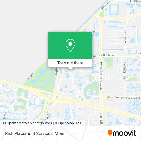
See Risk Placement Services, Plantation, on the map
Public Transit to Risk Placement Services in Plantation
Wondering how to get to Risk Placement Services in Plantation? Moovit helps you find the best way to get to Risk Placement Services with step-by-step directions from the nearest public transit station.
Moovit provides free maps and live directions to help you navigate through your city. View schedules, routes, timetables, and find out how long does it take to get to Risk Placement Services in real time.
Looking for the nearest stop or station to Risk Placement Services? Check out this list of stops closest to your destination: Northwest 136th Avenue/Northwest 12th Street.
Bus: 22, 23, 36.
Want to see if there’s another route that gets you there at an earlier time? Moovit helps you find alternative routes or times. Get directions from and directions to Risk Placement Services easily from the Moovit App or Website.
We make riding to Risk Placement Services easy, which is why over 1.5 million users, including users in Plantation, trust Moovit as the best app for public transit. You don’t need to download an individual bus app or train app, Moovit is your all-in-one transit app that helps you find the best bus time or train time available.
For information on prices of bus, costs and ride fares to Risk Placement Services, please check the Moovit app.
Use the app to navigate to popular places including to the airport, hospital, stadium, grocery store, mall, coffee shop, school, college, and university.
Risk Placement Services Address: 1300 Sawgrass Corporate Pkwy Fort Lauderdale, FL 33323 street in Plantation
- 24 Hours Plumbers,
- Barron Collier Commercial,
- Dental Whale Savings Network,
- Navy Talent Acquisition Group Miami,
- Interactive Metronome,
- SB Insurance of Florida,
- SMC Air Conditioning,
- Jacaranda Country Club,
- Ortega Group,
- Stafflink Outsourcing, Inc.,
- Tag Three Engineering,
- Concrete Reinforcing Products,
- Homewell Care Services,
- Globecastsunrise,
- Team SCG,
- FedEx,
- Medical Surgical-Telemetry Critical Care Emergency Department,
- United Kingdom Bridge House,
- Right Choice Mobile Detailing,
- Nsolo Consulting Group
Places Near Risk Placement Services (Plantation)
- Keiser University Flagship Campus, West Palm Beach,
- Aventura Mall, Miami Beach,
- Miami Freedom Park, Miami,
- Dolphin Mall, Miami,
- Sawgrass mall ( FL ), Miami Beach,
- Miami-Dade County Courthouse, Miami,
- Port of Miami Cruise Terminal, Miami,
- Bayside Marketplace, Miami,
- Zoo Miami, Miami,
- Brickell City Centre, Miami,
- Aventura Mall, Miami,
- Miami Design District, Miami,
- Dolphin Mall Bus, Miami,
- Marlins Park, Miami,
- Little Havana, Miami,
- Hard Rock Stadium, Miami Gardens,
- Miami VA Hospital, Miami,
- Richard E. Gerstein Justice Building, Miami,
- Sawgrass Mall, Miami,
- Wynwood, Miami
How to get to popular places in Miami with public transit
Get around Plantation by public transit!
Traveling around Plantation has never been so easy. See step by step directions as you travel to any attraction, street or major public transit station. View bus and train schedules, arrival times, service alerts and detailed routes on a map, so you know exactly how to get to anywhere in Plantation.
When traveling to any destination around Plantation use Moovit's Live Directions with Get Off Notifications to know exactly where and how far to walk, how long to wait for your line, and how many stops are left. Moovit will alert you when it's time to get off — no need to constantly re-check whether yours is the next stop.
Wondering how to use public transit in Plantation or how to pay for public transit in Plantation? Moovit public transit app can help you navigate your way with public transit easily, and at minimum cost. It includes public transit fees, ticket prices, and costs. Looking for a map of Plantation public transit lines? Moovit public transit app shows all public transit maps in Plantation with all Bus, Train, Light Rail and Ferry routes and stops on an interactive map.
Miami has 4 transit type(s), including: Bus, Train, Light Rail and Ferry, operated by several transit agencies, including Broward County Transit, Miami-Dade Transit, Metrorail, Palm Tran, Tri-Rail, Brightline, MARTY, City of Homestead Trolley, Key West Transit, Treasure Coast Connector, GoLine IRT, Amtrak, Greyhound-us, FlixBus-us and Aventura Express Shuttle Bus