How to get to Risk Placement Services by bus?
Click on the bus route to see step by step directions with maps, line arrival times and updated time schedules.
From Carlstadt, NJ, Carlstadt
64 minFrom Wayne, NJ, Wayne
102 minFrom Passaic, NJ, Passaic
69 minFrom Holy Name Hospital, Teaneck
49 minFrom Paramus, NJ, Paramus
41 minFrom Totowa, NJ, Totowa
62 minFrom BAPS Shri Swaminarayan Mandir, Clifton
66 minFrom Clifton, NJ, Clifton
85 minFrom Lodi, NJ, Lodi
64 minFrom Teaneck, NJ, Teaneck
54 min
How to get to Risk Placement Services by train?
Click on the train route to see step by step directions with maps, line arrival times and updated time schedules.
Bus stops near Risk Placement Services in Fair Lawn
Train station near Risk Placement Services in Fair Lawn
- Hawthorne, 32 min walk,VIEW
Bus lines to Risk Placement Services in Fair Lawn
What are the closest stations to Risk Placement Services?
The closest stations to Risk Placement Services are:
- Fair Lawn Ave at Chandler Dr is 1105 yards away, 13 min walk.
- Maple Ave at Elm Ave is 1509 yards away, 18 min walk.
- Hawthorne is 2744 yards away, 32 min walk.
Which bus lines stop near Risk Placement Services?
These bus lines stop near Risk Placement Services: 171, 746.
Which train line stops near Risk Placement Services?
MCL (Suffern)
What’s the nearest bus station to Risk Placement Services in Fair Lawn?
The nearest bus station to Risk Placement Services in Fair Lawn is Fair Lawn Ave at Chandler Dr. It’s a 13 min walk away.
What time is the first train to Risk Placement Services in Fair Lawn?
The MCL is the first train that goes to Risk Placement Services in Fair Lawn. It stops nearby at 5:16 AM.
What time is the last train to Risk Placement Services in Fair Lawn?
The MCL is the last train that goes to Risk Placement Services in Fair Lawn. It stops nearby at 2:13 AM.
What time is the first bus to Risk Placement Services in Fair Lawn?
The 171 is the first bus that goes to Risk Placement Services in Fair Lawn. It stops nearby at 5:12 AM.
What time is the last bus to Risk Placement Services in Fair Lawn?
The 171 is the last bus that goes to Risk Placement Services in Fair Lawn. It stops nearby at 1:46 AM.
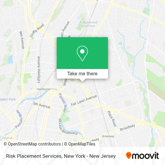
See Risk Placement Services, Fair Lawn, on the map
Public Transit to Risk Placement Services in Fair Lawn
Wondering how to get to Risk Placement Services in Fair Lawn? Moovit helps you find the best way to get to Risk Placement Services with step-by-step directions from the nearest public transit station.
Moovit provides free maps and live directions to help you navigate through your city. View schedules, routes, timetables, and find out how long does it take to get to Risk Placement Services in real time.
Looking for the nearest stop or station to Risk Placement Services? Check out this list of stops closest to your destination: Fair Lawn Ave at Chandler Dr; Maple Ave at Elm Ave; Hawthorne.
Bus: 171, 746, 145.Train: MCL, PJL.
Want to see if there’s another route that gets you there at an earlier time? Moovit helps you find alternative routes or times. Get directions from and directions to Risk Placement Services easily from the Moovit App or Website.
We make riding to Risk Placement Services easy, which is why over 1.5 million users, including users in Fair Lawn, trust Moovit as the best app for public transit. You don’t need to download an individual bus app or train app, Moovit is your all-in-one transit app that helps you find the best bus time or train time available.
For information on prices of bus and train, costs and ride fares to Risk Placement Services, please check the Moovit app.
Use the app to navigate to popular places including to the airport, hospital, stadium, grocery store, mall, coffee shop, school, college, and university.
Risk Placement Services Address: 17-17 Route 208, Ste 220 street in Fair Lawn
- Jonathan Resnick, Md, Facg, Fasge,
- David Arbit, Md,
- Thomas Molloy, Md, Faac,
- Magna Group,
- Wyatt & Sons Air Duct Service,
- Anthony's Coal Fired Pizza & Wings,
- Justina Deitz, Do,
- Ruth Gold, Md,
- Jennifer Sherman, Do,
- Arnold Rabinowitz, Md,
- Erica Weitzner, Md,
- Karen Balonze, Md,
- Cook Maran & Associates,
- Verizon,
- Russell Cellular Agent Partner,
- Qdoba Mexican Eats,
- Moxie Salon and Beauty Bar,
- Fair Lawn Promenade,
- Jersey Mike's,
- Dreamy Nails Spa
Places Near Risk Placement Services (Fair Lawn)
- Hudson Yards, Manhattan,
- Chinatown, Manhattan,
- Mountainside Hospital, Glen Ridge,
- qqqq, Manhattan,
- 66 John Street, Manhattan,
- Bellevue Hospital, Manhattan,
- Wall Street, Manhattan,
- 376 Hudson Street, Manhattan,
- 3 Stone St, Manhattan,
- San Gennaro Feast, Manhattan,
- SoHo, Manhattan,
- 26 Federal Plaza, Manhattan,
- Queens Center Mall, Queens,
- Times Square, Manhattan,
- 1 Police Plaza, Manhattan,
- Rockefeller Center, Manhattan,
- 911 Memorial, Manhattan,
- Pier 83, Manhattan,
- 111 Centre New York City Supreme Court, Manhattan,
- Katz's Deli, Manhattan
How to get to popular places in New York - New Jersey with public transit
Get around Fair Lawn by public transit!
Traveling around Fair Lawn has never been so easy. See step by step directions as you travel to any attraction, street or major public transit station. View bus and train schedules, arrival times, service alerts and detailed routes on a map, so you know exactly how to get to anywhere in Fair Lawn.
When traveling to any destination around Fair Lawn use Moovit's Live Directions with Get Off Notifications to know exactly where and how far to walk, how long to wait for your line, and how many stops are left. Moovit will alert you when it's time to get off — no need to constantly re-check whether yours is the next stop.
Wondering how to use public transit in Fair Lawn or how to pay for public transit in Fair Lawn? Moovit public transit app can help you navigate your way with public transit easily, and at minimum cost. It includes public transit fees, ticket prices, and costs. Looking for a map of Fair Lawn public transit lines? Moovit public transit app shows all public transit maps in Fair Lawn with all Bus, Train, Subway, Light Rail, Ferry and Cable Car routes and stops on an interactive map.
New York - New Jersey has 6 transit type(s), including: Bus, Train, Subway, Light Rail, Ferry and Cable Car, operated by several transit agencies, including MTA Subway, Metro-North Railroad, LIRR, PATH, MTA New York City Transit - Express routes, MTA Bus, NJ Transit, NYC Ferry, NICE bus, Bee-Line Bus, NJ Transit Rail, Norwalk Transit District, Hartford Line, River Valley Transit and HART