How to get to Risnadi by bus?
Click on the bus route to see step by step directions with maps, line arrival times and updated time schedules.
From Jl.slamet Riyadi, Surakarta
39 minFrom Keraton Solo, Surakarta
50 minFrom Toko Oli 158, Surakarta
51 minFrom Sritex arena, Surakarta
49 minFrom GOR Sritex Arena Solo, Surakarta
40 minFrom Universitas Negeri Yogyakarta, Surakarta
52 minFrom Solo Grand Mall, Surakarta
38 minFrom Royal, Surakarta
50 minFrom Nguter Sukoharjo, Sukoharjo
49 minFrom Gereja Katolik St. Antonius Purbayan, Surakarta
53 min
Bus lines to Risnadi in Karanganyar
What are the closest stations to Risnadi?
The closest stations to Risnadi are:
- Lanud is 76 meters away, 2 min walk.
- Klegen Barat is 541 meters away, 8 min walk.
Which bus lines stop near Risnadi?
These bus lines stop near Risnadi: K1, K5.
What’s the nearest bus station to Risnadi in Karanganyar?
The nearest bus station to Risnadi in Karanganyar is Lanud. It’s a 2 min walk away.
What time is the first bus to Risnadi in Karanganyar?
The K1 is the first bus that goes to Risnadi in Karanganyar. It stops nearby at 4:32 AM.
What time is the last bus to Risnadi in Karanganyar?
The K1 is the last bus that goes to Risnadi in Karanganyar. It stops nearby at 9:49 PM.
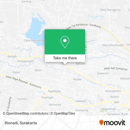
See Risnadi, Karanganyar, on the map
Public Transit to Risnadi in Karanganyar
Wondering how to get to Risnadi in Karanganyar? Moovit helps you find the best way to get to Risnadi with step-by-step directions from the nearest public transit station.
Moovit provides free maps and live directions to help you navigate through your city. View schedules, routes, timetables, and find out how long does it take to get to Risnadi in real time.
Looking for the nearest stop or station to Risnadi? Check out this list of stops closest to your destination: Lanud; Klegen Barat.
Bus: K1, K5, K4.
Want to see if there’s another route that gets you there at an earlier time? Moovit helps you find alternative routes or times. Get directions from and directions to Risnadi easily from the Moovit App or Website.
We make riding to Risnadi easy, which is why over 1.5 million users, including users in Karanganyar, trust Moovit as the best app for public transit. You don’t need to download an individual bus app or train app, Moovit is your all-in-one transit app that helps you find the best bus time or train time available.
For information on prices of bus, costs and ride fares to Risnadi, please check the Moovit app.
Use the app to navigate to popular places including to the airport, hospital, stadium, grocery store, mall, coffee shop, school, college, and university.
Risnadi Address: Karanganyar 57774 street in Karanganyar
- Ginah Atmorejo,
- Satinem,
- Tiyo,
- Kirmadi,
- Miyatun,
- Biyati,
- Nasipah,
- Mawardi,
- Kinem,
- Romlah,
- Sujiyem,
- B. Setyo Rahayu,
- Supardi,
- Wahono,
- Purwanto,
- Kardinah,
- Nuning Sholikah,
- Toko Sidodadi,
- Lina Hesti,
- Toko Ibu Heni
Places Near Risnadi (Karanganyar)
- Rsud Dr. Moewardi Surakarta, Surakarta,
- Rumah Sakit Ortopedi Dr Soeharso Surakarta, Surakarta,
- RS. Ortopedi Prof. DR. R. Soeharso, Surakarta,
- Kampung Batik Kauman, Surakarta,
- Dr. Hendrato Budiono, M.Sc, Sp.PD (Klinik Padma), Surakarta,
- Halte BST Purwosari, Surakarta,
- Halte BST Solo Square, Surakarta,
- Jalan Solo - Purwodadi, Surakarta,
- Solo Paragon Mall, Surakarta,
- Terminal Tawangmangu, Surakarta,
- Tawang Mangu, Karanganyar,
- Candi Cetho, Surakarta,
- Masjid Riyadh, Surakarta,
- RS Dr Soeharso, Surakarta,
- RSUD Dr. Moewardi, Surakarta,
- Halte Pasar Gede, Surakarta,
- IAIN Surakarta, Surakarta,
- Boyolali,Jawa Tengah, Surakarta,
- Singkong Keju cab.Ygy (SMA 7), Surakarta,
- karangpandan, Karanganyar
How to get to popular places in Surakarta with public transit
Get around Karanganyar by public transit!
Traveling around Karanganyar has never been so easy. See step by step directions as you travel to any attraction, street or major public transit station. View bus and train schedules, arrival times, service alerts and detailed routes on a map, so you know exactly how to get to anywhere in Karanganyar.
When traveling to any destination around Karanganyar use Moovit's Live Directions with Get Off Notifications to know exactly where and how far to walk, how long to wait for your line, and how many stops are left. Moovit will alert you when it's time to get off — no need to constantly re-check whether yours is the next stop.
Wondering how to use public transit in Karanganyar or how to pay for public transit in Karanganyar? Moovit public transit app can help you navigate your way with public transit easily, and at minimum cost. It includes public transit fees, ticket prices, and costs. Looking for a map of Karanganyar public transit lines? Moovit public transit app shows all public transit maps in Karanganyar with all Bus and Train routes and stops on an interactive map.
Surakarta has 2 transit type(s), including: Bus and Train, operated by several transit agencies, including Batik Solo Trans, Feeder BST, PT Kereta Api Indonesia and KAI Commuter