How to get to Ristorante Pizzeria Ksc by bus?
Click on the bus route to see step by step directions with maps, line arrival times and updated time schedules.
How to get to Ristorante Pizzeria Ksc by train?
Click on the train route to see step by step directions with maps, line arrival times and updated time schedules.
From MVV Energie Ladestation, Käfertal
107 minFrom FH 1863, Neckarstadt-Ost/Wohlgelegen
95 minFrom Möbel Höffner, Schwetzingen
82 minFrom Bad Dürkheim Reha, Bad Dürkheim
123 minFrom Hauptfeuerwache, Berufsfeuerwehr Mannheim, Neckarau
76 minFrom GRN-Klinik Schwetzingen, Schwetzingen
86 minFrom Schön Klinik Lorsch Se, Lorsch
94 min
Light Rail stations near Ristorante Pizzeria Ksc in Ludwigshafen-Friesenheim
- Kreuzstraße, 6 min walk,VIEW
Bus stops near Ristorante Pizzeria Ksc in Ludwigshafen-Friesenheim
Bus lines to Ristorante Pizzeria Ksc in Ludwigshafen-Friesenheim
- 70, Lu Hauptbahnhof,VIEW
- 89E, Adolf-Diesterweg-Str,VIEW
- 70E, LU Hauptbahnhof - LU Rathaus - Marienkirche - BASF (Tor 1+2) - Friesenheim Mitte - Sternstraße - Hans-Warsch-Platz - Adolf-Kolping-Straße,VIEW
- 89, Oppau Fritz-Haber-Straße (BASF Tor 12+13) – Friesenheim Mitte – Hans-Warsch-Platz – Buschwegbrücke – Hans-Warsch-Platz – Friesenheim Mitte – Oppau Fritz-Haber-Straße (BASF Tor 12+13),VIEW
- 90, Berliner Platz Bf LU Mitte - Friesenheim - Oggersheim Comeniusstraße - Notwende/Melm,VIEW
- E, Valentin-Bauer-Siedlung - Ostringplatz,VIEW
- E, Leuschnerstraße - Paul-Münch-Straße,VIEW
- E, Schulbus,VIEW
- E, Hans-Warsch-Platz - Leuschnerstraße,VIEW
- E, Buschwegbrücke - Leuschnerstraße,VIEW
- E, Hans-Warsch-Platz - Valentin-Bauer-Siedlung,VIEW
- E, Saarbrücker Straße - Goerdelerplatz,VIEW
- 90E, Berliner Platz,VIEW
- 6, Pfalzbau,VIEW
What are the closest stations to Ristorante Pizzeria Ksc?
The closest stations to Ristorante Pizzeria Ksc are:
- Kreuzstraße is 437 meters away, 6 min walk.
- Riedsaumpark is 662 meters away, 9 min walk.
- Sternstraße is 717 meters away, 10 min walk.
- Ammoniakstraße is 723 meters away, 10 min walk.
- Friesenheim Mitte is 966 meters away, 13 min walk.
Which bus lines stop near Ristorante Pizzeria Ksc?
These bus lines stop near Ristorante Pizzeria Ksc: 62, 89.
Which train line stops near Ristorante Pizzeria Ksc?
S6 (Mainz Hbf)
Which light rail lines stop near Ristorante Pizzeria Ksc?
These light rail lines stop near Ristorante Pizzeria Ksc: 10, RNV 7.
What’s the nearest light rail station to Ristorante Pizzeria Ksc in Ludwigshafen-Friesenheim?
The nearest light rail station to Ristorante Pizzeria Ksc in Ludwigshafen-Friesenheim is Kreuzstraße. It’s a 6 min walk away.
What’s the nearest bus station to Ristorante Pizzeria Ksc in Ludwigshafen-Friesenheim?
The nearest bus station to Ristorante Pizzeria Ksc in Ludwigshafen-Friesenheim is Riedsaumpark. It’s a 9 min walk away.
What time is the first light rail to Ristorante Pizzeria Ksc in Ludwigshafen-Friesenheim?
The 10 is the first light rail that goes to Ristorante Pizzeria Ksc in Ludwigshafen-Friesenheim. It stops nearby at 4:39 AM.
What time is the last light rail to Ristorante Pizzeria Ksc in Ludwigshafen-Friesenheim?
The 10 is the last light rail that goes to Ristorante Pizzeria Ksc in Ludwigshafen-Friesenheim. It stops nearby at 8:59 PM.
What time is the first bus to Ristorante Pizzeria Ksc in Ludwigshafen-Friesenheim?
The 90E is the first bus that goes to Ristorante Pizzeria Ksc in Ludwigshafen-Friesenheim. It stops nearby at 4:11 AM.
What time is the last bus to Ristorante Pizzeria Ksc in Ludwigshafen-Friesenheim?
The 90 is the last bus that goes to Ristorante Pizzeria Ksc in Ludwigshafen-Friesenheim. It stops nearby at 12:47 AM.
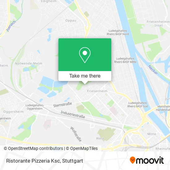
See Ristorante Pizzeria Ksc, Ludwigshafen-Friesenheim, on the map
Public Transit to Ristorante Pizzeria Ksc in Ludwigshafen-Friesenheim
Wondering how to get to Ristorante Pizzeria Ksc in Ludwigshafen-Friesenheim? Moovit helps you find the best way to get to Ristorante Pizzeria Ksc with step-by-step directions from the nearest public transit station.
Moovit provides free maps and live directions to help you navigate through your city. View schedules, routes, timetables, and find out how long does it take to get to Ristorante Pizzeria Ksc in real time.
Looking for the nearest stop or station to Ristorante Pizzeria Ksc? Check out this list of stops closest to your destination: Kreuzstraße; Riedsaumpark; Sternstraße; Ammoniakstraße; Friesenheim Mitte.
Bus: 62, 89, 70, 89E, E, 70E, 90, E, E, E, E, E, E, E, 90E.Train: S6.Light Rail: 10, RNV 7.
Want to see if there’s another route that gets you there at an earlier time? Moovit helps you find alternative routes or times. Get directions from and directions to Ristorante Pizzeria Ksc easily from the Moovit App or Website.
We make riding to Ristorante Pizzeria Ksc easy, which is why over 1.5 million users, including users in Ludwigshafen-Friesenheim, trust Moovit as the best app for public transit. You don’t need to download an individual bus app or train app, Moovit is your all-in-one transit app that helps you find the best bus time or train time available.
For information on prices of light rail, train and bus, costs and ride fares to Ristorante Pizzeria Ksc, please check the Moovit app.
Use the app to navigate to popular places including to the airport, hospital, stadium, grocery store, mall, coffee shop, school, college, and university.
Ristorante Pizzeria Ksc Address: Teichgartenweg 2 67063 Ludwigshafen am Rhein street in Ludwigshafen-Friesenheim
- Aiki Dojo Ludwigshafen,
- Ksc Lu Friesenheim,
- Kraft-Sport-Club 1893 e.V.,
- Ksc-Sporthalle,
- Ksc Vereinsgaststätte,
- Deesse Shop de,
- Falken Ludwigshafen,
- Sozialistische Jugend Ortsverband,
- L.A Shisha Lounge,
- Otto-Buckel-Platz,
- W. E. H. L. Hausmeisterservice, Gebäude- und Gartenpflege,
- Freie Akademie Rn,
- Evang. Religionspädagogisches,
- Festival des Deutschen Films,
- Karl Wallauer Rechtsanwalt,
- Ortsvorsteher Friesenheim,
- Museum Friesenheim,
- Ferkelbraterei,
- Seelsorgestellen Auslän,
- Rochus Denkmal
Places Near Ristorante Pizzeria Ksc (Ludwigshafen-Friesenheim)
- Mercedes-Benz Museum (Mercedes Museum Stuttgart), Bad Cannstatt,
- Mettingen Eros-Center Puff Laufhaus, Esslingen Am Neckar,
- Schleyerhalle, Bad Cannstatt,
- Hanns-Martin-Schleyer-Halle, Bad Cannstatt,
- Gleis 101/102 (tief), Stuttgart-Mitte,
- Gasometer Pforzheim, Pforzheim,
- Klinikum Stuttgart - Katharinenhospital, Stuttgart-Mitte,
- SI-Centrum, Möhringen,
- Im Wizemann (Halle), Bad Cannstatt,
- Mercedes-Benz Museum, Bad Cannstatt,
- FlixBus Haltestelle, Stuttgart,
- Waldfriedhof, Degerloch,
- Wilhelma (U-Bahn Wilhelma), Bad Cannstatt,
- Porsche-Arena, Bad Cannstatt,
- Porsche Museum, Zuffenhausen,
- Pariser Platz Stuttgart, Stuttgart-Mitte,
- Marmorsaal Im Weissenburgpark, Stuttgart-Süd,
- Geilhaus Haus 33a, Reutlingen-Betzingen,
- Hanns-Martin-Schleyer-Halle (Stuttgart Hans-Martin-Schleyerhalle), Bad Cannstatt,
- Hauptbahnhof Stuttgart, Stuttgart-Mitte
How to get to popular places in Stuttgart with public transit
Get around Ludwigshafen-Friesenheim by public transit!
Traveling around Ludwigshafen-Friesenheim has never been so easy. See step by step directions as you travel to any attraction, street or major public transit station. View bus and train schedules, arrival times, service alerts and detailed routes on a map, so you know exactly how to get to anywhere in Ludwigshafen-Friesenheim.
When traveling to any destination around Ludwigshafen-Friesenheim use Moovit's Live Directions with Get Off Notifications to know exactly where and how far to walk, how long to wait for your line, and how many stops are left. Moovit will alert you when it's time to get off — no need to constantly re-check whether yours is the next stop.
Wondering how to use public transit in Ludwigshafen-Friesenheim or how to pay for public transit in Ludwigshafen-Friesenheim? Moovit public transit app can help you navigate your way with public transit easily, and at minimum cost. It includes public transit fees, ticket prices, and costs. Looking for a map of Ludwigshafen-Friesenheim public transit lines? Moovit public transit app shows all public transit maps in Ludwigshafen-Friesenheim with all Bus, Train, Subway, Light Rail, Ferry, S-Bahn and Funicular routes and stops on an interactive map.
Stuttgart has 7 transit type(s), including: Bus, Train, Subway, Light Rail, Ferry, S-Bahn and Funicular, operated by several transit agencies, including SSB - Stadtbahn, SSB, SSB - Seilbahn / Zacke, S-Bahn Stuttgart, Rhein-Neckar-Verkehr GmbH (rnv), Karlsruher Verkehrsverbund, DB AG, DB Regiobus BW, Arverio Baden-Württemberg GmbH, DB RegioNetz Verkehrs GmbH Westfrankenbahn, DB Regio AG Baden-Württemberg, Südwestdeutsche Verkehrs-AG, DB Regio AG Mitte Region Hessen, DB and Bodensee-Oberschwaben-Bahn
Public transit lines with stations closest to Ristorante Pizzeria Ksc in Ludwigshafen-Friesenheim
Bus lines with stations closest to Ristorante Pizzeria Ksc in Ludwigshafen-Friesenheim
Riedsaumpark
 70LU Hauptbahnhof - LU Rathaus - Marienkirche - BASF (Tor 1+2) - Friesenheim Mitte - Sternstraße - Hans-Warsch-Platz - Adolf-Kolping-Straße
- 89EOppau Fritz-Haber-Straße (BASF Tor 12+13) – Friesenheim Mitte – Hans-Warsch-Platz – Buschwegbrücke – Hans-Warsch-Platz – Friesenheim Mitte – Oppau Fritz-Haber-Straße (BASF Tor 12+13)
Sternstraße
- 70ELU Hauptbahnhof - LU Rathaus - Marienkirche - BASF (Tor 1+2) - Friesenheim Mitte - Sternstraße - Hans-Warsch-Platz - Adolf-Kolping-Straße
- 89Oppau Fritz-Haber-Straße (BASF Tor 12+13) – Friesenheim Mitte – Hans-Warsch-Platz – Buschwegbrücke – Hans-Warsch-Platz – Friesenheim Mitte – Oppau Fritz-Haber-Straße (BASF Tor 12+13)
- 90Berliner Platz Bf LU Mitte - Friesenheim - Oggersheim Comeniusstraße - Notwende/Melm
- EValentin-Bauer-Siedlung - Ostringplatz
- ELeuschnerstraße - Paul-Münch-Straße