How to get to New Valletta Restaurant by bus?
Click on the bus route to see step by step directions with maps, line arrival times and updated time schedules.
From GRA - Exit 4 - Trionfale, Roma
106 minFrom Prima Porta, Roma
98 minFrom Prima Porta, Roma
105 minFrom Sant'Andrea Hospital, Roma
117 minFrom San Pietro Hospital, Roma
85 minFrom Collegiata Salus Infirmorum Care Home, Roma
89 minFrom San Filippo Neri Hospital, Roma
92 minFrom Via della Lucchina 41, Roma
89 minFrom San Pietro Fatebenefratelli Hospital, Roma
86 minFrom La Giustiniana, Roma
66 min
Bus stop near New Valletta Restaurant in Roma
- Baccanello/Fosso Piordo, 7 min walk,VIEW
Train station near New Valletta Restaurant in Roma
- Cesano Di Roma, 53 min walk,VIEW
Bus lines to New Valletta Restaurant in Roma
- 036, La Storta Station,VIEW
What are the closest stations to New Valletta Restaurant?
The closest stations to New Valletta Restaurant are:
- Baccanello/Fosso Piordo is 486 meters away, 7 min walk.
- Cesano Di Roma is 4122 meters away, 53 min walk.
Which bus line stops near New Valletta Restaurant?
036
What’s the nearest bus station to New Valletta Restaurant in Roma?
The nearest bus station to New Valletta Restaurant in Roma is Baccanello/Fosso Piordo. It’s a 7 min walk away.
What time is the first train to New Valletta Restaurant in Roma?
The FL3 is the first train that goes to New Valletta Restaurant in Roma. It stops nearby at 5:49 AM.
What time is the last train to New Valletta Restaurant in Roma?
The FL3 is the last train that goes to New Valletta Restaurant in Roma. It stops nearby at 10:56 PM.
What time is the first bus to New Valletta Restaurant in Roma?
The 036 is the first bus that goes to New Valletta Restaurant in Roma. It stops nearby at 6:05 AM.
What time is the last bus to New Valletta Restaurant in Roma?
The 036 is the last bus that goes to New Valletta Restaurant in Roma. It stops nearby at 12:44 AM.
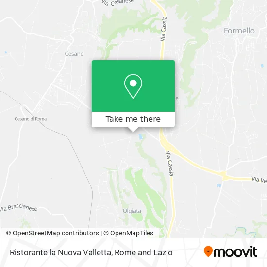
See New Valletta Restaurant, Roma, on the map
Public Transit to New Valletta Restaurant in Roma
Wondering how to get to New Valletta Restaurant in Roma? Moovit helps you find the best way to get to New Valletta Restaurant with step-by-step directions from the nearest public transit station.
Moovit provides free maps and live directions to help you navigate through your city. View schedules, routes, timetables, and find out how long does it take to get to New Valletta Restaurant in real time.
Looking for the nearest stop or station to New Valletta Restaurant? Check out this list of stops closest to your destination: Baccanello/Fosso Piordo; Cesano Di Roma.
Bus: 036.Train: FL3.
Want to see if there’s another route that gets you there at an earlier time? Moovit helps you find alternative routes or times. Get directions from and directions to New Valletta Restaurant easily from the Moovit App or Website.
We make riding to New Valletta Restaurant easy, which is why over 1.5 million users, including users in Roma, trust Moovit as the best app for public transit. You don’t need to download an individual bus app or train app, Moovit is your all-in-one transit app that helps you find the best bus time or train time available.
For information on prices of bus and train, costs and ride fares to New Valletta Restaurant, please check the Moovit app.
Use the app to navigate to popular places including to the airport, hospital, stadium, grocery store, mall, coffee shop, school, college, and university.
New Valletta Restaurant Address: Via del Fosso Piordo, 59 street in Roma
- Via del Fosso Piordo, 59,
- Olgiata Ditch Street,
- Unica Car Solutions,
- Motor Point Mechanical Workshop,
- SR2bis / Cassia Regional Road,
- A.s. Le Rughe,
- Saro Tobacco Shop,
- Portanova,
- Autohotel Saro by Giorgio Federico Nitti,
- Vagabonda - Outlet,
- The Bouquet at the Wrinkles,
- Le Canape Piccola Cooperative Society,
- Le Rughe Jewelry,
- Le Rughe Newsstand,
- Ssd Swim Pro,
- Tellini Tennis,
- Pam Panorama,
- The Treasure Island,
- Benedetti Italy,
- De Vita Transportation Services
Places Near New Valletta Restaurant (Roma)
- Tiber Island, Roma,
- Santa Maria Maggiore, Roma,
- Villa Borghese, Roma,
- Scuderie Del Quirinale, Roma,
- Gemelli Polyclinic, Roma,
- Trastevere Quarter, Roma,
- Tor Vergata, Roma,
- Casilino Polyclinic, Roma,
- Auditorium Music Park, Roma,
- Gravity, Roma,
- Cristo Re Hospital, Roma,
- The Wow Side, Fiumicino,
- Roma Est Shopping Center, Roma,
- Paths, Roma,
- The Sail, Roma,
- Sandro Pertini Hospital, Roma,
- Olympic Stadium, Rome, Roma,
- IDI (Dermopatico Dell'Immacolata Institute), Roma,
- Coppedè Quarter, Roma,
- Termini Station, Roma
How to get to popular places in Rome and Lazio with public transit
Get around Roma by public transit!
Traveling around Roma has never been so easy. See step by step directions as you travel to any attraction, street or major public transit station. View bus and train schedules, arrival times, service alerts and detailed routes on a map, so you know exactly how to get to anywhere in Roma.
When traveling to any destination around Roma use Moovit's Live Directions with Get Off Notifications to know exactly where and how far to walk, how long to wait for your line, and how many stops are left. Moovit will alert you when it's time to get off — no need to constantly re-check whether yours is the next stop.
Wondering how to use public transit in Roma or how to pay for public transit in Roma? Moovit public transit app can help you navigate your way with public transit easily, and at minimum cost. It includes public transit fees, ticket prices, and costs. Looking for a map of Roma public transit lines? Moovit public transit app shows all public transit maps in Roma with all Bus, Train, Metro, Light Rail, Ferry, Funicular and Gondola routes and stops on an interactive map.
Rome and Lazio has 7 transit type(s), including: Bus, Train, Metro, Light Rail, Ferry, Funicular and Gondola, operated by several transit agencies, including ATAC, Cotral, Trenitalia, Troiani Transportation Services, BIS, ATR Mobility, Tuscia, Shuttle, Seatour, Troiani Bus Lines, CSC Mobility, Terravision, ATRAL, Tambus and Sitbus