How to get to La Rampa Restaurant by bus?
Click on the bus route to see step by step directions with maps, line arrival times and updated time schedules.
From Galileo Hotel, Pisa
24 minFrom Mondo Convenienza, Farmhouse
74 minFrom Le Piagge, Pisa
32 minFrom CNR Research Area of Pisa, Pisa
42 minFrom It - Oo - Cs Cascina, Farmhouse
76 minFrom Leopolda Station, Pisa
33 minFrom Decathlon, Farmhouse
78 minFrom Borghi Center, Navacchio, Farmhouse
76 minFrom Pietrasantina Park Bus Station, Pisa
40 min
Bus stop near La Rampa Restaurant in Pisa
- S.Piero A Grado Cycle Path 1, 3 min walk,VIEW
What are the closest stations to La Rampa Restaurant?
The closest stations to La Rampa Restaurant are:
- S.Piero A Grado Cycle Path 1 is 153 meters away, 3 min walk.
Which bus line stops near La Rampa Restaurant?
10 (Tirrenia Belvedere)
What’s the nearest bus station to La Rampa Restaurant in Pisa?
The nearest bus station to La Rampa Restaurant in Pisa is S.Piero A Grado Cycle Path 1. It’s a 3 min walk away.
What time is the first bus to La Rampa Restaurant in Pisa?
The 10 is the first bus that goes to La Rampa Restaurant in Pisa. It stops nearby at 6:16 AM.
What time is the last bus to La Rampa Restaurant in Pisa?
The 20 is the last bus that goes to La Rampa Restaurant in Pisa. It stops nearby at 12:28 AM.
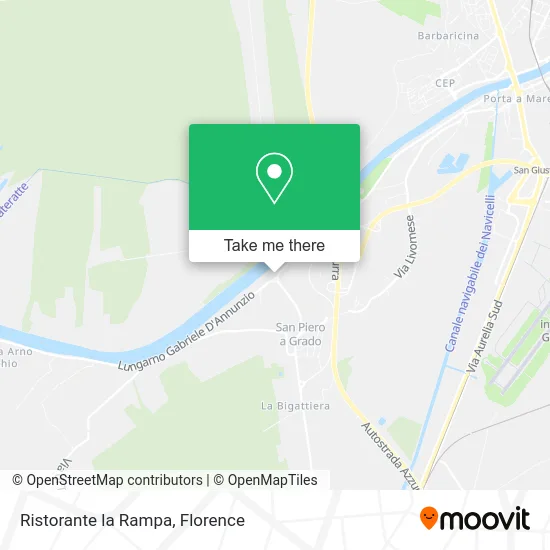
See La Rampa Restaurant, Pisa, on the map
Public Transit to La Rampa Restaurant in Pisa
Wondering how to get to La Rampa Restaurant in Pisa? Moovit helps you find the best way to get to La Rampa Restaurant with step-by-step directions from the nearest public transit station.
Moovit provides free maps and live directions to help you navigate through your city. View schedules, routes, timetables, and find out how long does it take to get to La Rampa Restaurant in real time.
Looking for the nearest stop or station to La Rampa Restaurant? Check out this list of stops closest to your destination: S.Piero A Grado Cycle Path 1.
Bus: 10, 20.
Want to see if there’s another route that gets you there at an earlier time? Moovit helps you find alternative routes or times. Get directions from and directions to La Rampa Restaurant easily from the Moovit App or Website.
We make riding to La Rampa Restaurant easy, which is why over 1.5 million users, including users in Pisa, trust Moovit as the best app for public transit. You don’t need to download an individual bus app or train app, Moovit is your all-in-one transit app that helps you find the best bus time or train time available.
For information on prices of bus, costs and ride fares to La Rampa Restaurant, please check the Moovit app.
Use the app to navigate to popular places including to the airport, hospital, stadium, grocery store, mall, coffee shop, school, college, and university.
La Rampa Restaurant Address: Lungarno Gabriele D'Annunzio, 56122 Pisa street in Pisa
- Blue Marlyn by Paolicchi M. & C.,
- Marinanova Arno Point,
- Oasis on the River,
- Nautilus Boat Restaurant,
- Villa Giraffa,
- Fontani Construction Site,
- San Rossore Infant Nursery,
- San Roore Nursery School,
- San Rossore Kindergarten,
- Bancolat in San Piero a Grado,
- San Rossore Corporate Recreation Club,
- Forest Station Command S. Rossore,
- Sports and Gastronomic Circle All Sea,
- San Piero A Grado Cemetery,
- New Farmhouses,
- San Piero a Grado,
- Vaccaro Vincenzo,
- Italian Red Cross,
- White Sail,
- San Lussorio Church
Places Near La Rampa Restaurant (Pisa)
- IKEA Florence, Sesto Fiorentino,
- Santa Maria Novella Station, Florence,
- Nelson Mandela Forum, Florence,
- Piero Palagi Hospital Facility-Florence, Florence,
- Cascine Park, Florence,
- Michelangelo Square, Florence,
- Santa Maria Nuova Hospital, Florence,
- Verdi Theater, Florence,
- Campi Bisenzio, Campi Bisenzio,
- OOO, Florence,
- Torregalli Hospital Scandicci *, Scandicci,
- Tobacco Manufacture, Florence,
- Asmana, Campi Bisenzio,
- Artemio Franchi Municipal Stadium, Florence,
- Wanny Palace, Florence,
- Viola Park, Bagno a Ripoli,
- Field of Mars, Florence,
- Mandela Forum (Nelson Mandela Forum), Florence,
- Michelangelo Square, Florence,
- I Gigli, Campi Bisenzio
How to get to popular places in Florence with public transit
Get around Pisa by public transit!
Traveling around Pisa has never been so easy. See step by step directions as you travel to any attraction, street or major public transit station. View bus and train schedules, arrival times, service alerts and detailed routes on a map, so you know exactly how to get to anywhere in Pisa.
When traveling to any destination around Pisa use Moovit's Live Directions with Get Off Notifications to know exactly where and how far to walk, how long to wait for your line, and how many stops are left. Moovit will alert you when it's time to get off — no need to constantly re-check whether yours is the next stop.
Wondering how to use public transit in Pisa or how to pay for public transit in Pisa? Moovit public transit app can help you navigate your way with public transit easily, and at minimum cost. It includes public transit fees, ticket prices, and costs. Looking for a map of Pisa public transit lines? Moovit public transit app shows all public transit maps in Pisa with all Bus, Train, Light Rail, Ferry and Funicular routes and stops on an interactive map.
Florence has 5 transit type(s), including: Bus, Train, Light Rail, Ferry and Funicular, operated by several transit agencies, including Florence Urban - Tuscan Bus Lines, GEST, Livorno and Province - Tuscan Bus Lines, Arezzo, Florence and Provinces - Tuscan Bus Lines, Prato and Province - Tuscan Bus Lines, Lucca and Province - Tuscan Bus Lines, Massa, Carrara and Province - Tuscan Bus Lines, Pisa and Province - Tuscan Bus Lines, Grosseto, Siena and Provinces - Tuscan Bus Lines, Arezzo, Siena and Provinces - Tuscan Bus Lines, Florence and Province - Tuscan Bus Lines, Pistoia and Province - Tuscan Bus Lines, Siena and Province - Tuscan Bus Lines, Arezzo and Province - Tuscan Bus Lines and Trenitalia