Directions to Ritab_Nails (North Las Vegas) with public transportation
The following transit lines have routes that pass near Ritab_Nails
 Bus: 219.
How to get to Ritab_Nails by bus?
Click on the bus route to see step by step directions with maps, line arrival times and updated time schedules.
From David Copperfield Show at the MGM Grand Hotel and Casino, Las Vegas
67 minFrom Nelson's Landing Cliff Jump, Las Vegas
60 minFrom Arizona Charlie's Decatur (Arizona Charlie's Decatur Casino & Hotel), Las Vegas
65 minFrom Las Vegas Strip, Las Vegas
55 minFrom Foremaster Lane & North Las Vegas Boulevard, Las Vegas
43 minFrom Amazon Fulfillment Center-LAS8, North Las Vegas
69 minFrom John C Fremont Middle School, Las Vegas
57 minFrom Las Vegas Natural History Museum, Las Vegas
41 minFrom Aliante Casino + Hotel, North Las Vegas
64 minFrom Dv Love Boutique Stratosphere, Las Vegas
56 min
Bus stop near Ritab_Nails in North Las Vegas
- Eb Craig After Commerce, 6 min walk,VIEW
Bus lines to Ritab_Nails in North Las Vegas
- 219, 219 Craig Eastbound,VIEW
What are the closest stations to Ritab_Nails?
The closest stations to Ritab_Nails are:
- Eb Craig After Commerce is 500 yards away, 6 min walk.
Which bus line stops near Ritab_Nails?
219 (219 Craig Westbound)
What’s the nearest bus station to Ritab_Nails in North Las Vegas?
The nearest bus station to Ritab_Nails in North Las Vegas is Eb Craig After Commerce. It’s a 6 min walk away.
What time is the first bus to Ritab_Nails in North Las Vegas?
The 219 is the first bus that goes to Ritab_Nails in North Las Vegas. It stops nearby at 4:27 AM.
What time is the last bus to Ritab_Nails in North Las Vegas?
The 219 is the last bus that goes to Ritab_Nails in North Las Vegas. It stops nearby at 1:26 AM.
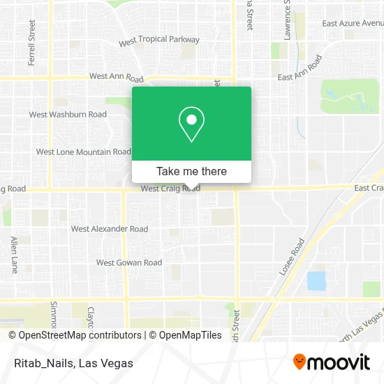
See Ritab_Nails, North Las Vegas, on the map
Public Transit to Ritab_Nails in North Las Vegas
Wondering how to get to Ritab_Nails in North Las Vegas? Moovit helps you find the best way to get to Ritab_Nails with step-by-step directions from the nearest public transit station.
Moovit provides free maps and live directions to help you navigate through your city. View schedules, routes, timetables, and find out how long does it take to get to Ritab_Nails in real time.
Looking for the nearest stop or station to Ritab_Nails? Check out this list of stops closest to your destination: Eb Craig After Commerce.
Bus: 219.
Want to see if there’s another route that gets you there at an earlier time? Moovit helps you find alternative routes or times. Get directions from and directions to Ritab_Nails easily from the Moovit App or Website.
We make riding to Ritab_Nails easy, which is why over 1.7 million users, including users in North Las Vegas, trust Moovit as the best app for public transit. You don’t need to download an individual bus app or train app, Moovit is your all-in-one transit app that helps you find the best bus time or train time available.
For information on prices of bus, costs and ride fares to Ritab_Nails, please check the Moovit app.
Use the app to navigate to popular places including to the airport, hospital, stadium, grocery store, mall, coffee shop, school, college, and university.
Ritab_Nails Address: 345 W Craig Rd street in North Las Vegas
- 116,
- W Craig Rd / N Commerce St,
- Craig Ranch Regional Park,
- Canyon Springs High School,
- M and R Transport,
- N 5th St,
- Oak Island Dr & White Quail Ct,
- Home Depot N Las Vegas,
- Santa Fe Station Bowling Center,
- Conway St,
- Creative Carpets,
- Breath of Life Basic Life Supp,
- E Craig Rd / Donna St,
- Crying Heart St,
- Craig Rd North Las Vegas NV,
- Craig And Martin Luther King / Camino El Norte,
- W Craig Rd / N Martin Luther King Blvd,
- Chino Ave,
- Olive Garden,
- Alexander & MLK
Places Near Ritab_Nails (North Las Vegas)
- The Neon Museum, Las Vegas,
- Las Vegas Premium Outlets-North, Enterprise,
- Las Vegas South Premium Outlets, Enterprise,
- Koolsville Tattoos, Las Vegas,
- Allegiant Stadium, Paradise,
- The Palms Casino Resort, Paradise,
- Las Vegas North Premium Outlets, Las Vegas,
- The Deuce Bus Stop at Fremont St, Las Vegas,
- Area15, Las Vegas,
- Trump International Hotel Las Vegas, Paradise,
- Walmart, Las Vegas,
- Meow Wolf - Las Vegas (Meow Wolf's Omega Mart), Las Vegas,
- Welcome To Fabulous Las Vegas Sign, Paradise,
- Omega Mart, Las Vegas,
- Lee Canyon, Las Vegas,
- Walmart Supercenter, Las Vegas,
- Zak Bagans Haunted Museum, Las Vegas,
- Town Square, Enterprise,
- Arte Museum Las Vegas, Paradise,
- Gold & Silver Pawn Shop, Las Vegas
How to get to popular places in Las Vegas with public transit
Get around North Las Vegas by public transit!
Traveling around North Las Vegas has never been so easy. See step by step directions as you travel to any attraction, street or major public transit station. View bus and train schedules, arrival times, service alerts and detailed routes on a map, so you know exactly how to get to anywhere in North Las Vegas.
When traveling to any destination around North Las Vegas use Moovit's Live Directions with Get Off Notifications to know exactly where and how far to walk, how long to wait for your line, and how many stops are left. Moovit will alert you when it's time to get off — no need to constantly re-check whether yours is the next stop.
Wondering how to use public transit in North Las Vegas or how to pay for public transit in North Las Vegas? Moovit public transit app can help you navigate your way with public transit easily, and at minimum cost. It includes public transit fees, ticket prices, and costs. Looking for a map of North Las Vegas public transit lines? Moovit public transit app shows all public transit maps in North Las Vegas with all Bus and Monorail routes and stops on an interactive map.
Las Vegas has 2 transit type(s), including: Bus and Monorail, operated by several transit agencies, including RTCSNV, City of Las Vegas, Alvand Transportation, Vegas Airporter, Las Vegas Monorail, FlixBus-us and Greyhound-us